First Aid Courses
RYA One Day First Aid Courses – 9th July, 18th Aug, 20th Sept, 20th Oct,19th Nov, or 6th Dec or contact us to organise a bespoke course for your crew or organisation

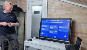
RYA COURSES & BESPOKE TRAINING FOR LEISURE BOATERS
RYA One Day First Aid Courses – 9th July, 18th Aug, 20th Sept, 20th Oct,19th Nov, or 6th Dec or contact us to organise a bespoke course for your crew or organisation
2026 Course dates – 18th July, 5th Sept, 26th Sept, 1st Nov, 12th Dec. We can schedule other dates if you have a group of people to book on.
One Day VHF Classroom Course – next dates: Sun 5th, Mon 6th, Sun 19th or Thurs 30th July Check out the calendar below to book, or click the online course , or book a bespoke course on a date to suit you and your crew!?
Read More VHF Courses
New added blogs on VHF – Group MMSIs, Trip to Lulworth and Southampton Boat Show
Lots of chat this year on social media regarding Southampton Boat Show almost had me not visiting but really glad we did. We spent two days visiting the show. It felt different this year. It took a while to adjust my mindset but once I did I found so much to do, it felt like there was more depth and less superficiality. This will no doubt attract a different crowd and it remains to seen whether this is the correct route to ensure viability. I certainly hope it is.
Prices on the door seemed expensive and so the hunt for discounted tickets began. Talk around sailing clubs locally had been similar, everyone was hunting for codes. I know many who didn’t go this year due to prices. In the past, RYA members received a free ticket although this year a £5 charge was introduced. This was only available for a short period for early booking but was a fair offer. Other than that the best offers we could find were £19.99 if booked before the show started. Grateful thanks to a lovely previous student who kindly organised a complimentary ticket for us to return for a second day.
Parking is plentiful around the show. Surprisingly we arrived late but still parked on the bottom floor of the multistorey, unheard of in previous years. Best value was actually on street parking but West Quay is easy. The entrance is further to walk now but to be honest quicker to get to the things that particularly interested me. It did make me wonder if visitor numbers were down or perhaps more people used public transport.
As we couldn’t visit the first weekend I made the mistake of looking at social media in advance. Lots of negativity almost put me off attending but glad we ignored it. A mixed bag, it gave us advice on what to hunt out but my feed wasn’t showing the positive news stories. Perhaps the exhibitors could try and push more positive news content but I know how exhausting it is just getting the stand together. A coordinated approach from all could help future events.
I was glad I researched the show in advance as there were some great talks and events to attend. I didn’t find it easy to find the information and found myself emailing people in advance about events I knew were happening but couldn’t find publicity for. Not sure if I just hadn’t looked for them before or there were more this year, but the talks program was excellent and definitely something to push.
Our first day was focussed on looking around, catching up with people and attending a couple of prebooked events. Initially the show seemed small and lacking in atmosphere but once we attended our first talk we got into the event. In terms of clothing chandlery, there were few mega bargains to be had but it was a good opportunity to look at items and pricing was comparable with buying online. Sadly, so much buying is now done online the days of the show end of line bargains are behind us.
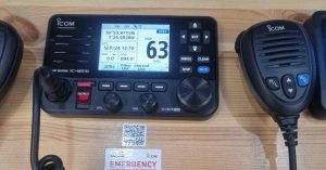
There were a few chandlery equipment stands and some good prices to be had on Icom radios, better than I could find online. Always good to have a look at equipment innovations and changes and chat to others. Stands were well manned and on the whole helpful, friendly staff. A shift in attitudes makes the show a much more inclusive event now, hopefully better reflecting our society.
The first talk we popped into was being hosted by Nicky Vaux, the Boat Princess, talking about different ways to get into boating. The topics covered included buying, chartering, boats clubs and shared ownership. It was a useful insight to hear the questions raised by the audience to better understand what queries and thoughts potential students may have. It is a way for us to ensure we cover material in training to best anticipate the questions people have. A discussion session is always a good way to prompt thoughts and often prompts questions people hadn’t previously thought of. It helps people getting into boating to develop their thoughts on the best pathway for them. I haven’t seen Nicky speak before but she brought great enthusiasm and was an engaging speaker.
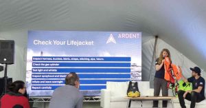
Next stop was a talk by Charly Hewett from Ardent Training on Lifejackets. She was looking at choosing lifejackets, key components and routine testing. We work with Ardent Training to provide our online Day Skipper course so its always lovely to catch up with them and we attended really to show a bit of support. Ardent bring a fresh approach to theory training and we love their positivity and innovate approaches to traditional topics. The stage was hard to find and sadly difficult to hear due to chatter from nearby. I suspect this impacted the attendance at the talk which was sadly poorly attended. This was a shame as Charly gave a great demo and talk and I’m sure many others would have found the information useful.
I would definitely suggest seeking out the talks if you can in future. Everyday is a school day. So many leisure boat users don’t get to see lifejackets inflated or being set off, many are unaware of what is inside them and yet it is something we rely on every boating trip. Charly gave a really useful insight into various aspects of lifejackets.
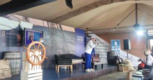
Following on directly in the same stage was Peter King from Ardent. He was giving a talk on passage planning for small craft. Such a huge topic and invaluable free advice and training that once again it was shame the audience was impacted by the lack of visibility of the stage. If you were at the show and didn’t attend you really did miss out on some great free training from Ardent. We attended as a way of exchanging ideas. Peter sensibly changed the format from a presentation to facilitating a small group discussion which worked well. We would have struggled to hear over the nearby noise which had increased since Charly’s talk, so a small group huddled around the stage worked great.
The talks were a fantastic initiative and very valuable. Anyone would could participate at whatever level. For future, I’d suggest these greater publication in advance so people can plan their day. It would be helpful to have better planning and a host for each stage. A compere introducing speakers and promoting future talks brings more atmosphere. A host outside guiding people, showing them to seats and encouraging questions would feel more welcoming. That said, the drop in/out format is always nice at a show as no-one wants to feel trapped!

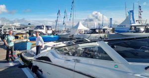
We quickly made the decision to return for a second day to focus on electronics. The first day was spent meandering. The show was smaller this year but felt more relevant and focussed. Alongside a browse of the standard chandlery stands, we also visited friends on trade stands, marine charities we work with. Of course, there was also a quick walk around the on the water marina.
At the risk of missing names, here are a few exhibitor highlights. On the chandlery stands this year was great to see so many options for boat hooks. It sounds random but having a choice of boat hook makes life so much simpler for leisure boaters. From the buoy catcher to the moor fast, the simple boat hook is not always a simple choice!
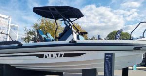
We had a great chat with Tom on the stand. He is always enthusiastic and it was great to look around their range. They have certainly grown in popularity around Poole and we often see these for own boat training. We had a chat about future potential options for ourselves as well as looking at models that would suit different client groups. Our students that have bought Highfields seem pleased with them. The variety of options across the leisure range, professional and adventure certainly offer lots of choice. I got so engrossed looking at them that I forgot to take many photos. The choices on board make these boats a popular choice. Thanks for Jelly beans and blue Honda Duck too!
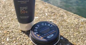
We use a LOT of sun cream during training so always good to look at options. For years I had a favourite, if not pricy, sun cream but these was unavailable for a while and then reintroduced with a new formula and only available in certain months. I have tried the standard supermarket brand which do the job for everyday but I was interested to look at the Ocean Freedom range. Not a brand I know much about but having spent time in Australia its clear we don’t take this topic seriously enough in the UK. Ocean Freedom were giving out free samples at the show. A South African brand now available in the UK. A few days after the show I was particularly impressed with their Surf Clay which seemed to do the job well. Still investigating this one but a brand to watch.
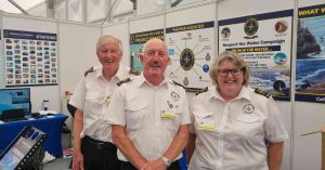
NCI are always a favourite. Lovely people providing a valuable volunteer led service to keep us safe on the water. We always pop by the stand for a chat and we were pleased to see our local teams from Hengistbury Head and Swanage across our two day visit. If you haven’t heard of NCI do go check them out. We use their service regularly for radio checks and they kept their friendly eye on us on trips along the coast. A charity we always talk about during our VHF radio courses. We also got to chat with our local RNLI community safety team. Chris from their team is always helpful and full of ideas so lovely to catch up. Again, another valuable volunteer led resource. Do check out their Mayday cards.
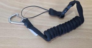
Icom – we couldn’t attend the show without stopping by to say hi. A lovely chat with Chris, updating us on news and new products. In particular a chance conversation led to the revelation that ICOM sell radio lanyards. Anyone who has attended our VHF courses know that we strongly recommend getting a lanyard so great to hear you can now order these.
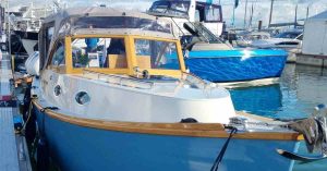
Tas is a beautiful boat built by the Traditional Shipwrights who are our neighbours in Poole. The owners are rightly very proud of her. She is a Westons Point 27.
Always good to catch up with friends from Saltwater Solutions who were displaying two Windy models.
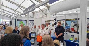
The final part of our day was dedicated to the Women in Marine event. This event is open to all and everyone is encouraged to attend, not just women. This year it was good to see the publicity made this clear. It is a free event made possible by sponsorship and the discussions panels always cover diverse topics. Women are still underrepresented in the marine sector and this event is designed to offer support, look at the reasons why and try to offer solutions to promote a generally more diverse work force. The barriers affecting women often affect other underrepresented groups too. Thankfully the main British Marine page advertised the event as disappointingly this never made it to the main Southampton Boat Show webpage. This shows why you need to research your day before attending the show to find all the ‘hidden’ events too.
The discussion panel was hosted by Nicky Vaux and panellists included:
A review of the panel and discussions is available on my LinkedIn page: LinkedIn Women in Marine Post
On day two we ran into various past students which was lovely for a catch up. Our particular focus though was the electronics stands, updating our product knowledge. We focussed on Raymarine, Garmin and B&G.
Raymarine is a brand known to us as we have their plotters on our own boats so this was a was quick catch up.
Next stop was Garmin. We found the fantastically helpful Meggie who was happy to answer all the questions we threw at her. Amazing product knowledge, willing to chat, demo and find answers. Really useful to chat about the comparisons between dedicated chart plotters and app based options, particularly with a brand that offer both. Alongside general queries we chatted about setting geofences on the devices, auto guidance routes, processing power of different devices and the relief shading.
Final stop was Navico to discuss Simrad, B&G and Lowrance. A slightly different approach to other companies, Navico have different brands aimed at specific sectors whether that is sailing, fishing or powerboating. These brands are starting to appear on boats we train on so great to be able to compare them and discuss. Richard on the stand, who turned out to be local to us, was brilliant in guiding us through the systems. It was end of the final day of the show but he still showed lots of enthusiasm and definitely a brand we would now consider using fully.
A different show this year, smaller but more focussed and with a little planning very worthwhile.
It would be great if there was more interaction in advance with organisations such as sailing clubs and commercial training centres. Lots of show content that we could advertise to potential visitors that we often don’t hear about until after. The talks were great, would love to see more of them with a little adaption of advance publication and hosts or comperes for the stages. The show could also be a great event for CPD sessions for commercial sectors whether skippers or instructors beginning or end of day, it could prompt great relevant to the commercial leisure sector. More information, a welcome on the gate, more announcements.
Finally a plea as with all shows a plea for exhibitors to respect visitors by not packing up early! We were nearly flattened towards the end of the show by a group trying to remove a large desk arrangement blocking an entire aisle and requiring us to take cover in an adjoining stand! It was potentially hazardous not to mention a poor reflection on their brand.
All in all, well worth visiting whether you are a professional or leisure boater. Thank you Southampton Boat Show for another great event and particularly to the sponsors who made the talks possible.
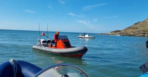
We know from talking to our students that many of you want to make the trip to Lulworth by boat but this is a trip that requires careful planning. It’s a trip we have undertaken many times but not one for beginners as lots to think about. Last week we found a good weather window, support from others and our two boats were recently serviced and ready to go so we thought we’d share our thoughts on things to think about. We don’t want to put people off but its important to recognise this is trip for experienced boat handlers who understand navigation and safety situations as well as boat handling.
We know that being on the water is not all about qualifications. Time on the water is important as that is where people learn. However ‘bits of paper’ do give us a measure. It is a careful balance between pushing the comfort levels but not too far! Blissful ignorance is a dangerous thing! Experience is a personal measure that only you can determine. Turning our attention to qualifications in the Powerboat Scheme, the PB2 is really aimed at trips of up to 3 miles, local day time trips.
By the time people move onto the Intermediate scheme they should already have theory knowledge to the level of Day Skipper Theory and lots of time on the water. The Intermediate Course looks at making passages along the coast. However, we should bear in mind that our coastline is very different. Heading to the Solent from Poole is very different to heading to Weymouth. It is important any skipper has a good understanding of not only the theory of tidal races, but also sea survival and handling boats in rougher conditions. This comes with experience not necessarily just qualifications. By the time a Skipper achieves the Advanced qualifications they should be more than capable of determining the conditions for making this run.
Before getting to a passage plan, keep an eye on the weather to identify a good window. We knew the week was looking good so narrowed it down to the best day looking at weather and tide. We had light North Westerly winds and tide was favourable. As the evenings start to draw in we wanted to ensure good visibility and to be back before fading light. We weren’t fixed on a set day and instead had flexibility to react.
Next step in the planning was identifying accompanying boats or people to make the trip to Lulworth by boat together. We could have simply made the trip on one of our boats. The boats are serviced and maintained, full of fuel but that leaves us with little contingency if anything goes wrong. Cars break down even when serviced so it is reasonable to assume this can on occasion happen to boats. The coastline is not forgiving in the event of a breakdown due to overfalls, a rocky shore and deep water.
Going in company gives us back up to at least tow away from danger whilst resolving an issue. We planned to take both our RIBs but contacted an experienced friend to accompany us on the second boat for another pair of hands. He asked if another friend could join with their boat. We know him well enough to know he would only have suggested another capable boat and skipper. That gave us three boats and five skippers, all very experienced and with recently serviced boats. Travelling in company is not only potentially safer but also enjoyable.
Choose your travelling companions well. We knew four of the people and knew that the fifth person was well known to the others who we trusted. He had someone we knew on board which left us confident that we could have a fun trip without worrying about unsafe high jinks. We all know about impact injuries and waves and are all old enough to have aches and pains we don’t want to make worse! The trip would be no fun if you were worrying about someone acting dangerously. This was meant to be a relaxed and enjoyable trip.
We knew we were all happy to act independently. There was no silly close quarter high speed passes, no wake jumping and everyone was respected to travel at their own pace. Just an occasional glance to make sure we were all still visible. Amongst us we had instructors, commercial skippers, ex Navy and ex RNLI crew. We have all completed first aid courses, sea survival, navigation and VHF radio as a min alongside boat handling. We are not saying you need all these qualifications, just an awareness of the reassurance this gives us.
Check your boat is kitted out before coastal trips. In our case both RIBs are used for training and commercial work so we had little extra to add. We did ensure we had plenty of fuel for a longer trip and took a slightly more enhanced tool kit for repairs if needed – realistically gaffer tape and cable ties provide a lot of temporary fixes! A trip to Lulworth by boat from Poole does require some extra planning than a simple trip to Studland. In terms of personal kit, a quick check upon meeting showed that everyone had hats, sun cream, full waterproofs, spare layers etc.
I’m not sure exactly how many handheld VHF radios we had! By chance we all had at least one each plus a fixed radio on each boat! On this occasion not everyone had a PLB and its something to think about potentially adding. We weren’t unduly worried on this occasion due to the people involved, number of boats and daylight calm weather trip. Every person on the trip could have handled a MOB situation, first aid or radio calls. Don’t forget food, although there was no posh picnic, we all had spare snacks and plenty of water.
This isn’t a blog to go into detail on how to make a passage plan but suffice to say that each skipper should make their own. The complexity of it will depend on experience and local knowledge but be aware of a few specifics on route to Lulworth. Think about the tidal races at Old Harry/Handfast Point, Peveril Ledge, Durlston Head/Anvil Point and at St Albans Ledge. Check your contour lines and check out potential hazards on route such as rocks and wrecks. We chose to stop at Chapmans Pool on route which gave us chance to catch up, take a break and reassess the ranges.
Its helpful to have looked at position in terms of Lat/Long for the ranges in advance and checked where on board you can monitor this. In our case, the inner range was operating and we’d spoken to the ranges both before leaving by phone and then by VHF radio on route. We were given a clearance of being south of 35′ and were clearly being monitored by the range boats on route. We were probably quite identifiable as a group of three.
Consider what equipment you have on board for how much detail you need in terms of bearings, distance and speed time distance calculations. In our case three boats, 5 mobile phones, each with at least two navigation apps (!), hand bearing and fixed compasses…. but we still had a paper plan in case and screenshot to our phones. Our port of refuge as we headed down the coast changed with a view that Weymouth or Portland would be easier than returning if assistance needed. In addition to electronics we also carry paper charts.
It is worth calling NCI on route, not only for a radio check but as they are the eyes and ears along the coats logging each boat as it passes. We had a slight issue with one radio so it was useful to call a specific NCI station to check range of communication. Reassuring to receive a message on our Facebook page that we’d been spotted, listened to and logged on route! We are very lucky in this area to have numerous NCI stations.
It turned out to be the perfect day for the trip. We had a slight delay in the morning getting organised but took this time to ensure the boats were ready. We knew we still had sufficient time to be through and return with favourable tides and weather. Out of Poole Harbour, speed limits now relaxed in the main channels but don’t forget no excessive wash & safe speed still applies. The 10 knot speed limit is also in place for the section between Bell and just past Channel 8 buoy. We met up with the third boat, pleasantries exchanged and off past Old Harry. The boats separated a little through Swanage with one boats choosing to go inshore around the bay and the others cutting straight across.
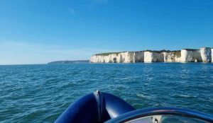
Swanage NCI are always a reassuring sight as we pass Peveril point on route to Durlston and Anvil Point. The sea through all three sections was nice and calm with a slight swell running as we all explored the coastline around Dancing Ledge and the caves on route. No specific birdlife to report but one day I will get to see the Puffins! On this occasion it was lots of walkers and rock climbers to watch. Next stop was round St Albans Head. It was smooth water but with a definite swell running through which the boats made light work of.
Next stop Chapmans Pool for a water stop and catch up. Impressed to see people still swimming! Quick chat with the range boat and next we headed South to the point agreed and then Westwards past the firing range. Finally, a line into Lulworth Cove. Interesting spectator sport watching the range boat chasing boats who hadn’t responded to calls over the radio.
The return route scooted round the ranges and then straight back. The tide was starting to run and definitely more swell than the run out particularly around St Albans and Peveril. Much harder to take videos and photos as we needed to hold on but no craziness and the boats handled it easily. All in all a good day out. None of the boats missed a beat which was great. Surprisingly fuel bill not too bad and everyone enjoyed the day.
Every day is a learning day…what might we do differently? Checking who had PLBs earlier in the trip, entering the third boats MMSI number into our phone books although we had, at least, pre agreed a VHF channel. Extra suggestions we have for you – ensure each boat knows the skipper is responsible for their own boat and decisions. Know when to bail out and check the weather carefully. Make sure you are sufficiently experienced before attempting this trip and consider travelling in company.
We train people both on our boats and their own. Whilst we teach the RYA courses, we have a large focus on bespoke training. We enjoy working on an individual level with people to ensure they get the best from their time on the water. Own boat training may be the right solution for some and in this blog we will look at topics to think about before booking. The blog is by no means comprehensive, no doubt in time we’ll add to it. However, it hopefully will raise ideas in your mind. It is focussed on people using boats within our local area of Poole, Dorset. Whilst you may book training at end time of boat ownership, it is often just the beginning of your journey. This is an exciting time, buying a boat but a few thoughts below:
A question we are asked regularly but one that has no set answer. The benefits of completing training on a ‘school’ boat before moving onto your own boat training may include a perceived increased availability due to more instructors working on ‘school’ boats, the ability to slot onto a course as an individual, the confidence that it is a training boat and not your own precious new purchase, and the wear and tear being on someone else’s boat.
Let us address each of those and compare to own boat training. Availability for ‘school boat’ may well be better than ‘own boat’ at larger schools as they can bring in freelance instructors to work on a standard ‘school’ boat. At our centre almost all courses are taught by Sarah or Dom, our Chief Instructor and Principal so this doesn’t affect us significantly, we work across our boats and own boats.
The ability to slot onto a course as an individual cannot be disputed, but we would urge you to consider whether you will in fact be on the water alone in future. If this is a family boat, do consider a bespoke course for your group whether everyone takes the full qualification or instead looks to learn crew skills alongside you. Training with family aids communication for the future and we can bespoke suggestions for your family dynamic.
Damage to your precious new boat, there is of course a possibility that a boat may get damaged, in just the same way a school boat might, BUT we should always be aiming not to damage any boat. As a training centre we put a large investment in our craft and as such respect them in the same way we would expect respect for someone’s own boat. We provide plenty of fenders and every manoeuvre is dynamically assessed by an experienced instructor to ensure it remains entirely manageable. It is your own insurance that covers damage expect in specific circumstances. Please bear in mind that if any damage were to occur we would have to complete an incident report so that acts as an extra incentive alongside basic respect!
In addition, the benefit of training on your own boat includes the fact we can talk through controls, help you to assess your particular berth or launch facility, work with you to suggest the best approach to manoeuvres with respect to that boat and the boat will handle differently to a school boat if it is a different design. Most training centres use RIBs for training but if you have a hard sided boat, whilst the principles are the same, the handling may feel quite different. A hard sided boat is often more significantly affected by the wind.
It is sensible to query who your instructor will be in terms of not just qualifications but whether they have experience of the style of boat and engines you have and the precise location it is kept. Clarify what is included within the training – it is a price per person or per course. What hours are you anticipating and what preparation do you need to have done in advance? Do you need to have a fully kitted out boat or are the centre able to provide extras? What happens in inclement weather? Do you have a plan if the boat breaks down? What is covered within the course and are there any specifics you need covering in more detail on an individual basis? Don’t overly worry, there is an answer to everything, but do at least consider options.
At Dorset Marine Training, we only use instructors who are personally known to us. We then allocate jobs accordingly. Whilst Sarah and Dom do most of the training, occasionally we do use other instructors who have specific skill sets. This is discussed with you in advance. We both have wide experience across a range of boats and are not only advanced instructors but commercial skippers too. We always want to provide you with the very best options. Whilst courses are planned around a 9am -5pm plan, we have complete flexibility to adapt subject to tide and weather. Often we have groups that need specific timings. We often work evenings and yes we do work both weekends and weekdays!
We provide a list of equipment in advance and then anything you don’t have on the list we bring with us at no extra charge. The weather can be challenging but we want you to get the most from your training and enjoy your time on the water. At Dorset Marine Training, if it is unsuitable we will simply postpone and rearrange.
If a boat is new to you, ‘gremlins’ can occur on first outings. We expect the boat to have had recent servicing, but should the unexpected arise we have a ‘black book’ of contacts who can often provide out of hours solutions. If training is significantly affected then we may need to move onto our boat or postpone training either of which may incur an additional cost. Generally though we are able to be flexible with timings and adjourn to the training room for a bit of theory and shuffle topics. We are as considerate as possible in finding solutions.
We would anticipate that you have had a handover on the boat from the supplier in advance of the course. In order to complete the syllabus within the allotted time you should have awareness of the operation of the boat. Ideally it will fully fuelled and you should know where isolators, sea cocks, bilge pumps etc are located. If this has not happened we are certainly able to help. However, you may find we need to schedule extra time to complete the training.
Surveys and sea trails: Depending on the boat, these are both worth considering. If you do go ahead then ask around about survey options. With sea trials, who are you taking with you on this trip? It may be worth considering taking an engineer with you. Who is permitted to go on the sea trial? Is there a cost? Who is driving and what will it cover in terms of distance, speeds etc. The value of the boat may well be a factor. In advance of an offer, check the boat over yourself. Not only how she handles at sea but also servicing records, whether covers fit, lids and hinges etc. Check what equipment is included in the sale and if none factor this into purchase costs.
What will be covered at the handover? We would suggest ensuring you have a detailed session explaining sea cocks, bilges alarms, isolators, bungs, start up procedures, alarms, covers etc. The complexity of the boat will determine how long a session this needs to be. For some boats it will be a straight forward process.
The RYA has several articles on boat buying: Tips for Buying a Boat and Boat Buying Made Easy. These are worth a read prior to purchase. It is an exciting time buying a new boat, but do think practically too!
This is not a comprehensive list but a few ideas to help you assess what is already on board a boat you are considering purchasing. We can provide these for your course, please do not run out and buy new ahead of training, let us chat about what is most appropriate for your individual situation. Not all of these will be appropriate to all boats!
Now you’ve had time to think it through & completed your checks it is time to get excited about using the boat again!
Ready to book? Contact Dorset Marine Training
Group MMSI numbers are something we talk about regularly on our VHF courses but only a handful of people seem to use. After a round of VHF courses for our local sailing club we piqued enough interest to apply for a group MMSI. Pleased to report that Lilliput Sailing Club has now been granted a number by OFCOM. I thought it might be useful to explain a little more.
An MMSI number (Maritime Mobile Service Identity) is a unique identifier for radios capable of Digital Selective Calling. This can perhaps best be compared to a phone number. In reality, most fixed radios on boats are now digital and capable of DSC. Each boat or station will have its own individual MMSI number. We discuss this fully on our VHF courses or perhaps take a look at this ICOM article. We can then also subscribe to group MMSI numbers.
A Group MMSI number is used by organisations and event organisers to assist with radio communications. It allows one alert to be sent to all within that group at once. It is a useful way to communicate, send alerts and coordinate activity. To obtain a Group MMSI, an organiser must apply to OFCOM via the licensing portal. All MMSI number are nine digits, individual ship MMSIs will start with the Country code but Group numbers start with a single zero. Once a group number has been issued, the organiser will send this number out to their organisation. No longer will each individual boat have to be called.
The Group MMSI starting with a zero will be sent out to the group participants. Each participant should then enter this number into their phone books on their VHF radios, saving it under group number. Participants may belong to several groups. When the organiser wishes to send an alert to the whole group they will select this number when making a group call. Anyone who has the group number in their phonebooks on their radio will find that their radio starts sounding an alert. If the call is accepted the radio will default to the channel the announcer has chosen and everyone on that channel will hear the voice call.
Any participant can make a group call and it is up to the organiser to ensure it is used appropriately. The benefit of using DSC is that it doesn’t matter which channel each boat is on individually, they will still receive the alert.
Lilliput Sailing Club has applied for a Group MMSI number.
This has been granted. Guidance notes are prepared and the number sent to members to add to their phone books.
Anyone at LSC wishing to participate adds the number to the phone book on their radios.
We have training sessions planned at the sailing club – I’ll let you know how this goes. We just need a few people to engage and this will make event coordination easier. As a centre we regularly run refresher session for clubs or groups. Participants must already have an Authority to Operate (usually their SRC/completed their VHF course). If you’d like us to organise a session for your group or crew please contact us.


Checking in at Mylor Boat Hire
Last weekend by chance we took a boat out from Mylor Boat Hire and had a wonderful day exploring the Carrick Roads. Boat Hire in Falmouth is such an amazing adventure. It was a random encounter, Dom had accompanied clients with their own boat on a trip from the Solent to Mylor, I went to collect him and by chance we ran into the lovely people at Mylor Boat Hire. It was too good an opportunity to pass up so we found ourselves out on a Plymouth Pilot motor launch. What an amazing day!!
Mylor Boat Hire is run by a friendly and experienced team. They offer both sail and power boats for hire. We’ll definitely be back to hire a sail boat as well as motor. They are also able to offer training. Boats are available for those with or without experience depending on the type of boat you wish to take out. Parking is close by and the whole thing was so easy to organise. The boats were well kept and we were pleased with the equipment on board.
Briefing:
When we arrived we had a friendly briefing and advice on where to visit. Even with experience it is always beneficial to take advice from locals. They know their waters and can offer great suggestions. The Sea Shanty Festival was on in Falmouth with wonderful sounds across the water but we fancied something a little more remote. We were given a map, very artistic and fun and decided to head off to Malpas. As Dom had just completed a training run he had VHF handheld radios with us and we both had portable navigation apps on our phones.


The journey:
And off we set! The Carrick Roads were beautiful to explore, it felt like a lovely unexpected but easy adventure. A fabulous opportunity to take time out just to explore and chat. The boat handled beautifully and was perfect for the area. A little cuddy at the front protecting us from any spray and enough power to make way against the tide. We saw lots of sights along the way to photograph for future training from day shapes to buoyage, hull shapes, lifejacket lockers, even bins on pontoons!
The map provided worked perfectly and was very pretty but it was also reassuring to have digital navigation on our phones. I was using the SavvyNavvy app which helped us work out why navigation marks were in certain places & how long the route would take. We also love the AIS function too showing the location of boats with AIS and a little nose as to what they are. The up to date tidal and weather information is great on the app. It is so reassuring to have a digital navigation app available wherever you are.

Coffee stop:
We spent a couple of hours exploring and arrived at Malpas. There was a helpful harbour master who advised us where we could moor on the jetty. They were willing to help take lines if needed but happy to leave you if feeling confident. Arriving by hire boat, one never knows quite how you will be greeted but they were professional and helpful.
The boat handled perfectly and we were alongside easily. A quick payment for a short stay, advice on where to go and we headed to the top of the pontoon to the Heron Coffee Shop. An amazingly cheerful person behind the counter who organised us nachos and coffee. We headed outside to tables overlooking the creek and the pontoon. A wonderful spot to sit and relax. The cakes were so good that we couldn’t leave without taking some for the journey back! An easy departure from the pontoon and a rising tide made the trip back reassuring.


Return:
We were met back at the pontoon in Mylor by the friendly team ready to take lines and assist us ashore. Felt quite odd to be the ones on the boat as opposed to guiding boats in ourselves! It is always interesting to experience boats in the way our students do. It initially felt a little uncomfortable to take an unexpected trip, less time to plan but equally comfortable knowing we had all the resources and experience we needed. I needed to know I was with a trusted business whose maintenance of boats I could trust, usually we have to prep the boat ourselves. It was a luxury to simply step afloat and head off!
If you find yourself looking for Boat Hire in Falmouth area I would recommend searching these guys out. We had a good chat about the sailing options too and definitely something we’d explore in the future. Thanks to all at Mylor Boat Hire for a wonderful day.


Our most recent talk for members of The Boat Club was on the topic of planning and places to go. This was aimed at those using powerboats around the Poole area.
We started with a chat about we need to make a plan. SOLAS V makes it a requirement that a passage plan be made when we head to sea. Further information on the requirements and legal status is given in an easy to read format in this RYA Guidance Note
Now we have decided that we need a plan we need to think about what sort of plan we want. Will it be written down or just thought about? We could write a list of information, use a form or draw a pictorial representation. It is important to consider whether we plan to use paper or electronic options. There are no rights and wrongs for our leisure boaters, where you are going will have an impact on what you choose. Generally, for short trips in the harbour I would start with my list of queries and then draw a pictorial drawing of my route. For trips further afield, to Swanage or the Solent, I’d start with my overall queries, have pictorial pilotage plans for the harbours and then also a passage plan form with details of tidal stream considerations.
Personally, we’d use a combination of electronic sources and paper-based resources. I prefer to start with an overview on a paper chart, having first considered the scale of the chart and whether it is a current edition. I would then use both paper and electronic sources of information to answer my queries. For the actual journey itself I would use a combination of the electronic chart plotter on board, electronic sources on my phone or tablet and a paper back up.
Our list of considerations before we start a drawing or form in planning:
Taking each of those in order:
Members of clubs are usually restricted to set areas to allow for safety. Often limits of operation increase with skill level but fundamentally our attendees are all using boats within familiar waters, in daylight and fair weather. The destinations vary from those around Poole Harbour, Studland, Swanage and for some the Solent destinations such as Lymington, Yarmouth, Beaulieu and Newtown Creek. Some of these destinations are tidal. We should also consider how far they are and how long the journeys will take along with the mooring options when we arrive. Some people enjoy anchoring and relaxing on the boat, others swimming or perhaps heading to walk ashore pontoon to visit a restaurant.
 Tides:
Not only do we need to consider the height of tide but also the speed and direction of the tide. The height of the tide will affect many locations in Poole Harbour as it is particularly shallow. On the other hand, a high spring tide may affect whether it is advisable to moor on the quay wall at Wareham! Don’t forget to check tides at different locations along the route.
We then want to consider how fast the tide is flowing and in which direction. We might use a tidal atlas or look up tidal streams on a chart or in the almanac. It We might use electronic navigation apps to assist but I tend to start with paper before cross referencing. The direction and speed may affect the fuel efficiency of our trip as well as the comfort levels of our trip – do we have wind against tide. Does this affect when we want to travel? For tidal streams double check the reference port for tide.
Sources of information for tides? Tide tables, almanacs, navigation apps such as Savvy Navvy or websites such as Easytide. Check that you understand whether you are working in GMT or BST.
A tricky query often asked is how far in advance can I trust the forecast? For local trips we tend to work on a basis of about 48hours in advance. Even then we will be looking to see how long it has been consistent and what different forecasting models show. On the day I will be particularly tuned in to the Inshore waters forecast and The Maritime Safety Information Broadcasts put out over the VHF Radio.
I would tend to also look at Windy, Windguru and perhaps local weather for my destination and I’d look across various forecasting models particularly the UKV2.
As part of the plan consider who will be on board. How much experience does the skipper have for the trip? Consider whether crew/ guests have been on the water before and whether there are any health considerations to take into account. At the very start of our careers on the water, a wise mentor advised us to always bring people back ashore before they ask to come back. That way they will want to go out again!
Whilst being on the water is an adventure, it is important to consider what waters your boat is designed for. At the club members will have specific areas identified for each boats use and these are designed with safety in mind. You should, as a minimum, consider how high the freeboard or bow are, whether there are legal restrictions and the design category of your boat alongside weather.
Use a chart or navigational app, as well as pilot books to consider hazards along your route when planning. This could be anything from tidal races to rocks, wrecks to shallows or LNTMs to Byelaws. When plotting a route consider whether you need to input waypoints onto electronics or a chart. We should think about the risks of asking electronics to plot a route from A to B without carefully reviewing it ourselves.
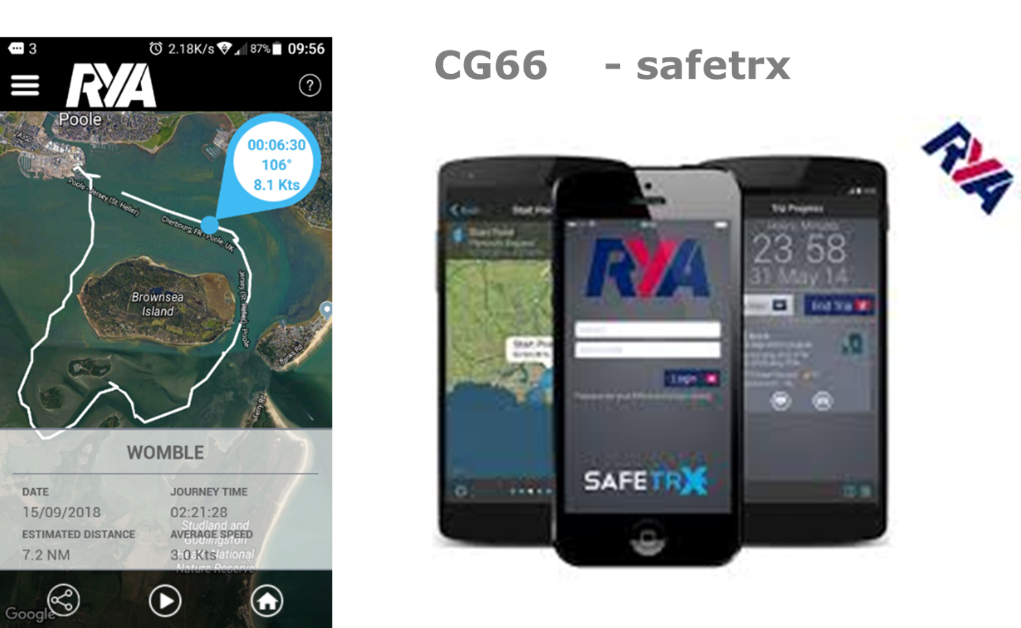
Before actually heading out we need to ensure we have a ‘Plan B’. We should give a safety brief to our crew and we should carefully check over the boat. In particular, check we have sufficient fuel!! It would be sensible to run Safetrx whilst out on the water.
In terms of destinations for our group last week we talked about:
In this blog we’ll just look at a couple of these destinations but if you’d like us to cover others just drop us a message.
 Brownsea:
The resources we might use for Brownsea would include tide and weather information. We would look at the National Trust website, the Poole Harbour Guide and check LNTMs and Byelaws on Poole Harbour Commissioners site. The Imray Y23 or Y39 chart would be helpful. From these guides I would have ascertained that dogs aren’t allowed on Brownsea, the opening times and where snacks and toilets are located along with admission fees. I would know where landing is permitted and where it is not permitted and shipping movements to cross the channel in the Harbour.
The chart would also assist in determining where we might anchor and what depths are in the channels around the island. I would also have noted the rock by Pottery Pier and the quiet zone/speed limit of 6 knots. I might have looked at a map of Brownsea using satellite imagery to assist and used app such as Savvy Navvy, clicked on the anchorage symbol to obtain further information about when the anchorage is protected from the weather.
We would then form a pilotage plan using a drawing style approach to plan our route. We might choose to use colours to help us identify navigational marks. On the day we’d update weather and time and check live reports whilst also using our VHF radio.
 Swanage:
We might start by getting an Imray C4 chart which also has insets of Old Harry on route to assist with planning. This would allow us to look not only at hazards but also to work out a distance and based on speed an approximate journey duration. We’d also plan our route through Poole Harbour perhaps using a Y23 or C4 Imray Chart.
We look online at information for visiting Swanage by boat and from this have ascertained where we could moor and the water taxi number. By looking at the charts we’d have ascertained where we might or might not (!) anchor. We could look at our Navigation app for information or websites such as VisitmyHarbour which gives you tips on anchoring within the bay – e.g. maybe use tripping line! I would also look at an Almanac such as Reeds.
Hazards to identify on route might include: chain ferry, training bank, shipping movements, rocks around Old Harry / Handfast Point, a wreck of unknown depth on route, the overfalls (disturbed water), pot buoys to avoid (lobster pots), the lack of a safe haven or shelter in certain wind directions,, the potential for wind against tide waves in the Swash Channel, possible parachuting activities described in LNTMs and the usefulness of contour lines to stay a safe distance away from rocks in one direction and overfalls in the other.
A look at the chart would have shown me that I ought to look at tidal streams to calculate what state the overfalls might be and to assist with efficiency and a comfortable trip. If using the tidal streams in the C4 chart I would need to look at Dover as the reference port. I would look at using waypoints on route to act as reference points and I’d add these both to my paper and electronics plans.
On route I’d like to have electronics working with a route input, my mobile phone (with a battery pack) for mobile apps and I’d have both pilotage and a passage plan drawn out. If I were leaving my boat on a buoy, I would want to ensure it was secure before leaving. If leaving boats at anchor you should always check out whether your insurance is valid.
Navigating to The Solent will include ensuring we clear Christchurch Ledge, deciding on a route into the Solent, (North Head buoy route recommended) and then considering tidal streams with particular care at Hurst Narrows. It is important to think about possible hazards on route including Hook Sands, Christchurch Ledge, The Shingles, dive and fishing boats etc….
For information on ports alongside the other resources discussed we would recommend getting a Solent Guide Directory which contains lots of useful information. They produce a great paper copy as well as the electronic. An Almanac such as Reeds will provide much useful information too. Ensure you are signed up for LNTMs at the ports or harbours you will be visiting. Yarmouth, Lymington and Beaulieu all have helpful Harbour Authority websites and Lymington even has a video showing you the approach through the river.
This is just a flavour of the thought processes that go into planning trips out. There are many different ways of achieving the same aim. Fundamentally however we need to plan. We hope this blog has given you a flavour of the things to consider. If there are other destinations, you’d like us to include please let us know.
You will need a VHF radio for planning these trips – if you haven’t done so already its time to get your VHF Course completed now!
Yesterday we held a training talk on safety topics and pre-season reminders for members of The Boat Club at Parkstone Bay Marina. We thought it may useful to replicate some of the content here. The talk was regarding safety topics and things to think about, ahead of a new season. They are always a great chance for members to get together and exchange ideas within a structured session. This is not a full guide and is designed as an aide for those who attended but this blog might be a useful extra to boat owners too. Most of our members are getting afloat locally, in daylight, so the information reflects that.

The first topic we talked about was planning our trips and our preferred apps and sources of information. We asked members to throw forward their ‘go to’ apps to ensure safety afloat.
Weather: For predicted wind forecasts two of the preferred apps in the room appeared to be Windy, Windguru and Savvy Navvy. The importance of also checking the met office inshore waters forecast was discussed.
Whichever app you choose it is important to ensure you have checked the units of measurement the information is presented in – knots, mph, beaufort etc. Don’t forget that on windguru you can click on the windspeed to reveal all the different forecasting models allowing an easy comparison.
We then talked about the usefulness of live information and one of our local sites Weatherfile. Not only does it allow you to compare the forecast with what is actually happening but also to look back and quick a log of windspeeds and whether that was comfortable. Another favourite of ours is Windycator which collates information from different sources.
In Poole we have a fabulous tide planner that we recommend people buy. This allows you to se the tidal curve and the whole years predictions. Online one of the most popular sources of information was Easytide. SavvyNavvy also gives you a great visual guide.
Live information: bear in mind the information above is a prediction but the air pressure or even wind direction and strength can impact the reality. We are lucky in Poole that we can access live information and compare it to the prediction on the Harbour Master’s website Live Tide PHC
Weather radar can also help avoid rain during trips and a favourite of mine is RainAlarm. The Met Office also do a similar version Rain Radar


There are a variety of navigation apps out there but clearly SavvyNavvy was a preferred choice of members. One of my current favourite features is AIS, useful to see what commercial boats in particular are on route. I like to complement this with Memory Map which shows raster charts and also allows you to set routes etc. Other navigation apps include Navionics which has long been popular and CMap. Remember to analyse the information you receive and collaborate data. Looking out the window is important- don’t get lost in electronics!
Paper charts are still with us for a little while longer. We absolutely use these as we find it gives a good overview in advance of a trip. Imray and Admiralty are still providing charts. Check they are up to date using chart correction information.


Whilst members of The Boat Club and our own training boats all have trackers, it is also important to be running apps such as RYA Safetrx to enable the Coastguard to best help you should you require it. At the very least get registered on Safetrx. One of our members asked a good question about finding out data on club boats to be able to register them. I’d suggest the fleet tab on the members app is the best place to find this.
To my mind – the tracker helps me manage boats internally, check where they are, geofence locations and check past history. Safetrx is my active information on trips, allowing the coastguard to access data if needed.
Make sure you are registered to receive LNTMs (Local Notice to Mariners) for all the ports you visit. For members that will most likely be Poole but also Lymington, Yarmouth, Beulieu etc. In Poole you can still receive them via email – Poole LNTM. The Harbour Master also has a WhatsApp channel on which they are published which is really useful.

It is worth having a look at our own webpage for links to resources:
https://dorsetmarinetraining.co.uk/resources-page-boating-links/
Our next topic was lifejackets, and we started the chat talking about different types. It is important to check they are the right size and fit for the person involved, children have different requirements than adults. Also to consider what additional features you might look at such as sprayhoods, lights etc. The club provides members with fully serviced lifejackets but if you have your own it is important to ensure they are serviced annually. Also, important to ensure they are stored properly, not thrown in damp lockers or car boots. Respect your lifejacket!
We next had a quick competition whereby all attendees were handed a lifejacket and challenged to fit it to the best of their ability. Everyone was suitable involved, and we talked about the need to help each other and ensure the central belt is fitted properly before the crotch strap. The RNLI issue a great lifejacket guide which includes a video on fitting: RNLI Guide . The club has Seago Lifejackets and their guide on fitting can be found here: Seago Seaguard Lifejacket. Dom also showed a video from the RNLI highlighting the importance of correctly fitting crotch straps. This seemed to impact our talk attendees as it is a powerful visual. Although I haven’t the link to the exact video a similar version is available here: RNLI Crotch Straps
We then set lifejackets off on a couple of volunteers. Attendees commented how sizeable the lifejacket was, how to let a little air out and how cold the canister might be.
This led onto a chat about pet lifejackets and the need to be able to get hold of dogs if they fall in. We also discussed buoyancy aids and the need the consider this if paddleboarding. They are quite different to lifejackets – if you aren’t sure drop us a line to chat.


Next up was an interactive session on what information we thought we should include in a safety brief to friends and family. We discussed why they are so important. Lots of ideas from members including:
All good and valid points!
As we discussed getting ready to set off we chatted about electronics. When people undertake their initial training there is so much to remember that it is understandable they can’t remember exactly how to use every piece of electronics. The point of our chat was to suggest members use a bad weather day to look at the chart plotters on the pontoon.
A simple list of questions to ask includes can I:
Can I set up and operate the VHF radios?
Can I find the isolators?
Where is the fuel gauge particularly on digital displays?
Before we actually leave the pontoon we should ensure we have a routine of checks. Have we turned on isolators, checked lockers, fenders, bilge, controls, engines? Many people at the club use the term KNIGHTS for startup to check Killcord, Neutral, Ignition (checking behind), Gears, Hot Telltales and Steering (checking how many turns lock to lock). We have a short video as a reminder: Daisy Pre Start Checks Don’t forget to check fuel levels, VHF including volume and squelch and that the killcord works.
An interactive session asking what safety kit people thought should be on board the boat led to reasonably long lists. The club boats are all licensed, so safety kit is provided for members. It is however important to note where kit is stored and how and when to use it.
Ideas of safety kit included: anchors, ropes, bailers, fire extinguishers, first aid kits, TPAs (similar to foil blankets but the marine version for water), flares, throw line, compass, VHF radio, boat hook, life raft and life jackets. We also carry drogues, harnesses, radar reflectors, fog horns and buckets.
do you know what type are on board and how to use one? What size fire extinguishers are on board each boat. What should you do in the event of a fire?
we chatted about the kits we carry and the need to look after ourselves until help arrives. Would you know what to do in the event of needing CPR or choking onboard? Most people had not looked inside a Cat C kit before to know what was inside it, so we opened an old one and lay out the contents on the table. If it’s a while since you undertook a course, why not consider the one day RYA First Aid course which we run regularly on site. We can even organise bespoke courses for your family or crew.
It is important to practice and ensure you could use one effectively in the event of an incident. Most people in the room had taken the opportunity on their PB2 courses to have a go but if you missed out (as it isn’t compulsory) let us know. We can arrange a practice.
Flares are a last resort, and we have more effective less volatile means of calling for help now. However, if you do need one have a look at our dummy flares to understand the types and how and when to use them. Life rafts – these are heavy, think about how you’d move one. We do suggest ensuring it is tied on before casting it overboard! Why not think about attending our one-day RYA Sea Survival Course in which we cover the safety kit in details but also have a practical pool session inflating lifejackets and life rafts. Then climbing onboard and paddling them.
I think its fair to say that this session hopefully provided food for thought in terms of ensuring you know how all kit on board works.
We also chatted about own boat bags – what extras do members like to take onboard. Ideas thrown into the room included: sunglasses, suncream, lip balm, handwipes for messy jobs like anchoring, waterproofs and warm clothing, hats, charts, water and food, duck tape, multitools, cable ties, power bank for mobiles, medication, tide books, binoculars and a knife (rounded tip).
If you haven’t reviewed your own boat bag for this season now is a good time!

This led onto a discussion regarding Man Overboard. Don’t forget we teach two different methods of man overboard recovery techniques during training. Every member will have practised these on training but have you practised since? Very important note that we NEVER practice with a live person!
If unsure please organise a refresher session with us but a few points to consider: alert crew, slow down, point at the casualty and raise the alarm via the Red button on the VHF radio, ideally make the MAYDAY call, use one of the two techniques to return slowly to the casualty. If you lose sight or on making contact, you should almost always turn off the engine. Think about how you are going to recover the person, are there any spinal injuries to consider. If you do get the person back on board, consider how to proceed, back to shore and medical advice? Always consider the effects of Cold Water Shock, Secondary Drowning and Hypothermia. Think about using a TPA to mitigate effects when back on board and protect them from the wind.
In Feb 2025, an important update was issued regarding the effects of alcohol and cold water shock
In particular, the statements regarding the effect of alcohol even at limits less than the car drink drive limits on survival rates was quite sobering (forgive the pun).
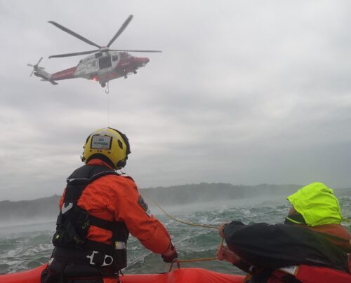
By now time was running away with us and we only got to briefly chat about helicopter rescue. However, it is important that you understand how this might occur and the issues to think about. On board each boat there is a copy of what to do and it would be a great idea to familiarise yourself with this at the start of the season.
Club boats have two VHF radios on board, the fixed set is a DSC radio with an emergency ‘red’ button’, the handheld is a standard voice radio. Start of season is a great time to check you know how to operate them and set them up, a reminder of the Mayday procedure and how to call for a marina berth at lunchtime. Most members have already completed their VHF courses but if not, get booked in now.
Don’t forget it’s a legal requirement to have that ‘Authority to Operate’ often referred to as the license to operate it and call for marina berths etc. If you took your course a long time ago why not organise a refresher. We worked in groups during our talk to try to put together a Mayday call in the correct order – fair to say that everyone found this a little memory challenging! Information given in the correct order will help the person listening to the call. All club boats do have it written down but it could be tricky to read depending on the situation.
Preparing now means you are more likely to have a safe and fun season afloat. It doesn’t have to be doom and gloom just because we think about these topics. Hopefully you will never need the safety kit on board or face an emergency. Remember lots of boats are going in and out of Poole Harbour all day every day perfectly safely!
Everyone left our session with a prompt sheet of reminders of ‘things to do’ ahead of the season. These have proved popular in the past.
Do think about booking some refresher training if it’s been a while since you’ve been on the water or you want to explore further afield.

This evening I had the chance to attend a presentation from Savvy Navvy aimed directly at Instructors. It is an app I’ve been using for some time but the presentation revealed a few few hints and tips. I will always love paper navigation for the overview it gives and the ability to fully prepare in advance. However, on the go, for familiar trips, Savvy Navvy is my go to app. I use it in the UK most days but also found it amazingly helpful out in Australia last year.
First and foremost when you log into the app make sure you input your boat settings. The app takes these into account when planning routes. It is also worth noting that you can download charts for use at a later time if signal might be an issue. These can be updated when next used to take into account current weather or chart changes.


Moving around the screen, on the right had side there are options for ‘North Up’ or ‘Heading Up’. Personally I prefer North Up as it helps relate what you are seeing on screen to that planned on a paper chart. You can also have a 2D or 3D image. The 3D is particularly helpful when entering a port.
We then move onto the various layers or presentation of chart types. There is the default image as presented above or a dark mode. It then gets more interesting with UK relief and satellite imagery. The relief shading useful for depths and the satellite imagery useful for an overview of a new destination. In any mode a post or buoy can be clicked on to obtain its light characteristics and information.


This include adding tide and/or tide calculations, AIS and clouds and rain radar. The AIS is a relatively new function that I’ve been playing with the last few weeks. It has been really useful not only identifying boats but distance to the craft. On route back from Lymington last week, a glance at AIS showed there was a dive boat ahead of us – useful information to give them a wide berth.


Along the bottom of the screen there are options to look at tide or weather for locations as you scroll around an area. There is the option to swap between forecasting models of GFS or ECMWF. The tidal data sources are currently being updated and should provide more comprehensive data shortly. There is also the option to view the users saved routes, ‘markers’/waypoints and tracks. It was quite cool to log into my tracks and look at my trip around Middle Harbour in Sydney last year!
To plot a route the user selects the Plan option along the bottom of the screen. Tapping the screen with a starting point and finish point the app will calculate the best route taking into account the conditions and boat settings. Then plotting route will display the route showing a yellow line for routes under power and a blue line for those under sail. Plot route will display a course to steer and ground track. The scheduling tool is a useful feature that not only allows to plan for an alternative day but also allows you to view the route, anticipated time and weather if the trip is delayed. This allow you to compare timings to find the most efficient options.


Saved points are a nice feature to keep waypoints and allow you to navigate directly to them.
Finally, there is the option to search for an anchorage, marina or destination. A click on the destination will reveal further information such as facilities, phone numbers etc. In this example I searched for Poole Quay Boat Haven.


Hopefully this was a useful quick run through of the useful features. In the interests of full disclosure, Savvy Navvy do provide the app to Instructors to demonstrate to their students. However, they have not asked me to write this article and have had no influence over it. I genuinely use the app regularly and find the clean view helpful. Over the last few weeks I’ve been loving the updates to the AIS features and now I’ve discovered the location information for destinations I’m busy investigating that too. I do use electronic apps – I’d be crazy not to, but I always use this in conjunction with a paper chart for new routes and question the information given to me, cross referencing it with other sources.
For information on pricing etc visit: www.savvy-navvy.com
As part of our continuing Professional Development, we attend training courses to further our own experience. This gives us perspective to present to you on the RYA Sea Survival Course. it turned into a pretty exciting time!
So even though we have a very accomplished Instructor for Sea Survival, I decided to attend the Sea Survival Instructor Course to better support our learning packages in this area. 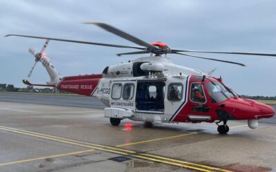
The three day course comprised some classroom based activity on background Knowledge in ‘Search and Rescue’ (SAR). There were up to date interactive training techniques and how our bodies cope with cold water exposure.
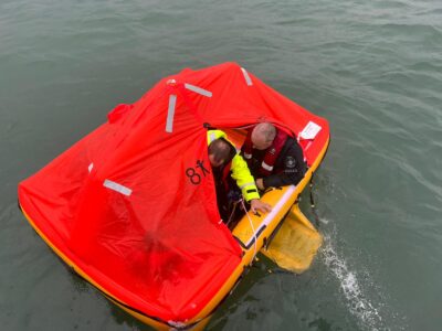
We experienced the water based parts of the course we teach for a much longer period. Finally, in the waters of the Eastern Solent for real, with liferafts….. and a helicopter!
The RYA Sea Survival Course helps users of small craft understand what actions to take if disaster were to strike at sea. The course was supported by Steve and Rose from Ocean Safety, who brought along a load of liferafts and training kit.
So.. on Tuesday 13th September at 12:50, we boarded the army’s motor cruisers and headed out from Gosport, arriving in Osborne bay around 13:30
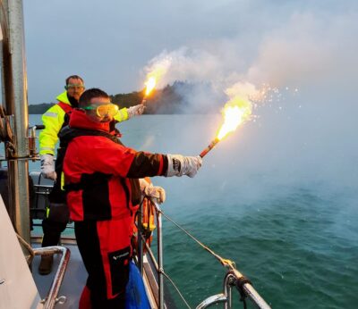 Using Pyrotechnics!!
We trialled the use of hand flares to ensure that we teach people exactly the correct way to fire these. Flares alert people to our position and signal that we are in distress.
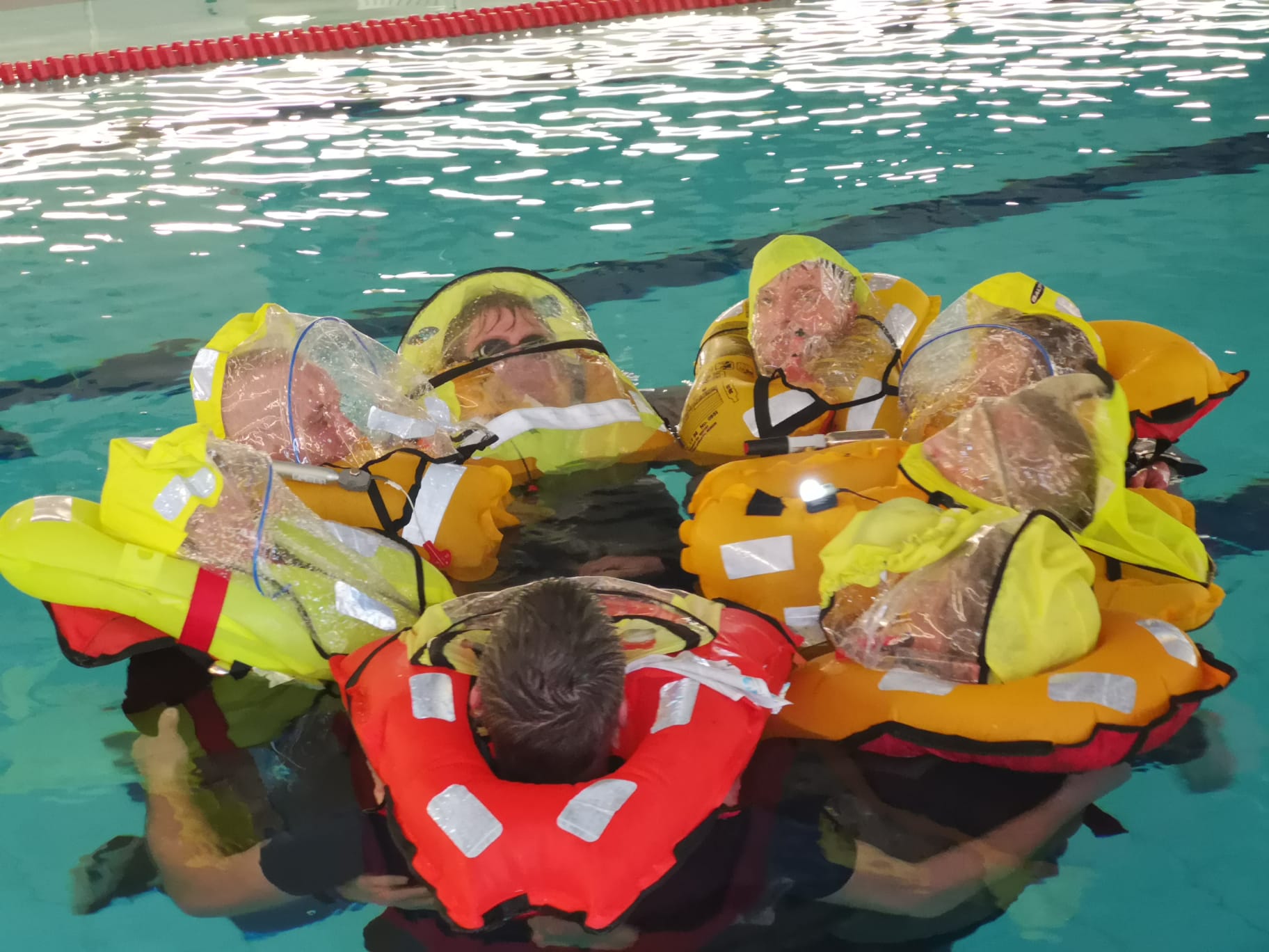
With support from two smaller ‘Ribs’ we inflated the Liferafts and got on board. We had Liferafts with a capacity for 8 persons, it felt cramped with only 6 of us. Whilst undertaking basic ‘liferaft management’ activities, we drifted alone for a few hours.
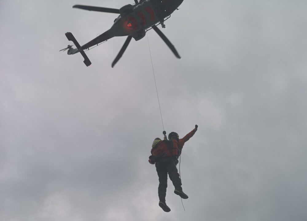
When the time was up, the coastguard helicopter came and dropped one of their team onto our raft. They ‘lifted’ some of the raft members to safety. The ‘downdraught’ from the helicopter is truly incredible and literally breathtaking!
The rest were ‘rescued’ by the RIBs and motor boats.
Whilst only a training day, the cold and exhaustion at the end was significant and emotive. The thought of being in a real raft, in a real situation, for much longer was that we should do everything to prepare for it well but aim to avoid it!
This experience has helped me modify our course presentation and thought processes, even enabling us to provide better links and resources to folks attending the course. Check out our course dates in the calendar if you’d like to come and join us.
It’s been lovely to see so many getting afloat and returning to the water for a new season over the last few weeks. Lots of happy faces and many successful first trips of the season completed. We have enjoyed meeting so many for bespoke refresher training and great to see that it is becoming a norm for people to book a half or full day refresher with an instructor on board to either refresh skills or learn new routes. Great to have lots of people who have trained with us previously asking us to check plans for routes and asking questions.
After the fantastic long Easter weekend with four brilliant boating days we thought now might be a good time for a quick reminder out including both things we have spotted and people have asked us about. As always please do drop us a line with queries. We are proud to be able to provide full time training both on clients own boats, Boat Club membership boats and our training school boats. If you want to get afloat but not sure how drop us a message and we can chat through Boat Club membership options or occasional charter with or without a Skipper.
We are clearly unable to cover all eventualities in this note below but we hope a few tips alongside the training you have received previously might be helpful. Don’t forget the suncream and drinking water!
 These are for your family and crew safety and should be worn at all times when underway – this guide from the RNLI is useful https://rnli.org/safety/lifejackets
In particular as we are returning to the water check: all lifejackets have been serviced this year (they require annual maintenance checks), children have appropriately sized lifejackets, you haven’t accidently mixed in buoyancy aids, lifejackets are worn as the top most layer of clothing (no coats over the top), lifejackets should be done up across the middle and crotch straps worn.
Ensure you have a plan before going afloat. Check the wind and tides and prepare a pilotage plan for where you are heading. We have seen a few boats heading across sandbanks and getting caught out by the tide – simple planning will help prevent such incidents. Have a plan for conditions changing.
Before leaving a pontoon check the boat (including safety kit, chart plotter and radio) and crew to ensure you have everything, check you have sufficient fenders in the right locations on board (watch the back corners in particular) and let someone know you are going afloat. We suggest using the FREE RYA Safetrx app
If unsure about anything before you start returning to the water or you can’t remember how to do a pilotage plan drop us a line and we can either meet up or we’ll send you a link to our YouTube video which explains it all. For our newly qualified PB2 boaters we are really looking at an area of Bournemouth Pier to Old Harry until you get more experience and awareness of tides, rocks contour lines and planning!
Before leaving the pontoon, assess wind and tide to think about which direction you will be pushed even in neutral. Run through start up checks (students who have trained with us will know the acronym KNIGHTS) and remember at all times the engine is running you must be wearing the killcord.
Once you are underway find a safe place to hold station to stow fenders and lines. On most boats the lines (and fenders) should be removed whilst underway or at the very least made secure on a cleat. If fenders are left out whilst you travel along they can scratch the gelcoat on fibreglass boats, they may cause splashing on RIBs and you are putting extra pressure on the lines, running the risk of loosing them.
When going faster or on the plane remember to ensure everyone is seated in a safe seat facing forward. This is usually behind the helm on most boats as the bow area will be subject to greater forces. If unsure please have a chat. Sitting on tubes on RIBs is strongly discouraged now in the wake of recent accidents. If going faster remember location, planning, scan the environment for other craft and hazards, slow slightly and trim in for turns and keep the turns big and wide to prevent the risk of hooking. Don’t forget to look right over your shoulder to the engine area before executing turns.
 Have a look at our resources available for those who wish to refresh their knowledge. We are first and foremost always happy to have a chat: Contact Us . We also have a YouTube channel and a dedicated webpage with links to all sorts of useful information such as weather forecasts, tidal information, lifejacket info, harbour byelaws etc. Don’t forget to sign up for the temporary changes to byelaws on the PHC website LNTMs
Ensure you remember what to do when approaching other boats, which way to turn and make decisions early. Before making any turns look over your shoulder all the way to the engine to look for other boats and warn crew before speeding up, slowing down or making turns.
 Remember to keep a listening watch on the harbour channel on the VHF so that you know where you will encounter shipping as we start returning to the water. To operate a VHF radio it is a legal requirement someone on board has a VHF license (talk to us about arranging this if you’ve not completed this yet – VHF Radio Courses) If going to another marina such as Poole Quay or Yarmouth you will usually need to book a berth. This should be on the appropriate channel using the radio. The VHF gives out information on new weather warnings, where divers might be in the water, shipping information and information as to hazards as well as being an emergency calling piece of kit.
Do you have a license but need a quick refresher arrange a time to catch up? Our training radios are set up in the classroom. We would encourage you to pop in and practice if its been a while since you last used the radio. To do a radio check try your marina, the local NCI or another boat.
The speed limits have now returned to the harbour. Remember this is a maximum and not a target! The speed limit extends just past channel buoy number 8 (some distance past the chain ferry). Don’t forget there is a quiet zone South of the Islands with a maximum speed of six knots. There are other specific limits for Wareham River and the Quay area. Don’t forget speed limits are not just about the speed displayed but also about wash. The harbour byelaw refers to excessive wash. Alongside the limits we all must abide by a safe speed (which may be less than the speed limit) at all times under the IRPCS legislation.
Have a plan for where you plan to stop and put out fenders and lines. Think about the wind direction to assess which side of the pontoon you wish to come alongside. As you approach have a look to see whether the pontoon is busy. Will you need to wait for a space? If you need to wait practise ‘holding station’ . To hold station you need to point the boat into the conditions. This is usually the same way the other boats on the moorings are facing. Don’t aim at the end of a pontoon but take pride in your ability to moor calmly alongside a pontoon. If you’d like practice parking why not book a half day?
Remember the saying that were almost certainly given to you on your PB2 course. “Slow is Pro”, “Steer before Gear”, “One Hand Gear, One Hand Steer”
A little planning and thought will ensure safe happy days out as you are returning to the water. We are clearly not able to cover all the information pertinent to going boating in this short note (written 2022). That is why we suggest all skippers complete a basic level of formal training. We all learn something every time we go afloat. The good boaters will ask questions and constantly seek to improve their skillset. If there is anything we have talked about in the about information that you are unsure about please just drop us a message to chat – we know it’s hard to remember everything so we are happy to help!
Our Preparations for Back to Boating Presentation last week looked at many different topics to consider before we get back on the water.
Initially we need to think about what boat are we going to use.
Do we already have a boat, will we be buying or renting? If buying its worth being aware that the Brokers are incredibly busy at the moment and you will probably need to be a in a position to move fast. Talk to them in advance rather than just ringing up about adverts. We work closely with Parkstone Bay Yachts but other local brokers include Bates Wharf, Gibbs and Yachts Co.
If you are looking to rent then will you be looking to rent in an ad hoc basis or instead looking at boat membership schemes? If looking to hire a Rib we may be able to help (people we have trained), for more accessible boats you could talk to Esther at Poole Boat Hire and if looking at membership then The Boat Club have either a membership scheme or a part ownership option.
If its our own boat, where do we plan to keep it? We could consider driveway storage and towing to slipways, marinas, swinging moorings or becoming part of a club who often have reasonable storage options. Some clubs are purely sail but many take motorboats as well. When considering the options there are a number of considerations. Do you have time to launch and recover? Would you prefer to have paid professional staff on site? Perhaps you want a DIY approach?
Do you have the necessary licenses? Most of us who own a boat will need to look at harbour dues and possible Crown Estate fees. Don’t forget permits such as water-ski, ‘jetski’ or commercial registrations. It is important and often mandatory that you have insurance for your boat or watercraft.
For those with small watercraft add a label which gives your emergency details in case your paddleboard, dinghy or kayak is found afloat.
It’s a good time to check details on your Ships radio and operators ‘licence’ are up to date as well. Do a radio check at the start of the season, perhaps with your marina, another local boat or your local NCI on Channel 65. It’s a great idea to have a Mayday prompt card by your radio in case you or your crew need to make an emergency call. If you haven’t taken your VHF course, make it a priority to get booked in now.
Check any other paperwork you are required to hold such as ICC’s for those boating abroad, professional qualifications for those working on the water and check your insurance to see if they make any specific requirements. Check whether anything needs updating.
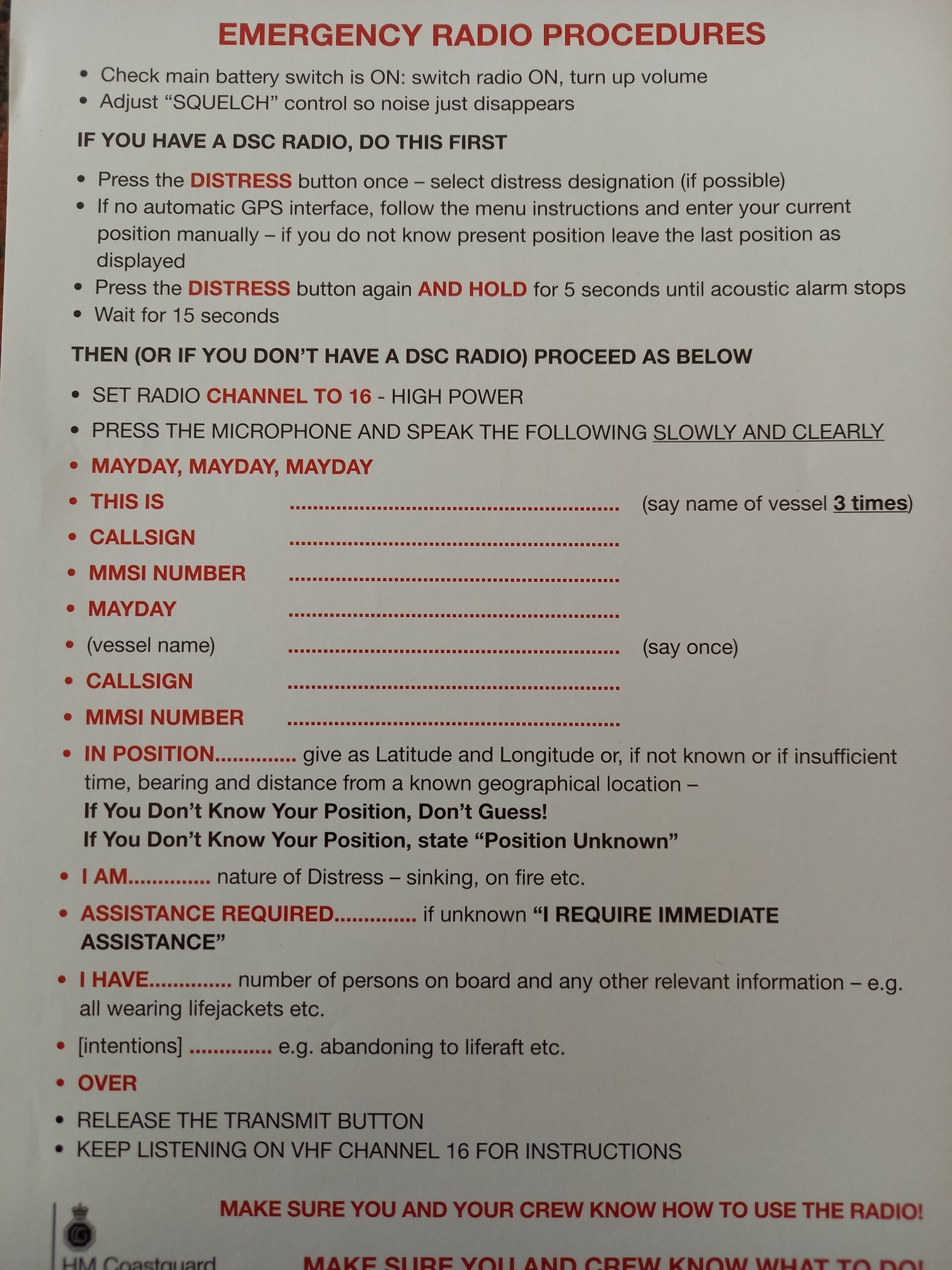
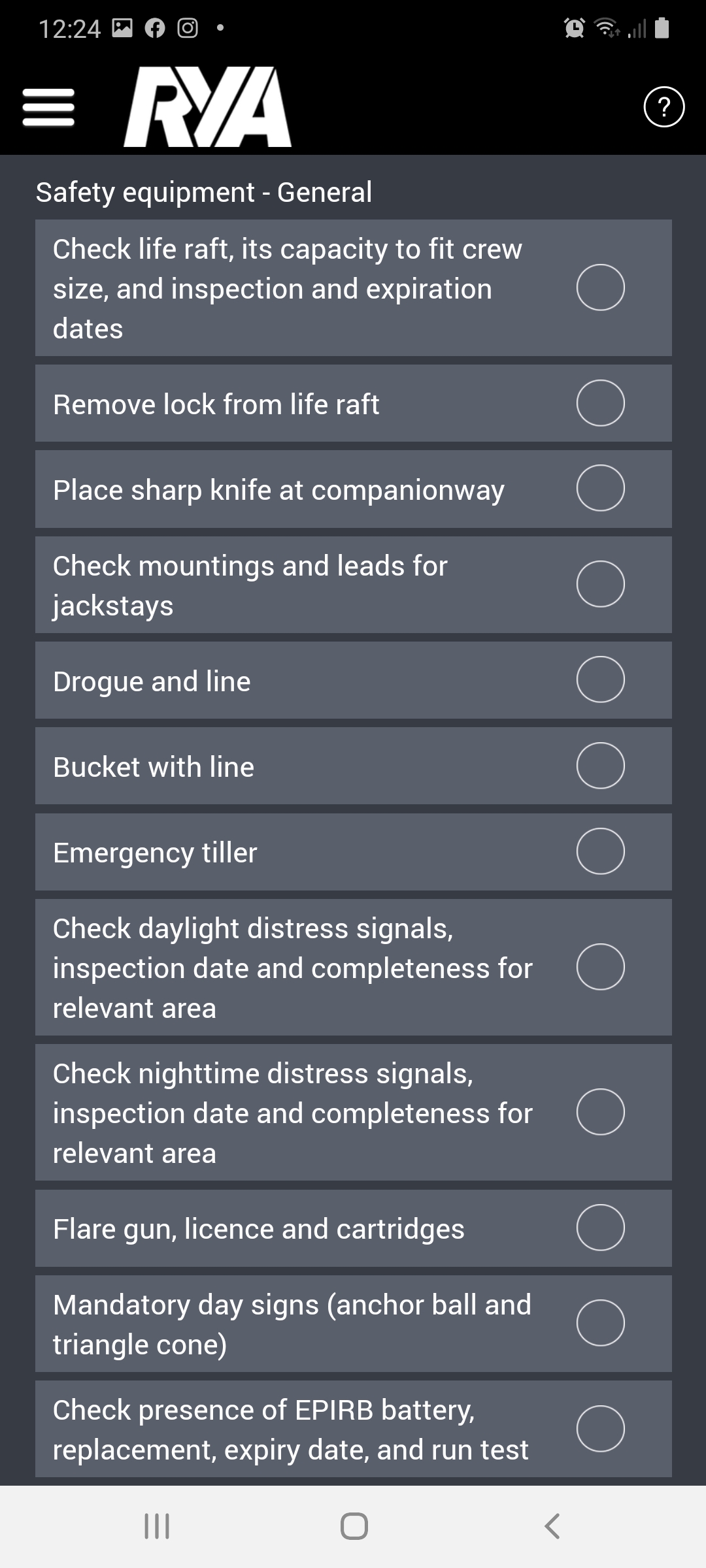
If it has been a while since you last went boating, it’s a great idea to start compiling checklists now. Checklists for boat equipment and personal kit. But also, safety briefing reminders and checks to be done before you go afloat. If you’ve ever played the game where you view objects on a tray and then an item or two are removed and you have to remember them, you’ll see the importance of lists. It is hard to notice what is missing. Checklists come from a variety of sources. For those of us using commercial boats we will have formal checklists. If you are a leisure boater you could write you own, view the ones we use or use the checklist function in the Safetrx app. It is important you take the time to compile your own list as the equipment you take will be different for each person.
Don’t forget things such as bench seats, pumps and the floor boards if you are a SIB user!
Now you’re compiled your list it important to check the items. Is the list still appropriate? It may be that you need to replace items due to wear or expiry dates. Items to check for expiry dates include lifejacket canisters, flares, first aid kits, fire extinguishers, liferafts and perhaps provisions. Comment below with other things that may expire on board.
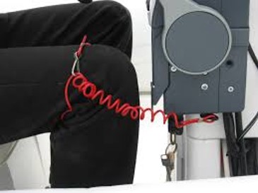
Check safety kit such as Killcords and Liferafts to remind yourself of use and ensure they are in good condition Make sure that any items that require servicing are checked. Further info on Killcords available here.
Also have a think about equipment that may be subject to mice attacks over the winter. Check inflatable boats, drysuits, and sails amongst others!
If you’ve updated any equipment make sure your Safetrx registration is up to date. Also check MMSI numbers for VHF radios.
Check your phone now and make sure apps are up to date and working. Most boaters will have a number of apps on their phones ranging from weather and tides through to knot tying and navigation.
Check your Safetrx profile to make sure it is up to date. Have you uploaded a photo of your boat? Added your emergency contacts? Included a vehicle registration etc. The Safetrx app is not just for trips but also acts as a registration scheme with emergency details.
Engines: Take the time now to complete engine checks and servicing. Familiarise yourself with the work you can complete yourself and recognise when you need a professional. Consider keeping some spares in if you are capable of basic repairs.
Think about fuel. Is there any risk of water in the tank from condensation? Is the fuel fresh? It is worth thinking about fuel stabilisers but seek advance from your mechanic.
For inboard engines think about acronyms you can use to make checks easy to remember. A popular one is WOBBLED but you may well have your own version. Water, Oil, Belts, Bilges, Electrics, Look around and Diesel. Hopefully, this will mean something to you if you have been on a course with us!
Its is important to check anodes and replace them if needed. Have a check of seals and sea cocks to ensure they are working. Don’t forget to check wiper blades if you have a cabin boat – a bugbear of Dom’s is broken wiper blades!
Are they still in good condition? Check the rigging and components such as shackles and boom fittings ahead of your first sail. I am ashamed to admit that I was lucky on my first sail of the season in my dinghy last year when I realised a boom fitting had come adrift – easily done without through checks. For yachts have a check of the mast to ensure radar reflectors and VHf aerials are still in tact and for all boaters don’t forget a radio check.
I think its fair to say that many of us use some form of electronic navigation on board our boats. Whether you use an app on your phone or have a chart plotter we must keep them up to date. Remember these are a backup. Just as you would keep paper charts up to date so too would you with electronics. Some you will need to take a card and update it, others can be done on wifi. If you don’t update them be aware of changes! For example, within the last couple of week, PHC have issued a LNTM advising that they have removed one of the buoys. Quite important to know!
You can update your paper charts by visiting the website of the publisher. For example for Imray charts take a look at this link
Tide tables: for Poole and Christchurch the tide tables with the graph are by far the most useful. It’s a great idea to keep a copy with your boat kit. If you are relying on electronic tide tables, consider Easytide provided by the UKHO Office. Double check the tides as cached pages can affect the results seen. Remember to correct for BST if needed!
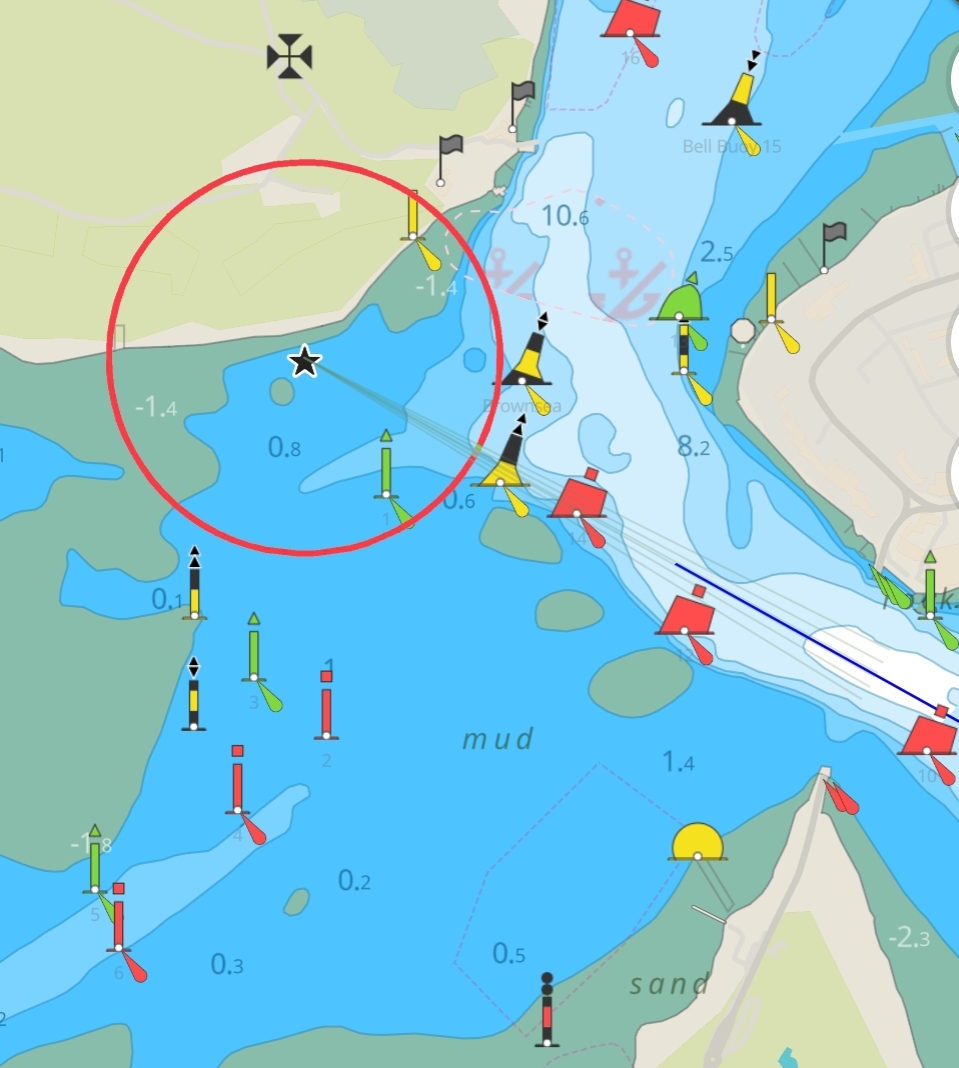
And the last paragraph brings us neatly to making sure we are up to date with harbour byelaws. PHC and most Harbour Authorities now have user friendly websites. Don’t forget to subscribe to receive updates when new LNTMs are issued. They might advise us of diving work in the harbour, parachute drops, changes to navigational marks etc. The link is here for Poole
This could be a massive topic all of its own but we covered the salient points during our chat last week. Trailers need servicing and maintenance, as do the vehicles that do the towing. Check hitches, bearings, welds, trailer boards etc all before setting off. The RYA have some useful tips for launching and recovering in this article . Useful information on the need for loading trailers correctly can be seen in this video
Finally, think about your own skillset. Is there anything you need to practice before going afloat again? Perhaps you need a reminder on how to use a plotter for making a pilotage plan? Maybe you need a reminder on basic boat checks before starting up the engine. It could be that you would like the reassurance of a trip out on the water to gain confidence at berthing or finding routes. Drop us a line if we can help. Its not just courses we run but also bespoke training.
We wish you a happy and safe boating season ?
![]()
Dom and Sarah run Dorset Marine Training based in Poole Harbour. We also run Harbour Sea School for The Boat Club based at Parkstone Bay Marina. We designed these blog articles are designed as reminders for those that have been along to our online training talks. Hopefully others find them useful too. We are unable to cover everything in a short blog article and make it relevant to everyone. You should seek formal advice or qualifications if necessary. If we can help further please drop us a message.
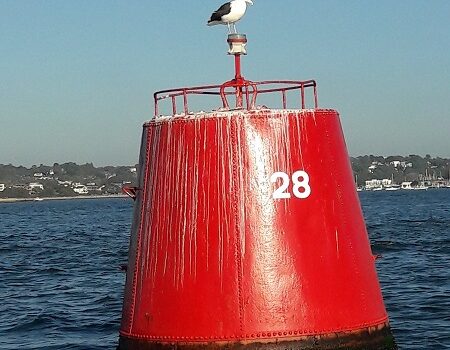
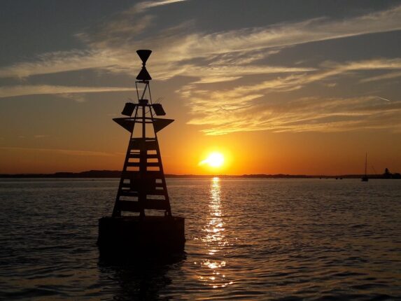
In this blog we will be looking at ‘Buoyage and Navigation Marks’. Why are buoys at certain locations and what are they telling us? Dom covered this topic during our ‘lockdown’ Training Talks earlier this week. We are running our Free Training Talks throughout lockdown – please contact us if you would like a link to join us online. The talks are intended as refresher sessions for some and a springboard into training for others. As seen during the Training Talk, no one topic can cover everything you need to go to sea!
Before we discuss colours and shapes of marks we must determine where in the world we are boating. This blog assumes we are boating in the UK. There are two systems of buoyage depending on where you are. We will be dealing with the IALA Region A system. More information if you are boating elsewhere can be found on the Trinity House Website . On their site is an interesting document about the history of the systems including permitted sizes, shapes etc.
The other document that you should start to look at if you extending your knowledge is NP5011 from the UK Hydrographic Office. Section Q deals with buoys and beacons.
These are basically our channel marks. They show us where the deepest water or safest route is. Bear in mind that this does not mean there will always be sufficient water for you. You must use them in conjunction with other considerations such as other traffic, byelaws, weather and tides. In many places we will have red and green marks and we will travel between the two. They will mark the sides of our channel and encourage us to stick in the middle.
Buoys are anchored to the seabed. In some places, buoys may be posts or sticks in the ground. Generally, where bigger ships go, bigger buoyage is used. As you head into less populated or shallower areas the marks will reduce in size until you finally meet withies (sticks in the ground usually made of willow).
Buoyage and Navigation marks may have numbers or names upon them. If numbered, then the numbers increase as you enter the harbour so the lower the number the closer you are to open water.
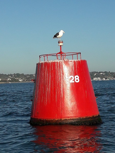
I have put the term ‘Port’ in brackets as this can sometimes confuse which side we pass the mark. Port is left and associated with the colour red. On the way into a harbour we will keep the red marks to the left (port) side of our boat. Conversely, when we leave a harbour they will be on the opposite side of our boat. Its important to have this clear in your mind before heading afloat.
Port Lateral marks are cylindrical, square or ‘can’ shaped. This may be the shape of the complete mark or it may be the top part of the mark. The shapes help us to identify the mark as a Port Lateral even if the colour is distorted. Port Lateral marks have even numbers such as 22, 24, 26 and 28
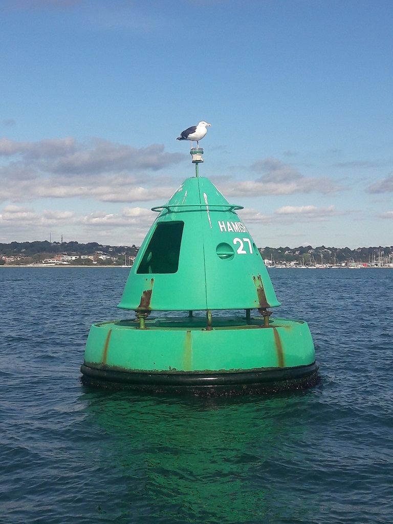
We discussed with the Port Marks that it is important to know which side to pass of the mark. On the way into a harbour we will keep these marks to the right (starboard) side of our boat.
The marks will be conical or triangular in shape. These might be the whole buoy or the top mark. If numbered then the numbers will be odd ie 3,5,7,9.
So now we have discussed channel marks we need to put the information into context. Bear in mind that just because there are markers this does not mean there will always be enough water for you and the marks might be sitting on the ground at a low tide.
If you see two marks ahead of you, red and green it is important to know whether you are heading into or out of the harbour to figure out which side you need to pass the marks. At a distance it can appear confusing.
Don’t forget to check which way you travelling. Are you going out to sea still? A good example in Poole is if you are travelling from the Quay towards Parkstone Bay or Yacht Club you are in effect heading out of the Harbour as you travel down the main channel and then North Channel. However, as you turn into the buoyed channel you are now heading into the marina and thus the buoy colour will swap. The Red Marks will be on your right hand side (starboard side of your boat) as you head down the main or North Channel. As you turn in towards the marina you are suddenly travelling into harbour and so the marks will swap sides. The red will now be on your left side, the port side of your boat. Similarly, the direction of buoyage reverses as you travel around the islands in the harbour.
To the best of my knowledge, we do not have any of these currently in Poole. The closest probably being Hamble River. These marks are used where there are two potential routes we could use but there is a preferred route that is most appropriate. In the Hamble River for example there is a pontoon in the middle of the River. We could pass either side of it but the preferred channel mark shows us they would like us to take the Starboard Channel. That is the main route of the River and keeps us away from all the marinas with people manoeuvring. If however we want to go into the marina we can take the Post channel.
A Starboard Preferred Channel mark is striped, red at top, Green in middle, Red at the bottom. It is the middle colour which tells us it is Starboard preferred mark. Alternatively, the bulk of the colour is red which show it is a Port mark and we should leave Port marks to the left of us as we go into the harbour or up-river.
Conversely a Port Preferred Channel Mark is striped, green at the top, red in the middle and green at the bottom.
These are four different marks black and yellow in colour and they follow the points of the compass. It is important to note that these show you where the safest water is. They may be buoys anchored to the seabed, or posts, or similar.
Theses buoyage and navigation marks can be used to identify :
In Poole Harbour we have lots of Cardinal Marks. At our last count it was 23! (Now there is a challenge to identify them all!) Cardinals are used in Poole, where two channels meet. There also some that identify hazards or dangers particularly around the harbour entrance.
We have North, South, East and West Cardinals. We can identify them by looking at either the colours or the top marks. Each one tells you where the safest water is. So for example, a North Cardinal indicates that the safest water is to the North. You should pass the North side of the mark.
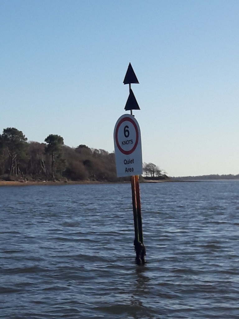
Have a think about the best way for you personally to identify them. It is really important that you don’t get them muddled up. Otherwise, you will end up in the exact opposite place and potentially in danger!
Now if the top marks are missing or hidden by the background as in the picture below we can identify them via the pattern of colours. They are all yellow and black but each forms a separate pattern. You will notice that the triangles point to where the black would be on the mark.
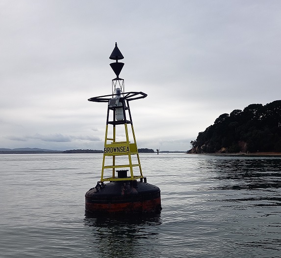
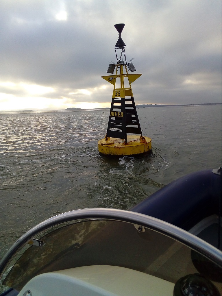
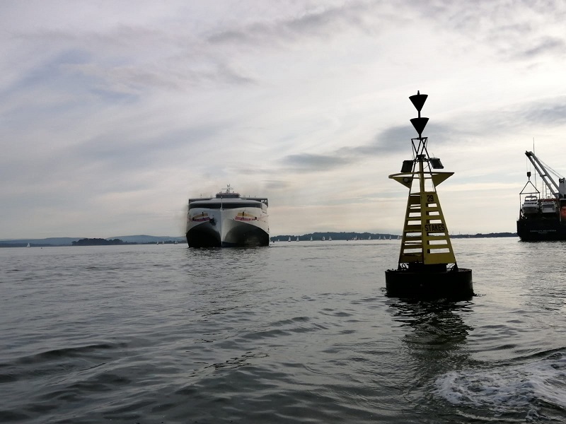
So now we know which side we need to pass we need to figure out how we know on a boat where North, South, East or West is. At this stage you will start to understand just how important it is to have a compass onboard. On many boats you will have a steering compass but even on smaller boats you can carry a hand bearing compass. It is important you understand how these work before going afloat.
Both types of compass are something we use on every RYA Powerboat Level 2 course we run. We will stop the boat and use the compass to figure out which side of a Cardinal Mark we should pass. During our Training Talk, Dom used a model boat, compass and chart to illustrate how they can be used. You can practice using a hand-bearing compass even on land if you are not able to get to your boat at the moment, That way you will be familiar and instinctive with use. We both use the Plastimo Iris 50 hand-bearing compasses.
It is possible although unlikely that you will see all four Cardinal Marks used. I have seen all four used in Sydney Harbour and Chichester Harbour.
This mark is red and black horizontal stripes in colour, with two balls (spheres) on the top of it. Many associate this with the cartoon character Dennis the Menace, for whom trouble always followed. Therefore, we must stay away from this mark to avoid trouble. Some might call it a ‘balls up’.
The isolated danger mark is used in places in which there is a hazard to avoid, the surrounding water is comparatively safe. In Poole, I am aware of two although I noticed on a recent chart a new one has appeared. As yet, we haven’t seen it on the water. Locally, Christchurch always used to have a significant mark upon entering the harbour.
It will often indicate something such as rocks which may not be visible above the water. Although we could potentially travel around it, we must consult the chart to establish what the hazard is and what distance we should keep from it. I would certainly not want to be travelling all the way round the one in Poole Harbour or I would run aground – I might make it in a canoe!
An isolated danger buoy, that is anchored to the seabed, will move with the tide. In a strong tide it may not be directly on top of the hazard. With a post it is likely to be on top of the hazard but we still do not know how big the hazard is. It may or may not be obvious from the water.
At the beginning of this blog we mentioned the importance of incorporating the information about buoyage with other topics. You can see how important it is to have a grasp of chartwork to understand the significance of the mark. RYA Courses such as the Essential Navigation & Seamanship contain a great introduction to all the topics and bring all the information together to get you started on the water.
You won’t see these appear on a chart as they are used temporarily whilst the decision is made over a sunken boat. They are yellow and blue vertical stripes with a perpendicular yellow cross on top. Typically, the buoys are used for the first 24-72 hours. After which the boat may be recovered, or perhaps an isolated danger mark used.
When I initially trained, I was told the only time I was likely to see one was on the Trinity House ship being transported. I have however seen these used even locally. A couple of years ago a buoy was deployed in Christchurch Bay to mark a yacht which had sunk. You could just about make out the rigging but it was in otherwise open water. The best known use of this buoy was when the Hoegh Osaka ship grounded in Southampton Water, to prevent it sinking. The ship was definitely more noticeable than the marker!
Be aware that in local waters more local variations might be used. In Poole I have seen yellow traffic cones with the words “Wreck”!
The Safe Water Mark is a red and white vertical striped spherical shaped mark. These are not used to highlight a hazard but instead safe navigable water all around. They can be used in a variety of locations to indicate safe water but most often known for their Fairway Buoy context.
A Fairway mark is used at the beginning of navigation into a harbour or waterway. It is the first mark you will see from open water before entering a channel and other buoyage. Not every harbour will use them.
Poole harbour’s Buoyage and Navigation Marks used to include a ‘Safe Water Mark’. The Buoy is now decorative feature on the Holes Bay Roundabout! The most local to us is probably the Needles Fairway Buoy which marks the Western entrance to the Solent.
Special marks indicate key features or geography. They should be yellow and may have a cross/x as a top mark. Often, they will include working or pictorial representations to inform you of their message. They are giving you information about an area. There is no specific shape but they must not be able to be confused with the shape of other marks.
Special marks are used extensively around Poole
In the harbour there are lots of special marks used for dinghy and yacht racing. These often have sponsors names on such as ‘Ellis Jones’ or ‘Chris Somner’ usually representing local marine businesses. The powerboaters amongst us might think therefore that they do not need to know about these. They are however relevant as if you see a fleet of sailing boats heading towards a mark there is every chance they are suddenly going to change direction as they pass it. Here is not the place to get into a discussion about the IRPCS (“Collision Regulations”) but more of a practical point that you may need to take avoiding action.
Also inside the harbour, special marks are used to identify areas for different water-sports. For example, the kitesurfing area, the personal watercraft area and the water ski-ing area etc. You might think that these areas are not important to your boating but they may have specific rules. If you are pootling across the Personal Watercraft area in your sailing dinghy do not be surprised when a ‘jetski’ flies past at a reasonable pace. In this particular area and under specific circumstances they are exempt from the harbour speed limit. For guidance have a look at this LNTM, PHC LNTM . The special marks often have pictures on them to help convey their message.
Outside the Harbour you will see special marks used to designate swimming areas, these are by the beaches and show the speed limit in Studland Bay. In the future we may see use of them to identify acceptable anchoring areas. Someone asked during our Training Talk whether these were always in shallow areas. This is not always the case, some of the special marks are used for Yachts to race around in the Bay. You may come across special marks used for weather monitoring buoys (ODAS buoys). Often recognised by their solar panels.
Returning to the Harbour the other use you may see is the use of Special Purpose Beacons. Two special marks are used to mark a transit to identify the entrance to a marina or a turning point for a ship. At Round island, a cable runs between the island and Arne. There is yellow beacon at each end of the cable and we must not anchor there. You will also see them between Brownsea Castle and Sandbanks, and quite a number between Furzey Island and Goathorn.
You will see from above that we cannot ascertain everything we need to know about buoyage and navigation marks from just seeing them. We must use lots of additional resources to understand the message of the mark. We have already discussed that we may need to consult NP5011 or LNTMs (Local Notices to Mariners). In addition, we will also need to consult charts, almanacs, and local harbour guides.
A look at the Key for the chart or NP5011 will show us the symbols used for different marks on the charts. These are unlikely to be in colour, instead appearing in black with the shape and top-mark and will often have the letters of the colours written underneath. For example, an isolated danger mark with have the shape and the two black spheres or ball. Underneath written BRB (Black, Red, Black). Don’t confuse the colours with the magenta teardrop used on some charts. A teardrop shows the mark is lit, at night. The colour of the light is coded by the symbol and is the topic for another blog!
If you are out on the water and need a quick check you may choose to use an chart app on your phone to identify marks. An example from the Savvy Navvy app shows the colours below. Bear in mind no apps should be your sole means of communication. They are great as back up but are subject to limitations which you must understand. That said, they can be great backups.
Below is a picture taken from an Imray chart showing the symbol which indicates the direction of buoyage where it is not obvious. Locally you will find it on Solent Charts:
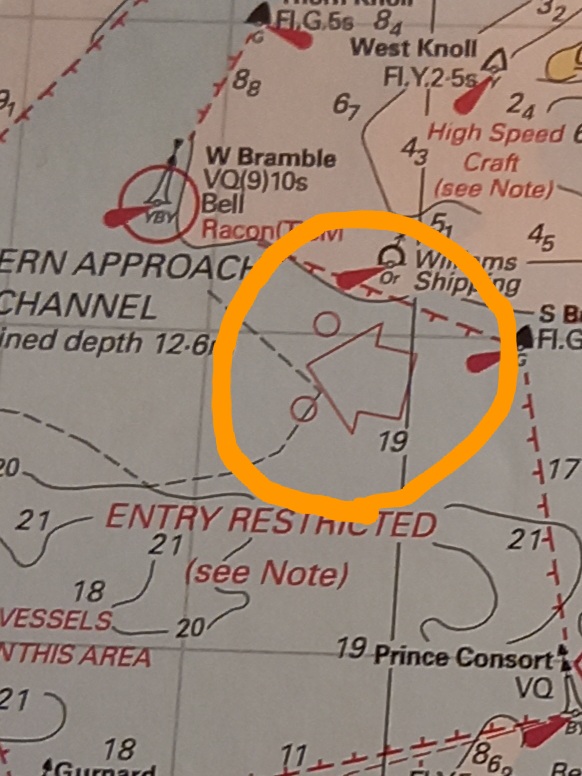
We hope this blog has been useful as a refresher or to prompt you to undertake formal training. It cannot cover all the topics usually covered on a course. Please contact us to contact us to discuss training options. For theory learning take a look at the Essential Navigation, Day Skipper or Yachtmaster theory. If you prefer to put it into context on the water why not book some bespoke training or a Powerboat Level 2 Course? Contact us to chat through options and ideas.
Please do drop us some feedback to let us know what you’d like us to cover in future blogs.
Let us know if you found this Blog on Buoyage and Navigation marks useful?
Recently a friend sent me details of a RIB they had seen for sale and asked for my thoughts. My initial reaction was great, I love encouraging people to get out on the water and buying a RIB is perfect. When I thought about formulating a reply though I realised that I didn’t know enough about their intended use for the boat.
The boat itself looked like a good buy but its worth thinking about what you individually want from a boat. Until you have purchased a boat these things may not be obvious. Often people will have undertaken a RYA Powerboat Level 2 Course on a Training Centre Boat and been focussed on the learning so perhaps didn’t think about different configurations and options. The boats we use for training may have different requirements than leisure boaters heading out for a picnic.
It’s quite normal for people to change their boat about their first season as they understand what their own requirements. To try to help you get it right first time we will look a few of these considerations.
The blog assumes you already have experience of driving RIBs but the first purchase of a boat. It is written in mind of those using boats in sheltered conditions on summer days. In a later blog we can look at the process of buying itself.
Consider whether the budget you have allocated needs to include the purchase of a boat and equipment and storage. Perhaps you have separate budgets allocated but don’t overlook the fact that with many boats safety kit will not come as standard. The kit you put on board will depend on where you plan to boat and what you want to use the boat for.
Unfortunately, the question of how much to allocate is tricky to answer. To help with budget it may be helpful to write a list of all the equipment you will require. Then when viewing boats you can ascertain how much is included within the asking price. If buying new this perhaps could be a negotiation tool.
Storage we will turn to later but do make sure you know whether this is included within your budget.
Does your budget include any repairs or modifications you require before you can use the boat? Even buying new, a boat is a bit like buying a new car – what optional extras would you like?
Don’t forget the costs of viewing boats if they are some distance away and the cost of transporting them home. Many a time I hear of someone who has bought a boat but not realised how much transportation costs home will be.
This will be very much a matter of personal choice. If you want to have a boat ready to go you need to undertake careful research into any boat including engines. Think about the process of buying a car – what risk level are you comfortable with? For some, buying a RIB new gives the comfort of a guarantee and a trader to seek support from should a problem emerge. That, however, comes at a price and so many will be looking to buy second-hand. All our boats have been second hand but carefully sourced. Do be aware when buying second hand that scams do operate on the internet so as with any purchase make sure you know who and what you are buying.
If you are buying second-hand but want the boat to be ready to go think about whether you have the expertise to view a boat alone or whether you should take along a friend experienced with boats, an engineer or a surveyor. It is a small world in boating and asking around will often enable you to find out the history of a boat. Ask the neighbouring boat owners, ask yards, ask on specialist forums, ask the fuel dock operator etc what they know of the boat. Boatyards are full of people happy to talk! Build a community of resource around you.
If you are tempted by a project boat make sure you have enough boating awareness to spot the difference between something that just needs work and something that is fundamentally dangerous. Make sure you have the skills to remedy any issues and the understanding of what is required for a boat to be safe. Ask yourself honestly do you have the skills, the time and the finances to see the project through? Have a plan in mind for where work will take place and the costings before you spend too much time browsing boats.
It may help to determine if you prefer an outboard, inboard or jet drive boat and petrol or diesel. Locally most leisure boats are petrol outboards for a reason. They are relatively easy to service, find parts and replace if necessary but you may have your reasons for choosing a different type of engine.
Are you planning to use the boat alone, with friends or family? Be realistic, as to whether this is your dream or others are genuinely interested. Some buy boats as their way to get some alone time, others are unrealistic about it suddenly being the families dream.
If using a RIB alone then consider will you be floating in warm waters and flat seas? In which case the seating will be a fairly straight forward choice on comfort. If you want to up the adventure or your location has the potential for waters to get ‘interesting’ then a jockey seat will probably be a more suitable choice. As you progress then shock mitigation seats become relevant but this blog is aimed at leisure boaters starting out. If boating with a partner or friends are you happy sitting one behind the others or would you prefer to be alongside one another?
If you are hoping to take family afloat, be realistic about the sort of conditions they will be happy in. Flat summer picnic days will require a different layout to challenging waters.
Also think about the height of consoles – you may well find the console the perfect height or throttle in a comfortable position but does the same work for other members of the family?
When you start the viewing process get on board the boats and sit in various places. Think about do you prefer to sit or stand to ‘drive’ the boat? Consider how this affects the viewing position.
If you plan to use the boats for picnics does the layout facilitate that? Most commercial RIBs are designed for safety at higher speeds and in choppier waters and therefore use jockey seats. These are not the most comfortable for picnics!
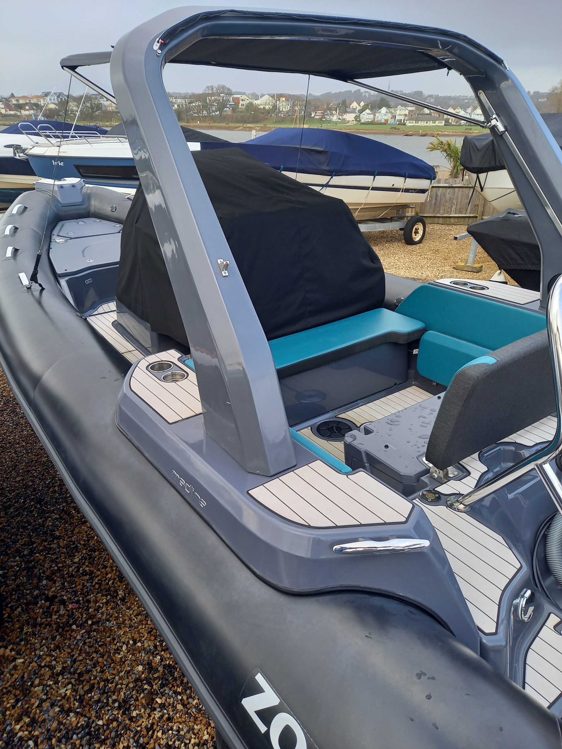
In either case consider what storage you require on a boat, both for safety kit and the personal possessions. Even spare waterproofs for a family need stowing somewhere! If you plan to take fishing kit or watersports toys such as ringos, wakeboards or paddleboards where will these be carried?
If the layout isn’t perfect ensure you have allocated money within the budget to make modifications. Don’t forget to allocate space for safety kit.
We now need to consider not just layouts but hull shapes. If we use the analogy of cars, you are unlikely to use a Porsche off road or an old transit for speeding down the motorway comfortably. You pick your car for the sort of conditions you will most often need it for and similarly with boats. This blog is aimed at those starting out on their boating journey so assuming we are looking at benign conditions. Ask around the locations you will be boating, have a look at how different boats handle the local conditions. Think about the depth of the waters you will be boating in, the weather patterns and the speeds you plan to safely travel at.
The lucky ones amongst us will probably enjoy drystack storage or a marina pontoon berth. These make boating relatively easy but come at a cost.
Many starting out have a plan that they will trail their boat to the water each time. In some locations this is practical but be realistic about the towing demands:
Be realistic about the time involved in launch and recovery.
Where you keep your boat may impact on the size of boats you will be looking at. In a marina or drystack you will probably be charged by the metre, if you are towing then tow weights and storage at home will impact the decision.
Hopefully the five points above will have started you thinking in general terms about what is practicable for your individual needs. As you start to search for boats you will no doubt become more specific. Do get a sea trail if possible.
Take your time to either visit shows such as the Southampton Boat Show or brokers such as Parkstone Bay who usually have a variety of different RIBs on brokerage that you can view on site. It is a great opportunity before buying a RIB to have a look around at different options.
Before finalising on a boat do obviously make sure you have completed legal checks, thought about insurance and whether the boat has a RCD plate.
We hope this blog has started raising questions in your mind. The priorities will be different for each individual but thinking about these aspects in advance will make your search more effective.
What else would you add to the list? Let us know below your thought and how your search process is going.
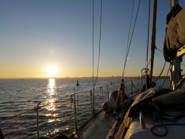
Beautiful Weather for Dom on this Delivery Trip
The talks are designed as a springboard into learning for those new to boating or refreshers for others. Please note that these talks are intended to complement training courses not replace them as there are lots of other topics to also consider before going afloat.
If you would like to attend our Free Training Talks please contact use or for the Spring 2021 series email us at online @dorsetmarinetraining.co.uk.
Links are provided to external sites. These are provided in the best of faith and although we make every effort to ensure these links are accurate, up to date and relevant, we cannot take responsibility for pages maintained by external providers. Before clicking please undertake your own checks. If you come across any external links that don’t work please let us know.
We first addressed the question of why we wanted to know about the weather. In our everyday lives we are interested in is it going to rain, be a heatwave or a hurricane. As boaters we need to consider many more factors. Not just the wind speed but the direction, sea state, visibility etc. We discussed where we source information and what impact weather has on our boating. We then looked at the terms used in forecasts and live weather vs predictions.
This presentation was mainly focussed with online sources of information but don’t forget forecasts can be obtained from NCI (VHF Ch 65 or their websites such as Hengistbury Head NCI), marina or harbour offices and Maritime Safety Information Broadcasts every three hrs on VHF and Navtex.
Dom introduced the Met Office Inshore Waters Forecast . This is valid for up to 12 miles offshore. We had a chat about the areas and started to look at the terminology used. For many new leisure boaters this may be the first time they have come across the Beaufort Wind Scale. Note this is a different forecast to the Shipping Forecast…a fascinating insight into both forecasts can be found here . The inshore waters forecast give us information on wind strength & direction, weather, sea state and visibility and includes timescales.
The wind strength in the forecast refers to the Beaufort Scale. We need to understand what it is, how it compares to other wind units and what it actually means for us as boaters. What is reasonable boating weather and how will it effect our day out? The wind strengths that you may go boating in will be different depending on locations, wind direction and crew and boat capabilities amongst other factors. However, for the Powerboat Level 2 students amongst our readers it is suggested that up to a F3 will be nice and calm whilst a F4 will become more challenging. Wind strengths above this are for more experienced boaters.
If you’d like to know more about the Beaufort scale along with quirky facts about it, see Met Office Fact Sheet – Beaufort Scale . In this a F2-4 was described as “With which a well-conditioned man of war, under all sail, and ‘clean full’, would go in smooth water from…” and it includes the history through to the scale we see today along with photos of sea states. It has since been updated!
We then moved back to the forecast to look at the terminology used. A guide can be found here – Met Office Glossary In the forecast terms are used relating to time frames, visibility, movement of pressure systems, pressure tendencies and wind directions. It is important to understand where to find out what terms such as imminent actually refer to. There was a question raised about Cyclonic winds, the answer to which can be found in the glossary or the factsheet. This table here is taken from: Met Office Forecast Factsheet
Sea State: Wave height can be confusing. People seem to exaggerate the conditions they have been out in, probably because it seemed rough conditions but it can lull others into a misunderstanding of the conditions the forecast is referring to. Remember a sea state of rough is waves of 2.5 – 4m !
Next up was Windguru – a favourite of Dom’s this gave us the chance to look at different forecasting models. It is important to note the difference between gusts & wind speeds and the colours indicating wind strength. The ability to swap between units of wind speed was highlighted. The topic of accuracy in terms of timescales was then discussed. How far can we start to have confidence in the forecast? How can we zoom out to watch weather patterns to interpret the information.
Windy was up next, introduced along with the ability to zoom out and look at developing weather systems. It gave us the opportunity to start to talk about synoptic charts. We talked about high and low pressure systems and how we could look for weather patterns to interpret information. How the colour coding works and the ability to look at rain, waves etc as well as wind. Another nice feature is the link to local webcams to see what is actually happening. Once again we looked at the differing weather modelling systems and looked a week ahead to compare the different models.
XC Weather proved to be popular. Although much less detailed for a day out in the harbour this was an easy view option. We talked about wind directions and how these can be used to start to look at sheltered places for boating. How does wind direction affect the conditions you will encounter. We used Poole Bay and Poole Harbour to illustrate the points.
Lots of other favourite weather apps were mentioned and there is a lot of choice out there. Compare across forecasts and interpret the information you are given. The other forecasts people mentioned are listed at the end of this blog.
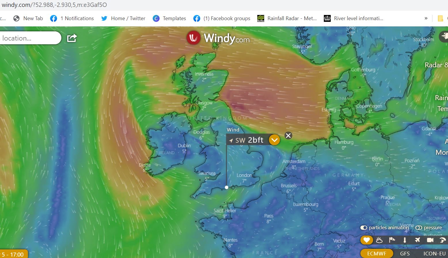
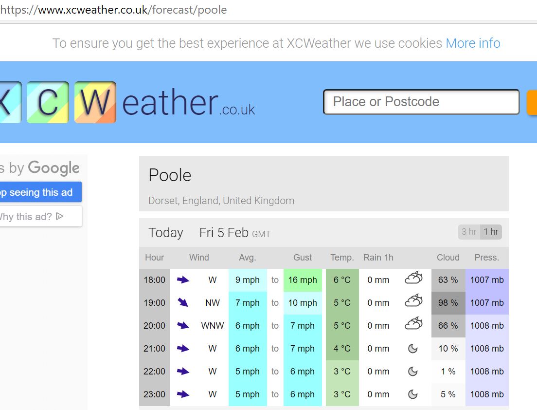
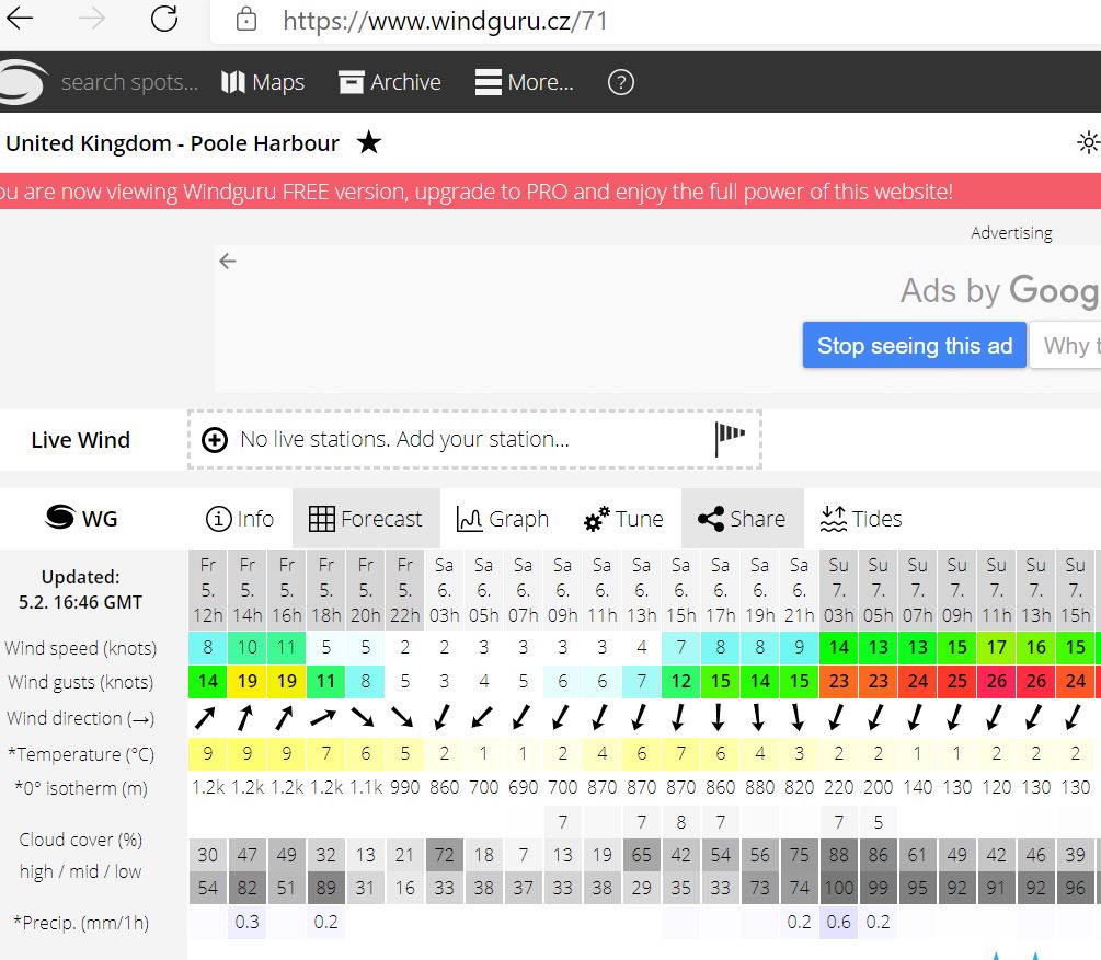
So far we have been looking at forecasts – these are predictions. We also have sources on information we can use to access live information.
For windstrength the website Weatherfile is a popular option. Very handy for us as there is a weather station right in the middle of our training area. Note that you can change location or the units of measurement in the menu.
Other popular sources include the website Bramblemet in the Solent BrambleMet or Hengistbury Head NCI Weather station
And many sailing clubs or watersports facilities have their own weather stations some of which are accessible to the public. One local example is Poole Yacht Club Weather click on ‘View Gauges’ towards the bottom of the page.
Webcams can also be useful to get a guide before heading down to the water but remember the angle on these can be deceiving.
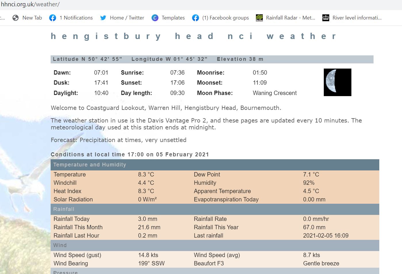
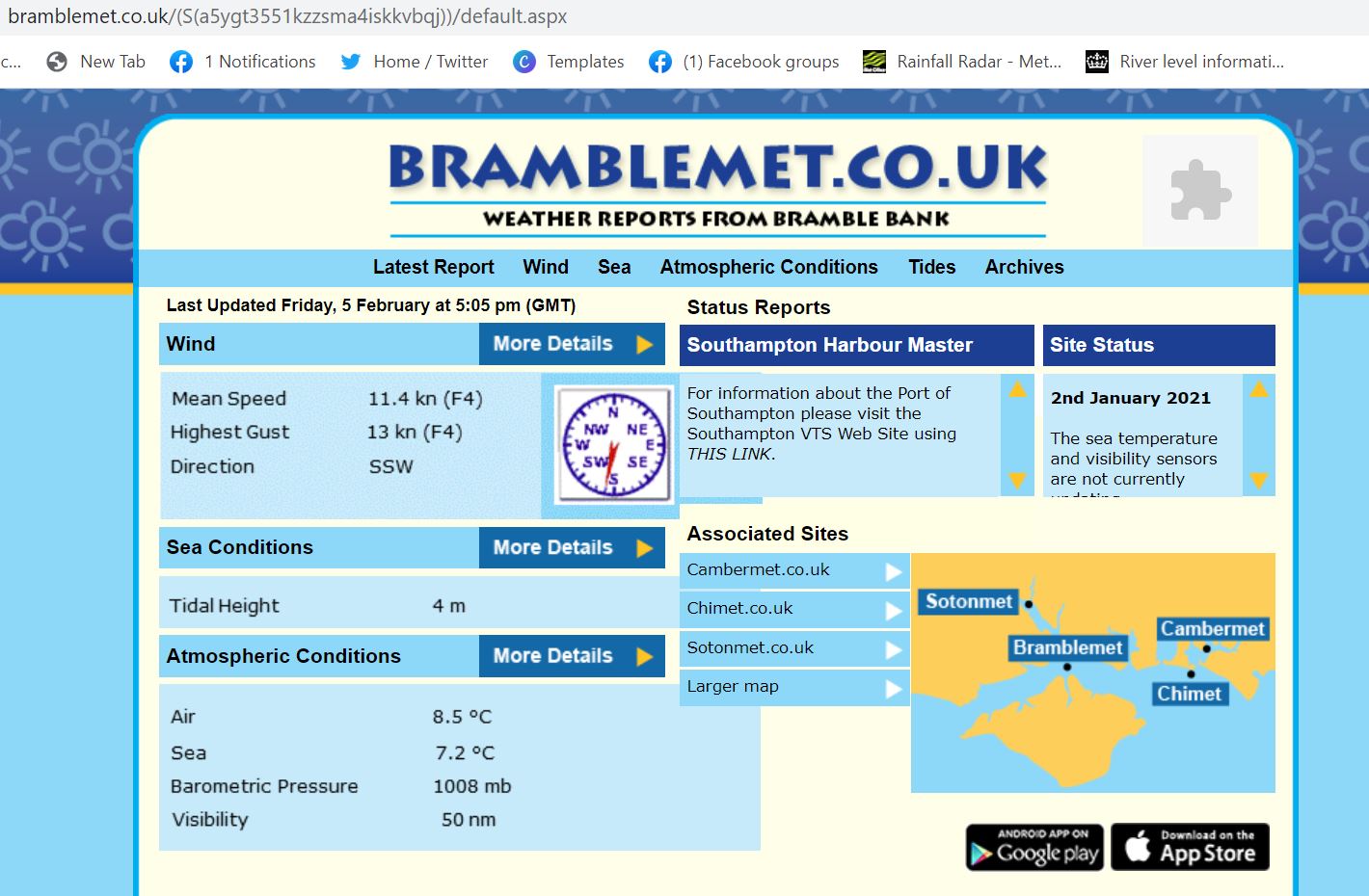
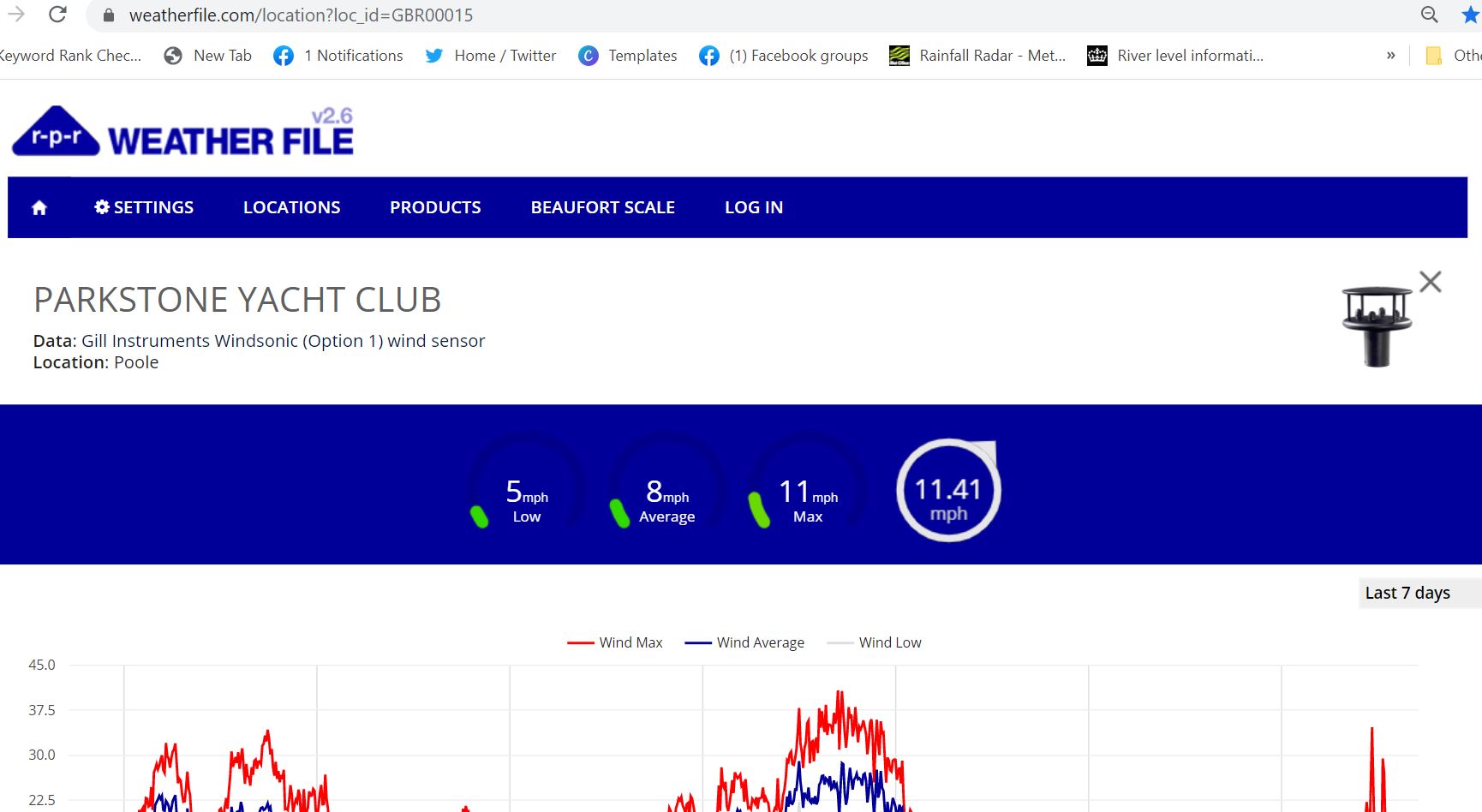
These give us information on wave heights. We find a user friendly view option is at Magic Seaweed Magic Seaweed – Wave Buoys. Click on the buoy nearest your location for information. For further formal information from CEFAS available here CEFAS Wavenet
Both Rain Alarm and the Met Office Rain Radar are useful if you’re trying to avoid the rain!
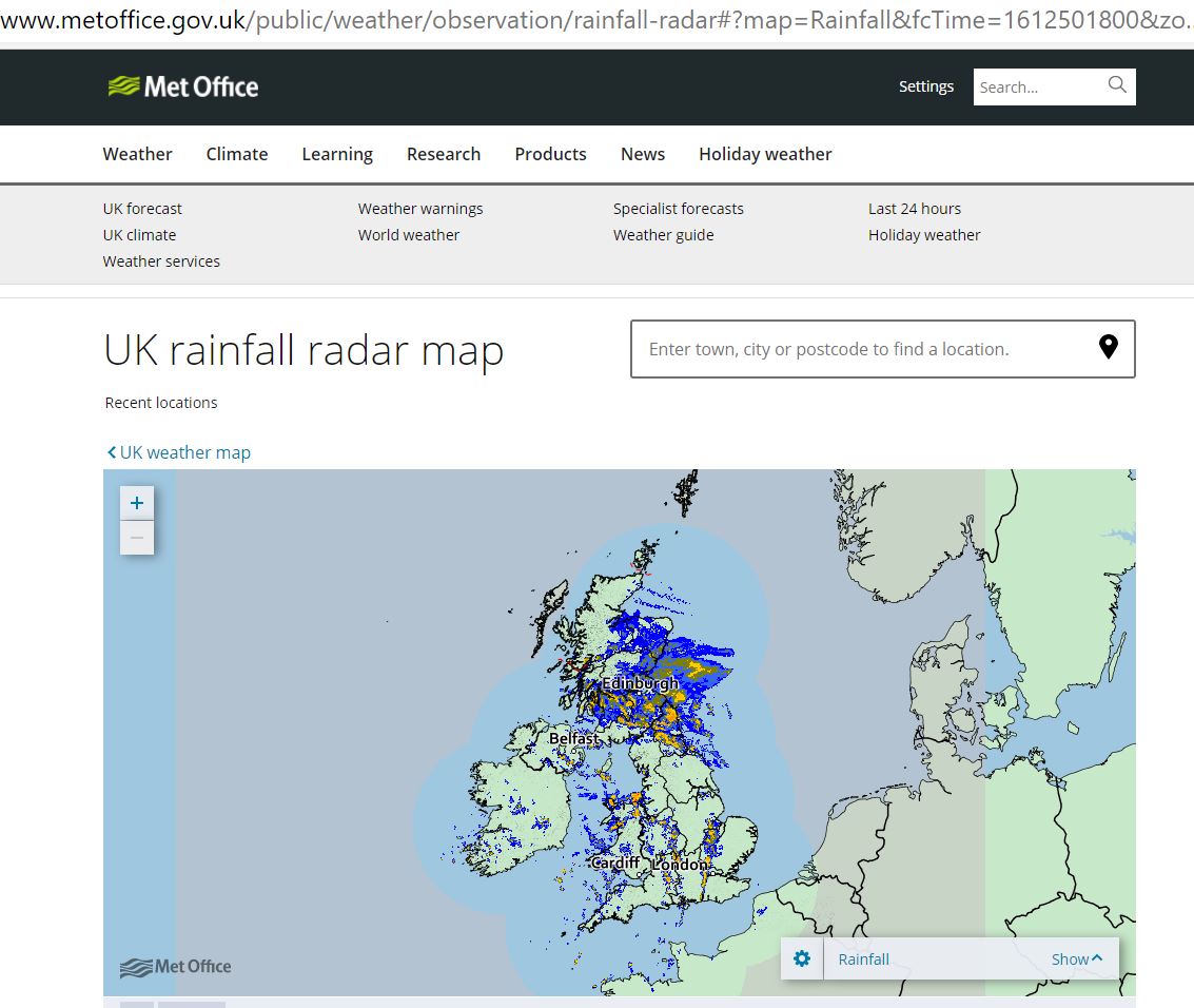
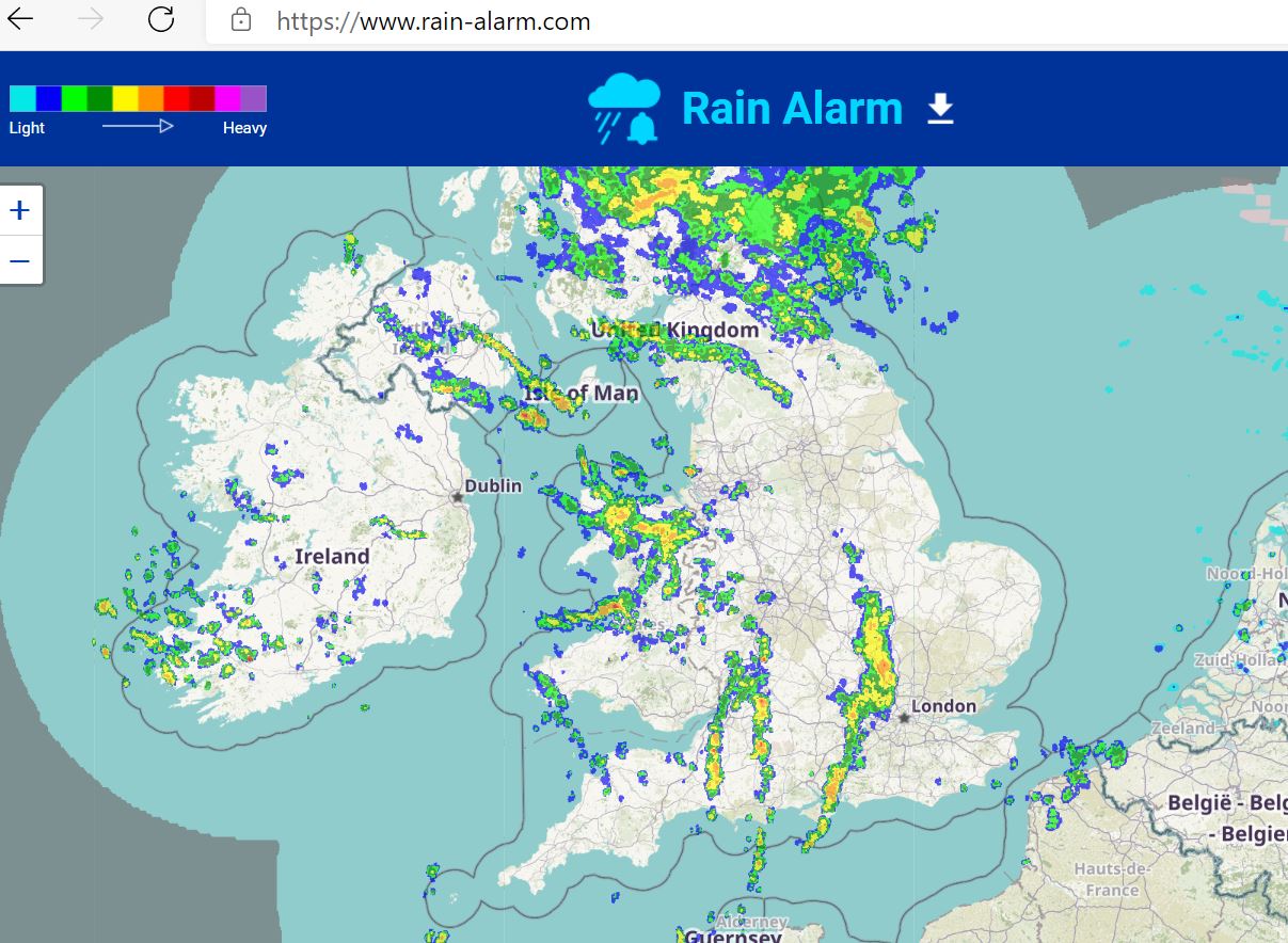
These are a whole topic of their own and we only briefly discussed them in the time we had allocated . If you are looking for more detail then the Met Office produce not only a great factsheet with pictures of clouds but also a really useful video. This useful guide can be downloaded as a poster from their site. On Day Skipper and Yachtmaster Theory Courses we cover these in much more detail.
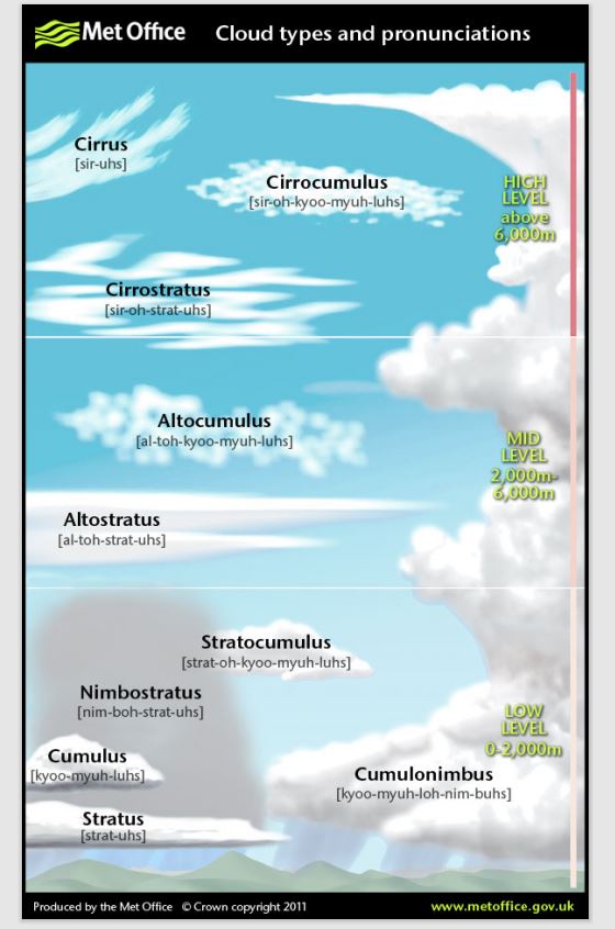
Some years ago I was fortunate to teach a Weather Forecaster for their Powerboat Course. We had a fascinating chat about the weather and I was told that their personal greatest guide was a barometer. The change in pressure being her greatest guide as to what to expect.
In very simple terms, we can usually expect more settled weather during periods of high pressure. It will often be calm and sunny although we should also be aware of the risks of fog. Conversely during periods of low pressure the weather is more unsettled and can be rainy and stormy with high winds.
By bringing all the information together we can demonstrate the impact on our boating. We looked at local conditions, sea breezes and land breezes, cloud formations and then onto advection fog and radiation fog. We used examples and a chart to demonstrate how different wind directions coupled with tide could impact our boating and how this may differ between powerboats and sail.
If you enjoyed the presentation and would like to know more about weather the Met Office have some great YouTube videos which we have links to on our channel YouTube and even a free course available here Weather Courses . They also have a great range of fact sheets.
The RYA Weather Handbook is well worth a read and can be purchased from the RYA shop.
The RYA Essential Navigation & Seamanship Course also has a useful section on weather and how we can use it for our boating along with many other theory topics. It is a great foundation for boating, usually undertaken online with about 8-10 hours study. (Cost Feb 2021 – £90)
We really enjoyed the providing the Training Talks and it is lovely that so many people sent in their own sources of information. We hope you found it useful. Listed below are resources that others sent in to us. We have not yet verified all of these so use your own discretion but looks like some great extra tools. You do need to understand the modelling systems are being used.
Greatweather.co.uk – huge list of resources Great Weather
UKWeatheronline – useful synoptic charts WeatherOnline
Thanks to all those who joined us in our Online Chart Chat last week. We hope it inspired you to get those Charts out to check them out before the new season starts. This was part of our Tuesday Training Night Talks and aimed as an introduction to charts.
I have included links below that we discussed during the chat in case you weren’t able to write them down.
Paper charts still have a valuable part to play in our boating. What happens when batteries or memory cards fail? The route on your device appears to take you straight across land? Or you fail to notice something because you have not applied the correct layers? It is important to have an understanding of using paper charts. A paper chart will also give you a greater overall view of your journey and allows you to se the bigger picture. Does that mean we shouldn’t use electronic devices? Not at all, of course we use them but they are an aid to navigation.
Locally for us the main options are Admiralty or Imray charts. In other parts of the Country you may have additional options more suited to local conditions. Admiralty Chart are published by the UK Hydrographic Office and you will find them in use on most Commercial Vessels. For our leisure boat users locally we usually suggest using Imray Charts. Those heading further afield may look at the Admiralty or Imray Leisure Folios.
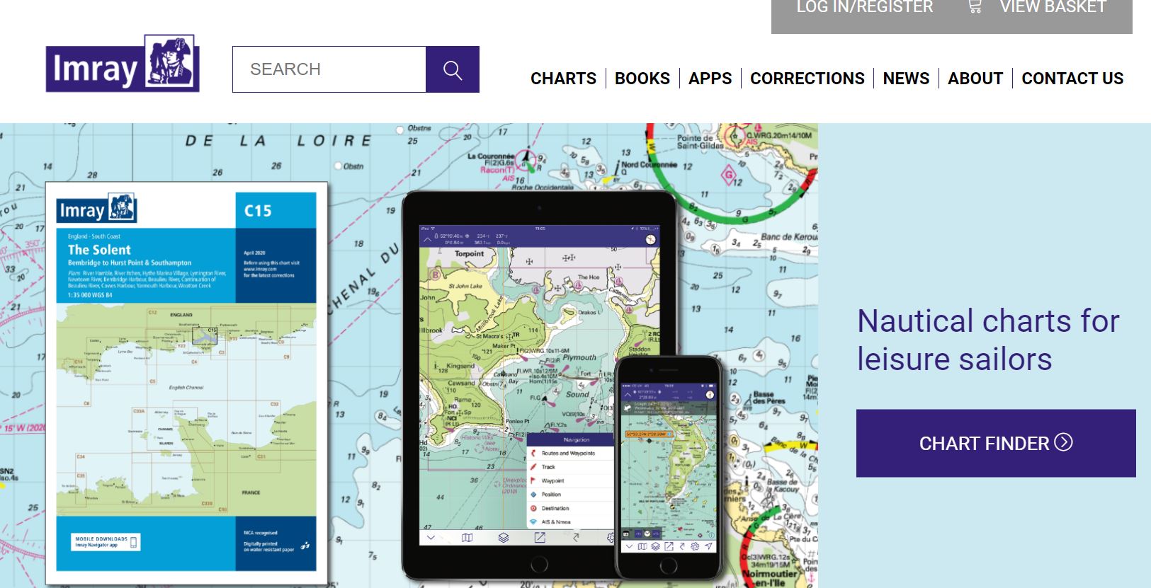
We generally use Imray Charts ourselves for local training. These are user friendly, covering the areas of most interest to us and individual charts can be purchase for localised boating. They also have an innovative approach to incorporating digital products to complement the paper charts. They have the ability to incorporate changes very quickly and act on feedback from local boaters. Imray charts come with a convenient Key to Symbols which can be particularly useful if you’re not sure what a purple zigzag line means, for example, on the chart. We will focus on Imray charts in this blog. Their webpage describes the features of their charts https://www.imray.com/charts/
The most obvious difference is the colours. Imray work on a user friendly scheme that Green is land and Yellow is drying areas (a bit like a beach would be). The colours are reversed on an Admiralty Chart. You will usually receive a key or guide to symbols on an Imray Chart. On an Admiralty you may need to refer to publication 5011 for guidance unless using a folio pack.
It is important to keep charts up to date. The version will be printed on the chart both on the front cover and at the bottom of the chart itself. The seabed, hazards and facilities will change over time so it is important to stay up to date. In between chart reprints, we can access chart corrections on the websites. Imray corrections can be accessed here – Imray Chart Corrections . Admiralty corrections here – Admiralty Notices to Mariners
Quite simply a chart is basically a map for water users. They are suitable for all and should be looked at before you go afloat on the sea. They can of course be used in depth for those navigating distances, working out courses to steer and planning extended passages. However, even if only boating in a Harbour they provide lots of useful information.
Charts have lots of uses and the more you look the more useful features you will find. It is not uncommon for someone on a course to ask about something we have perhaps not seen before on a particular chart. The chart will state which datum it is using for safe use with GPS navigation systems.
We all have to start somewhere with charts and the first step is buying a chart and pouring over it at home. If you’re not sure what you are seeing take a look at the Essential Navigation course or drop us a message to discuss bespoke training.
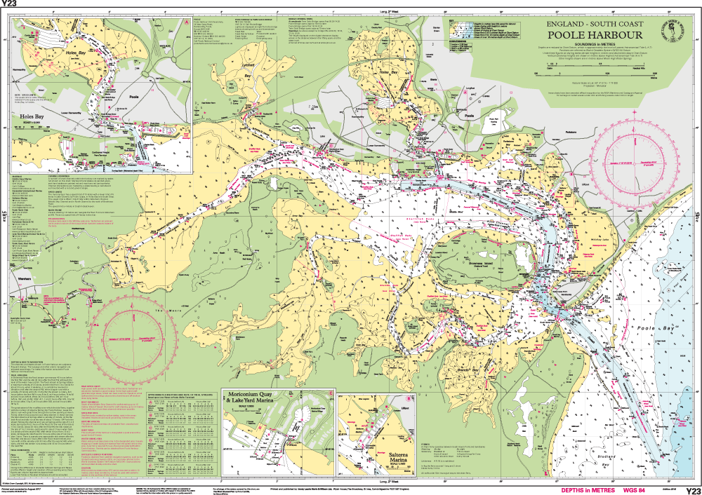
Most local boaters should consider the Imray Y23 chart or Y39 chart depending on where you will be using the chart (on the boat or at home). The Y23 is larger scale so easier to get a wider view. The Y39 is convenient for the boat and contains an inset to Studland Bay where many local boaters visit.
If you are travelling to the Solent as a more advanced boater then either an Imray C4 or a folio pack.
We carry a stock of local charts at our classrooms for immediate use or they can be purchased online from the manufacturers or at local chandlers.
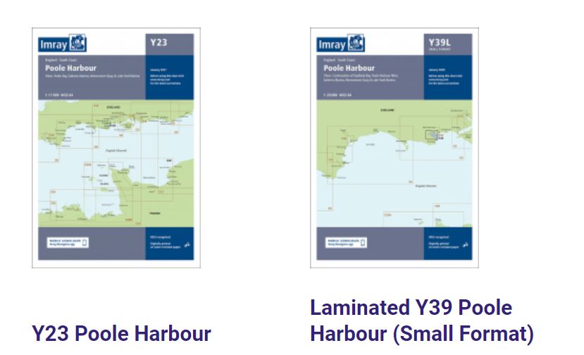
The paper charts allow you to take an overall, expanded view of an area.
They ensure you are not missing layers by zooming in or out too far.
It may be clearer to see the date of publication on a paper chart. When was the last time you updated your charts on a plotter?
Paper charts don’t suffer from power loss or battery failure. On the other hand, may not be as easy to consult on a wet open boat!
We will cover this in detail in a future blog but broadly speaking we are talking about chart plotters on your boat, portable GPS units and phone apps. For now you may wish to start to explore the apps such as Imray Navigator, Navionics or Savvy Navvy. Most of these have a chart viewer you can start to look at online for free. One can notice how detail is lost as you zoom in and out at scale.
You will notice when you load these that they all carry a warning that they should not be relied on as your sole means of navigation. As helpful as they are, you must understand the limitations of such apps. There is no shortcut to a study of basic navigation.
Imray have apps available to support your understanding of charts. At the moment these seem to only be available for Apple users. https://www.imray.com/navigation-apps/
We of course use electronic devices and plotters for navigation. However, the use of paper charts complements chart plotters. It is a way of double checking and cross referencing. A way to take a wider view and ensure that we haven’t lost detail on a plotter. Now is the time to buy a chart of your local boating area and start studying it. Contact us with any queries as you look at the charts.
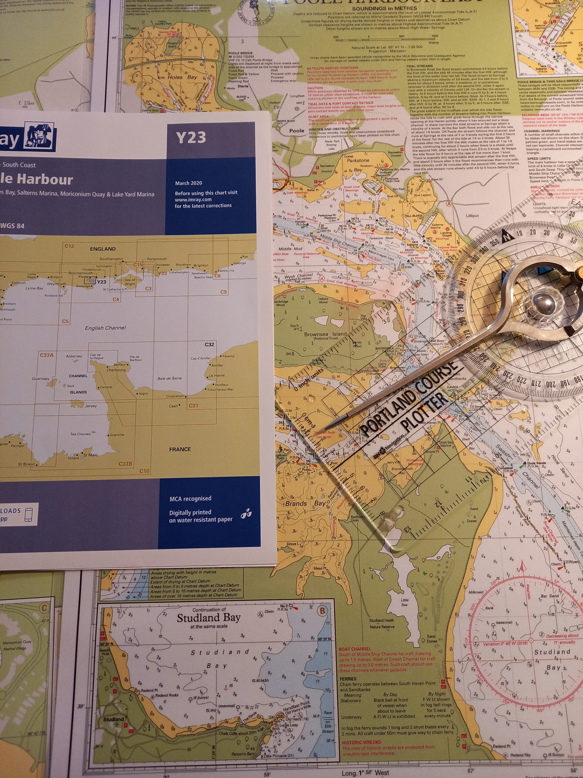
Due to the current global situation, we have reduced the majority of our courses to single household bookings. This provide a fantastic opportunity if your crew is in your ‘bubble’ but what about those who boat alone? We have the option of one to one boat training but what are the advantages and how do we address any disadvantages?
At Dorset Marine Training, we have always specialised in small group sizes on our courses. For our Powerboat Courses this is just two people and our Motor Cruiser courses four. On our classroom courses we usually limit them to between four and six. Of course, where groups want to book a full boat to benefit from economies of scale we do that too. We have always worked significantly under the maximum permitted ratios to give our clients more time learning. Quite frankly it also makes for a much nicer course for us to teach too. We know we have plenty of time to focus on the areas you need.
Over the last few months as we move between lockdowns and social distancing measures, we have reduced our course numbers further in most cases to just one household. For many couples, parents and children, crews or housemates this has been a massive benefit to them. It provides a lovely way for families and close friends to spend a few days ago. We have also seen some lovely courses between parents and adult or teenage children. It is such a lovely way to develop a relationship learning a new skill together & having lunch away from other demands on time.
For most, this has proved a great solution. But what about those who boat alone? Normally they would join another individual or group to keep costs low. This year for a few courses we were able to put individuals together on larger boats or in the larger classroom. This was with the understanding that they would need to be very respectful towards restrictions and distancing. This however does put more restrictions on how we could move around each other, cleaning routines and logistics on which tiers people were travelling from.
We have always welcomed those who wanted or needed one to one boat training and people are able to pay the two person rate to have the luxury of a one to one course. However, in the current situation we know that the one to one is not necessarily a choice but a necessity, so we have tried to help. For those who needed to visit us alone we introduced special discounts. Until April 2021 we have introduced a discount on our usual one to one training rate for Powerboat Courses. For VHF we have a min two person rate or the course can be taken online and we’ll conduct VHF assessments on a one to one basis.
Whether you visit us for a course on your own or with a group I hope this short article explains how we approach training. We are always happy to chat through options so please CONTACT US to chat further.
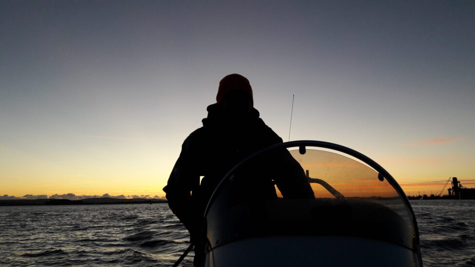
Blog one to One Boating
Lots of students each year book online courses with us, perhaps VHF, Navigation or for those that want to work on the water the PPR Professional Practices course. Many complete quickly on their own with little contact but we know that a few need some extra encouragement. We have compiled a 10 Handy Tips guide to help you succeed.
Last week for example we had a client who we stayed in touch with all day via text with encouragement and GIFs. Finally, after weeks of procrastination, they were motivated to complete the course in a day. Sometimes knowing someone is at the end of a phone helps.
I try to achieve a new qualification myself each year. At the moment I’m focussing on teaching skills, to make boating more accessible to all. This year I struggled to get into the momentum of my course due to the ever-changing nature of lockdowns so I do understand how hard it can be to stay motivated!
I don’t profess to be an expert in study techniques but thought I’d share a few thoughts here on how I’m now accelerating towards the end of my course. Perhaps you could share your strategies too?
1. Set yourself up with snacks and drinks in advance so no excuse to sneak off to the kitchen
2. Reduce your chance of being disturbed or distracted by hiding yourself away
3. Turn off notifications for social media
4. Break study down into manageable section even if that is just a few pages at a time. Make your aim achievable, anything else is a bonus
5. Use a dedicated study spot so that mentally you are prepared to settle down. For me it is a particular desk at home but it might be your favourite table in a café etc
6. Think about how you like to study and utilise that. Does highlighting text work, using sticky notes, drawing yourself pictures, listening to information etc
7. Use the weather to make the most of study time. If it is windy and wet outside use that time to study, don’t use time when you could be afloat if you will resent it
8. Keep in mind your aim. Will the course improve your boating, keep your safer, work towards a commercial qualification etc
9. Keep yourself refreshed with drinking water and getting up regularly for a quick walkabout.
10. Give yourself a reward for achieving your aims for the study session
ASK US FOR HELP – whether you are stuck, need motivation or just fancy a chat about boating!
If you’d like to see which courses are available please visit our online courses page or contact us to chat further.
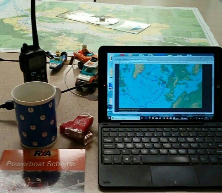
Last night our Training Talk was based on Electronic Navigation, both Chartplotters and navigation apps. It is clear that many of us rely on such technology but how much confidence should we place on it? Is it reliable and what is the information on the screen telling us? Do we still need paper navigation?
We talk about ‘The GPS’ but we are actually referring to a ‘GNSS’ (Global Navigation Satellite System). This is the name given to a system of global satellite positioning. ‘GPS’ is one of these, it used to be called ‘Navstar’ and is run by the USA.
You may have heard reference to ‘Galileo’, this is the European system. What about ‘GLONASS’ the Russian system or ‘Beidou’ the Chinese system?
Each is a system of satellites that provide data signals to enable position to be established. As long as your unit is able to ‘see’ three of these satellites its is able to provide a location. Similar to a three point fix in paper- based navigation.
Many people do refer to their chart plotter as a ‘sat nav’ and it is certainly similar. It helps us to navigate using maps or charts. The Sat Nav has rules in effect which will try to place you on a road. Chart plotters work slightly differently and you could be anywhere, land or water. Both allow us to navigate from a to B and both will have differing levels of complexity.
Our chart plotter on a boat may have access to additional data such as depth, speed and a ‘GPS’ heading. It is important to note that the GPS heading will be the direction we are going, or ‘Course Over the Ground’ and not necessarily the way we are pointing.
There are many different manufacturers and types and sizes of chart plotters. These range from small units with basic ‘numbers only’ functions through to larger displays with greater functionality. You can purchase a unit from as little as a hundred pounds through to several thousand! Some will have additional functionality such as fish finders and 3D seabed scans. Fundamentally they will each help us to navigate. Big brands include Raymarine, Garmin, Lowrance & Simrad. Most of the manufacturers will provide a nage of chartplotters to suit all budgets.
Many chart plotter now use a touch screen, some have buttons to control a cursor, some have both! If the instruments are inside a boat or you are sat in the marina planning a route then the touch screens are great. However, who has tried to use a smartphone with wet hands? You’ll soon find that on boats exposed to the elements or crashing over waves, buttons can be more useful although possibly more time consuming.
The more graphical and the bigger the screen, the more information we can see. It is important to understand that information. We need to recognise the symbols, understand relationships between colour coding and the different layers of data. The best way to achieve this is to have studied the paper charts and understand what the ‘top down view’ represents
Many plotters now use ‘Vector Charts’, this means that the image you see is compiled from data, rather than one big picture of a paper chart. It is possible to reduce the detail and even zoom out to a point where the detail starts to disappear. This can be dangerous if part of that detail is a hazard.
A useful feature comes in the form of ‘tracks’, this is present on almost all plotters and allows us to see a line on the screen showing exactly where we’ve been, which could be used to trace a route back. This is like an electronic ‘trail of breadcrumbs’ on the chart.
Probably the most important aspect of any electronic navigation system is the ability to guide you to a ‘point’ of reference. These ‘waypoints’ can be placed anywhere on the chart and then the system will either take you directly there or via extra ‘waypoints’ that you enter. Newer systems will ‘autoroute’ and suggest a route that takes you there via deep water and avoiding hazards. For the autorouting to work, you must have up to date software. It is important we remember that the water we are guided through is a result of the depth ‘settings’ that we have entered. Checking your settings and learning the menus is important.
Once we’re going to a waypoint, we get various information on the screen, given to us as abbreviations:
The position displayed on our device, for example: 50°43’.34N 001°12’.14W gives us a unique location somewhere on the planet, we really should be able to read this from the display and plot it on a paper chart. ‘Fixing’ our position in this way, at regular intervals, means that we would know where we were (or close by) if the electronics failed (which they sometimes do).
If we are taking positions between electronic and paper charts, we must ensure that we are using the same ‘datum’. This is the grid reference that it is all measured from and some countries use different systems. Generally, we see ‘WGS84’ as being the standard system on British / European charts. Check your plotter settings!
As we mentioned, having a backup is important. Being able to find your ‘satellite’ settings is useful, this can help you see how many satellites your system is ‘seeing’ and the relative accuracy of the ‘fix’. If your signal is interrupted, it may display ‘position lost’ and you then have to think where the receiver is located, if it is on the outside of the boat or built into the unit. It may be that someone has sat on the receiver with keys in their pocket…
As time progresses, manufacturers are including more and more features and facilities into the units. This is a fantastic opportunity to do more with our chartplotters, it does increase the stakes as we put ‘all our eggs in one basket’.
One unit that displays all our data and allows us to fly a drone, control the stereo and watch different webcams has a vast array of software that is (possibly) more prone to problems.
One feature that is undoubtedly of use to us is the ability to use ‘AIS’. ‘Automatic Identification System’ allows us to see other ‘AIS enabled vessels’ on screen and then be able to identify risk of collision. This is an ‘add-on’ or stand alone module that can be added to VHF radio or chartplotter.
We are seeing GNSS enabled phones now offering similar facilities to the chartplotters. Apps such as the Navionics ‘Boating HD’ allows us to buy segments of chart coverage as we go, as long as we have data coverage, they are ‘pay as you go’.
New software such as ‘Savvy Navvy’ incorporate the wind and tide forecasts, they plot an even more thorough route for our passage.
The most important ‘App’ that has been introduced is the RYA and coastguard’s collaboration on ‘Safetrx’, this is an app that allows us to use our phone as a remote monitoring and reporting device for safety whilst we are en route. Safetrx allows you to choose contacts who can receive updates, GNSS locations and even ‘late arrival warnings’. They can be an effective shore-side contact whilst you are out on the boat and the coastguard can access your data in case of emergency.
Absolutely, the technology allows us such flexibility and ease of use, the big displays allow us to view things more easily and the chart data is all stored on one small card.
We must beware and have a plan B, electronics do (and will) fail. Bigger screens are more expensive and the complexity means you must learn the system to prevent user error. If you’re using mobile apps, remember that dropping your phone over the side is pretty final.
No matter how much tech we have on board, we always carry a chart.
The ‘Essential Navigation and Seamanship’, ‘DaySkipper’ and ‘Yachtmaster’ theory courses all deal with this and other elements of navigation. The courses gradually increase levels of complexity.
For more information, or just to chat about the content today, please get in touch by email or any of our social media channels.
Dom and Sarah
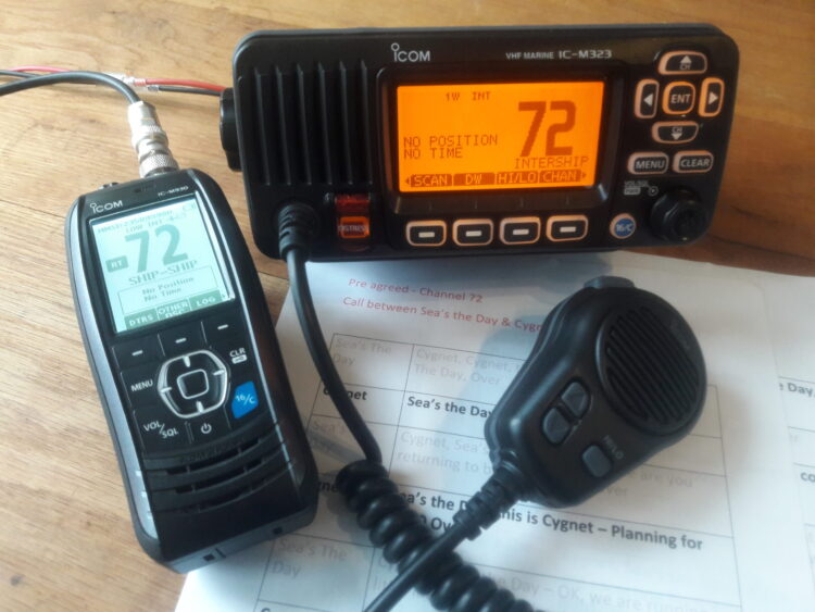
This week with our Training Talks we have been looking at VHF radios. We can never cover all the materials in a short one hour session (or a short blog!) so these were very much aimed at being refreshers and reminders for those with licenses and an introduction to why a course is a good idea for those without. Aimed at those boating in the UK. It is important to remember that on these sessions and courses, we use Training Radios, they are specifically designed and licensed for us to use them online and not transmit outside the room. You cannot practice distress calls on real sets!
The reasons will differ in different locations and for different boaters but there are many advantages to using a VHF on board. The VHF is designed to work on the water, they are usually waterproof and ergonomically designed for wet hands! They may provide us with a position, allow us to speak to multiple people at once and have potentially have direction finding capability for rescue services to find us. Depending on the type we may have better battery facilities than a smartphone. Our unique identifier on most of our radios also enables emergency services to match up contact information to ascertain who it is and where we are if we need help.
The mobile phone is of course useful at sea. It is great for calling friends or nearby restaurants and coverage may be fine but it is not designed to be used at sea. Many mobiles are not waterproof and who has tried to operate a touchscreen with wet hands! In the case of emergency it is harder for the rescue services to locate us if we are not quite sure where we are ourselves. It also means that we only speak to one person when requesting help and boats nearby that might be able to offer immediate assistance don’t know that we require help.
Dom and I have always tried to make it clear that we would rather encourage you to get the paperwork right by explaining the benefits and advantages rather than beating you with a legal stick! Feel free to approach us with individual questions. Whether it’s a new radio or you’ve had the radio for years please just ask. So what do you need?
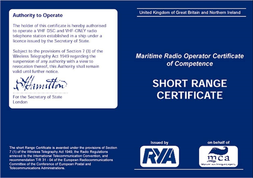
You will require an Authority to Operate a VHF Marine Radio. This is about you as a person using any VHF. The qualification is obtained by taking the SRC (Short Range Certificate) Course, often referred to as the VHF course. This is a course we run. You can take the course online or in the classroom (when we are all allowed back). The classroom course takes a day usually.
The online course can be accessed as and when you like. Either all in one sitting or over a series of weeks/months. You expect to spend about 8-10 hours on it. You will receive a course book to keep. Course (prices correct June 2020) is £65 online or £85 in classroom. There is a final assessment to sit which needs to take place at an RYA Training Centre like ourselves. This costs £60 payable to the RYA. Course details here: VHF Courses
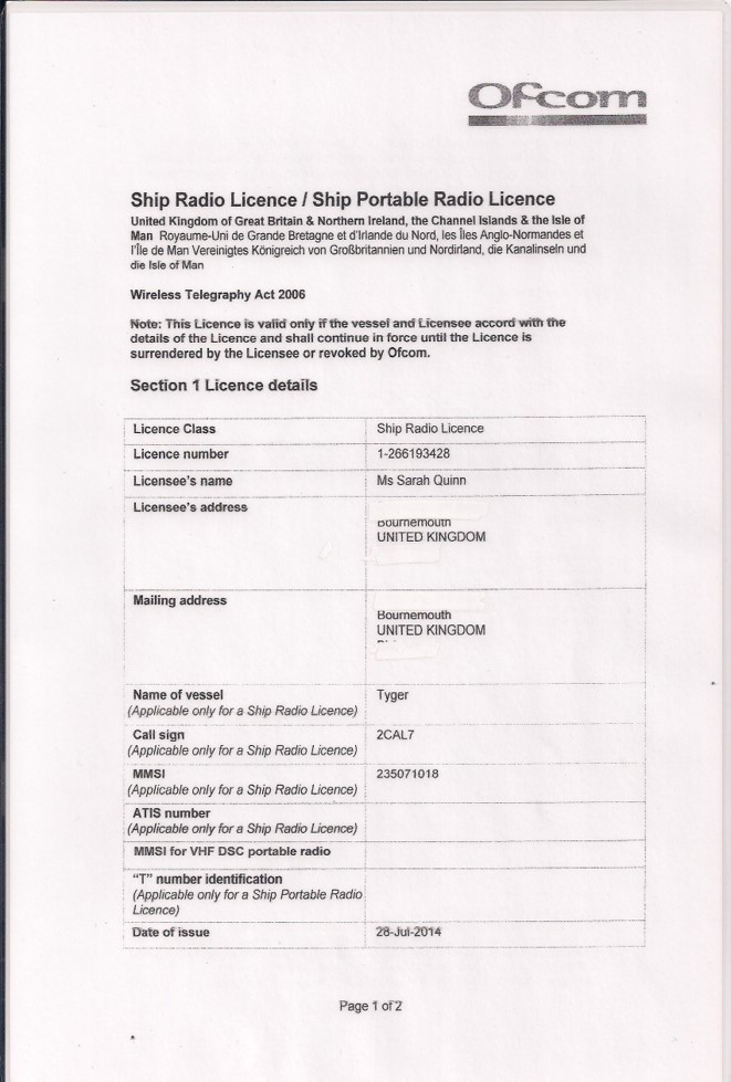 It sounds very grand particularly for those of us with small boats but, in essence, any radio needs to be licensed. This is FREE of charge online via OFCOM. There are two difference types of licenses. If you have a fixed VHF set wired in on your boat you require a Ship Radio License. If you have a handheld or portable you require a Ship Portable Radio License. Any other equipment that you have onboard which can transmit a signal also needs to be included on the license. There are a few exceptions so give us a call if unsure.
The Authority To Operate is simple to obtain once you have done the course. It is an assessment but no need to be afraid of that. We are both instructors and assessors and all we want to know is that you have understood the information on the course. Any issues we will carrying on teaching until you are ready but the reality is that if you have completed the course you will be fine. You don’t need any prior knowledge to take the course and it is suitable for skippers or crew. It is also a legal requirement to have the qualification (otherwise than in an emergency)
Why take the course? We honestly feel that you will become a safer and more confident boater with the knowledge gained. Some comments from previous clients
“Absolutely superb course. Really thorough. Felt that we were taught everything that we needed. Managed to combine really good training with a great atmosphere.”
“Very impressed would recommend the course”
“Very good course, informative with new items highlighted throughout discussions”
The radio license from OFCOM again is not only a requirement but it brings together all the contact information in case of an emergency. If you have a DSC radio (one with a ‘red button’) you will be allocated a MMSI number. This is a unique number to that radio and is transmitted during digital calls. Should you be reported missing or overdue the coastguard may send a routine call to you, to check you are ok.
A boat was reported overdue locally, last week. The coastguard sent a routine call to the boat radio but received no reply. As a result the lifeboat was launched. Fortunately, all ended well as the boat was found at anchor staying overnight in an inlet. Had the radio have been on it could have prevented a search operation.
We sometimes have people tell us they only plan to use the radio in an emergency so aren’t bothering to get the paperwork in place. The reality is that the course will give you confidence to trouble shoot your radio to ensure you have the maximum chance of rescue. The license ensures the coastguard has contact details and information to hand.
A few years ago a lady approached me to book a course for her husband. She then asked if I thought she should do the course – she was reluctant due to the assessment. I suggested she came along, did the course and then made a decision as to whether to sit the assessment. She took it and of course got full marks, having enjoyed the course. But the real point is that 10 days later the same lady came back to see us and they had a fire on their boat that weekend. She said she was amazed at how calm she was as she felt able to deal with the radio communications whilst her partner investigated the fire. All ended well and the fire was fortunately confined to the engine bay. She was incredibly glad to have taken the course and felt it had added to their safety.
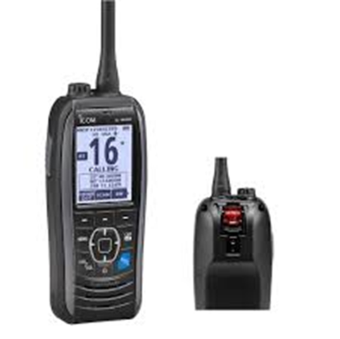
So many choices but first of all do you need a fixed radio, a handheld portable or a combination? Next do you need a DSC radio? Which leads us to ask what is DSC? DSC is Digital Selective Calling and rather than just voice calls the radio can send digital transmissions too. For most people now a DSC radio (one with a ‘red button’) is a good option. You can very quickly send a distress message simply by pressing and holding the red button in. It will in most cases then send your location and identity to not only the coastguard but other boats nearby.
Two limitations of DSC: They are slightly higher cost and the battery life is less for portables.
There are several manufacturers around. Personally, we tend to use Icom due to their amazing customer service, the menu structures and our own experience of how durable the radios are. However, there are other good manufacturers as well and it is a personal choice on cost and features required.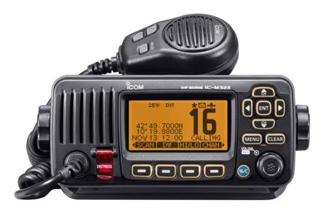
If your radio is a digital set, does it have an information source for it’s location? Many have inbuilt GPS receivers now but if your radio says no position found it is important to check this out as a significant safety feature is not working.
We often talk about brevity clarity and discipline on the radio. It is important to understand how to use the radio properly and follow the structures. This enables more people to use the radio and may prevent you from blocking an emergency call. We talked about prohibited actions, prowords, range, low power and high power, channel use and the phonetic alphabet. Who can you call? What are you allowed to discuss?
If you heard the words ‘Seelonce Mayday’ broadcast over the radio would you understand what that meant? It is important for safety that you do and we cover all of these topics on the course.
We talked about how listening to your radio can contribute to your safety. The benefits of harbour control channels and knowing shipping movements will greatly improve not only your safety but prevent you being a hindrance! After your course where do you find information about which channels to use? Almanacs, charts, harbour guides and websites are all important sources of information.
The ‘National Coastwatch Institution’ make to our boating lives. ‘NCI’ have a dedicated channel (65) and can provide radio checks plus information on weather.
This led nicely onto to the various features, buttons and setting on VHF radios. From backlighting to volume to squelch and a discussion about how useful dual watch can be. This is particularly in busy waterways or for those carrying out safety boat patrols.
Next up were calls, routine voice calls, routine digital calls and onto distress, urgency and securite calls. Some who have not undertaken training will dismiss the need to know about routine digital calls. However, digital calls can actually increase your confidence and use of the radio. If you use DSC there is no need to talk on channel 16 which makes the process quicker and less intimidating.
Dom demonstrated the benefits of understanding what to do if you receive a routine call. Often when a radio beeps people turn it off without reading the screen – what if it is the coastguard calling you to check an overdue report? The great thing about digital calls is that whatever channel you are on your radio will beep if you receive a digital call and when you accept the call it will automatically default to the channel the caller has chosen.
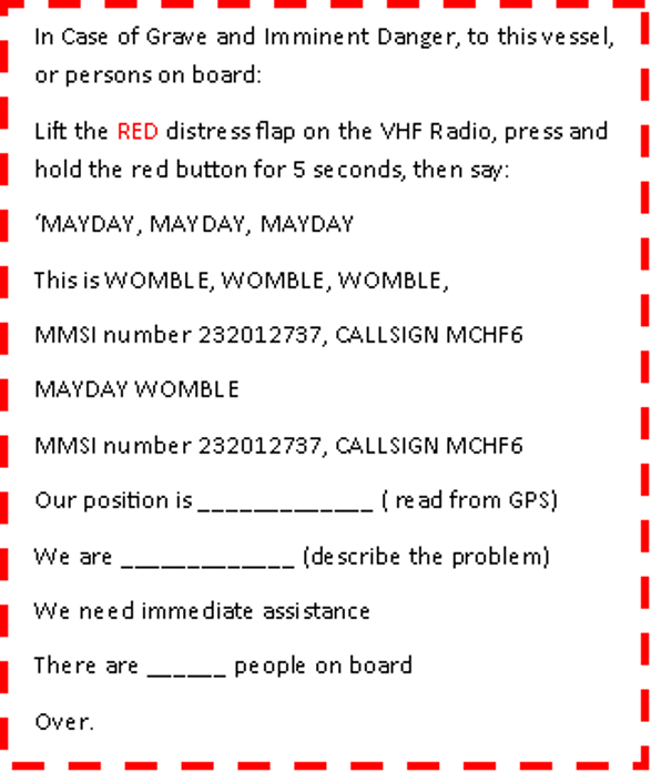
We ran through the Mayday call, when to make it and how. The level of detail in the call is important too. It is a great idea to have a proforma of the call written out and kept next to the helm position to ensure all crew know what to say. None of us know how we would react in an emergency so why not make it easier?
Free template available here: MCA Mayday Card
 One query raised was about accepting Mayday messages – I have included a page from the manual for the Icom M323 to explain the process. If you don’t accept the call the radio will not default to channel 16 for you to hear the message. Don’t forget we are talking about Class D receivers, those aimed at the leisure market. If you work in the emergency services you may well have a different type of set.
We then looked at the situations we would use for the different types of call. Ultimately, do not be so afraid of making the wrong call that you don’t ask for help. The coastguard are professionals ready to receive and help with our calls. They will guide you through the process. The earlier you call and ask for advice the easier any situation will be to manage for all concerned.
Finally, we looked at the importance of accepting and listening to safety alerts. These give us valuable information on anything from a buoy being out of place, divers in the water, new gale warning or navigational hazards such as submerged containers. How much safer would your boating be if you listed to these?
Don’t underestimate the value you will get from reading your manual. If you have already taken a course to gain the fundamentals, you will find that reading the manual for your own boat will complement your training and allow you to get the maximum use form your radio. We go afloat to get away from people but taking the time to learn how to use your radio effectively could make the difference to looking after you or your crew or indeed helping someone else in need. An example manual for the Icom M323 is available here: Icom Manual
 Safetrx:
Don’t forget that the free RYA Safetrx app feeds in to the overall safety system. Part of the registration includes the ability to include your MMSI number, call sign and Boat name. The Coastguard can link all the information together and attempt to call if you are reported overdue.
Further information here: RYA SafeTrx
It is important to ensure that crew know how to use the radio. The basics of how to raise a distress alert, to hold in the push to talk button to talk but release it to hear a reply and how to work out where they are to give a position.
Understanding your radio and being licensed makes your boating safer and more enjoyable. The course should not be seen as a trial, it’s something to engage with and to apply to your boating.
It is important we follow the protocols to protect everyone but don’t be afraid to use the radio if need for both routine or emergency calls.
Dom gave another great talk on Tues leading us through night navigation. Great feedback and clearly an appetite for us to continue the series of talks into June.
We started by talking about being prepared. How and why it is challenging at night and the level of experience suggested. We looked at suggestions for extra kit to carry at night. These included lights, head torches, flares, luminescent compasses and using radar if appropriate. Dom demonstrated how the lights on lifejackets activate upon contact with water. Also the important of having lights fitted. He also reminded us to adjust the backlight on equipment such as VHF radios (and remember to adjust it again before daylight). Adjusting backlight is something we look at on our VHF courses.
As this was an introduction to light it was impossible within the time frame to cover all possibilities, but Dom explained the difference on lights on the most commonly encountered vessels. Not only do we need to know which boats we need on our boats but we need to be able to recognise the vessels we may encounter at sea.
We looked at:
He then threw an unexpected quiz at us!! Putting light sequences up on screen and getting us to comment in the chat box if we could recognise the lights. Sadly there were no prizes but a great exercise. He went on to explain the level of details expected at different levels of qualifications and experience.
Next up were navigation marks. We considered what information we would have in advance to help aid out pilotage and what we would expect to see out on the water by using a chart. How do we tell if they are lit or not on a chart, how the chart manufacturers differ in the symbols used and what the abbreviations mean.
In Poole we looked at the light sequences on the lateral or channel marks. The differences in the light sequences helping us identify exactly where we are in relation to the Channel. In Poole we have a variety of different sequences used – some are quick flashing others flashing 3 times in every 5 sec etc.
And then we moved onto look at what these sequences actually mean. A useful guide is given in this link from the RYA Buoys and Buoyage
Cardinal marks were next. These are very important identifying where the safest water is and we chatted about the similarity to a clock face for light sequences.
E is 3 flashes, S is 6+1lg W is 9 and N is continuous flashing approximately once every sec.
We moved on to look at Isolated Danger, Special Marks, Fairway Marks and Temporary Wreck Markers.
Fixed lights and transits were also discussed and then onto sector lights. Dom showed us illustrations of how marina entrances might look night and day with fixed lights. He also discussed how the sector lights worked at the entrance to Beaulieu River
We looked at how we could use the information gained from the chart for pilotage to navigate a safe route the harbour.
We concluded by discussing when it is appropriate to go out in the dark and how to gain experience safely. Dom recommends all his Day Skipper & Yachtmaster Students sit on land in the harbour one evening and look out to see what they can spot be that buoyage or ships moving around. We talked about the limitations of colour blindness and how to provide solutions and chatted about lights that may be damaged. The issue of car lights on land, lights on the docks, traffic lights etc can all add to the general confusion at night and also how distance and speed perception is altered at night. We finished up by chatting about firework nights locally and the extra hazards that occur during those evenings
Another great talk by Dom – we do not recommend you rush out without appropriate training or experience but hopefully the talk acted as an insight into the factors we consider. If you want to learn more we cover lights on our Day Skipper & Yachtmaster Courses (currently live via Zoom) and for practical experience we run bespoke training in an evening. Night Nav is included in our Day Skipper Practical and Advanced Powerboat Courses as well. These are curtailed by the current situation but we will be looking to get these started again as soon as the Covid situation permits. We are also happy to rerun this presentation live with questions for individuals, groups or families at modest cost – contact us for details.
A fabulous resource is the electronic version of the IRPCS Book For this particular book we highly recommend the ebook version as it allows you to view vessels in different light scenarios. Just check before purchase that you are buying it in your preferred choice. Some prefer to use the RYA Books app others download directly through app store.
Another great Women on the Water chat last week. The topic for the week was boating clothing & kit, what you would recommend and what you are still looking for. It was great to have such a mix of experience on the call. Women who work on the water through to those taking their first adventures. It is a privilege to host these chats and thank you to all who participated.
First question of the hour related to Salopettes. Seemed to be agreement that it is worth getting female fit salopettes. You will be able to move round boats much more safely if you are not tripping over. It was not until I invested that I realised how much easier boating was. I could finally step over jockey seats, step up and down off the boat all so much easier. Those who had invested further in drop seat salopettes all seemed to agree they were a good idea.
We also chatted about jackets and the length of jackets sometimes being an issue in terms of being able to move about. The benefits of smocks were discussed too. One of the major discussions related to sizing of clothing. Several within the group expressed concerns that so often the ladies fit clothing stops at size 16 and we discussed alternative suppliers. Seems to me the main manufacturers are missing a trick here. I have had similar discussions in the past with guys too that technical clothing just isn’t easily visible in all sizes. Great to see that our discussion group could firstly reassure each other that other have found this too and then suggest manufacturers to look at.
In terms of brands the following comments arose from the discussions, no brand sponsorship! It was interesting to see that the same names came up from several people for recommendations, another brand was viewed with hesitation currently and a couple of brands not usually associated with boating were recommended for a look. One of the outdoor brands was discussed in detail and viewed as a brand to watch. We also chatted about colours on clothing – the commercial skippers in the group expressed their concern that operators often require us to be in black but it can be hard to source women’s fit waterproofs that don’t have a splash of colour- often pink!
Lots of discussion across all price points. What to look for whether you’re a day boater staying local or alternatively if you’re heading further offshore. Whilst the premium ranges got a good review it was clear that there is also some very affordable kit for those closer to shore. You don’t need to spend a fortune to stay warm and we discussed how some centres are moving to brands which were not traditionally seen as marine specialists. The discussion suggested that there is still some way to go with consistency for these brands but certainly something to look at. One point that seemed to be agreed on though was it was worth spending just a fraction more from the basic if possible to ensure you get breathable waterproofs. It was interesting to see that amongst participants we covered all price points across one particular brand so great for comparisons.
The discussion then turned to waterproofs use on courses or borrowed by friends. Many of the experienced boaters had experienced occasions of being given clothing that didn’t fit properly and we discussed how this made the introduction to boating harder.
If you are going on a course why not ask what brand of clothing they use and then look up in advance what size will fit you best? So many ladies had gone boating with ill-fitting waterproofs because they didn’t want to cause a fuss.
If you are taking friends out boating making sure you have suitable clothing for them or give them considered advice on what to bring. As a regular boater you will probably have technical clothing that will keep you warmer for longer – don’t forget your crew! For those instructing, try and find something that fits your clients- don’t embarrass them by handing out something that is going to be unsuitable. If unsure why not present a selection from them to choose from. (Current situation may prevent that from happening for a while but you get the idea!)
Not sure we really came to an answer for this. Those who have been on the water a while all seemed to have had disappointments with gloves. However, one solid recommendation was made. The biggest issue seemed to be the inability to put gloves back on once removed. This is usually due to the liners in many gloves. This led to a recommendation to consider a look at all season ski gloves.
For me the issue with gloves is: not waterproof whatever it said on label, or the liners make it impossible to put them back on, or they are too bulky to operate controls on boat. For local boating where not out too long I have resorted to neoprene gloves. I accept now my hands will get wet whatever so they might as well be warm! Others suggested gardening style gloves for certain tasks. Clearly it depends what you need gloves for, whether to stay warm or protection as to the style you choose but an area for more research! I was hoping someone would have tried the merino wool style gloves as that is my next thought but no feedback from the group.
This was my topic. I was happy to recommend a boot brand but I was in search of deckshoes suggestions.
Boots – for dinghy sailing or SIBs several agreed it was worth looking at diving brands. Often cheaper but so toasty warm. You will want different styles of boots depending on the type of dinghy sailing you do. If you are out on the trapeze on a Dart you may need something quite different to the boots I would use in my lightning. If you are new to sailing, ask around the fleet. Talk to people sailing in a similar role.
Waterproof Sailing Boots – for those sailing on longer passages there was one clear brand winner recommended by all. They are expensive but considered worth the investment by many in the group. For me, I’m usually out for shorter periods of time so I had my own mid price range recommendation. Thermal, good thick sole to take impact from powerboats were necessary for me. Do try on boots as it was clear that the calf size was an issue for many on certain brands. Several ladies preferred the shorted style of boot for comfort. My own tip is with the cheaper brands consider waterproof socks as a mid-layer in winter. These are one of the best investments I have made! Some of the cheaper brands of boots have very thin soles, take little impact and wear out quickly.
I was interested in the recommendations here as so many have too think a sole to take any impact or provide support. The trainer styles were recommended by several although not waterproof. Definitely something for me to look at. Specific brands were mentioned so as soon as lockdown is over I’ll be out looking!
It was a great chat and thanks to all those who participated. Boating can sometimes seem elitist and expensive. It was lovely to be able to share tips and hints to benefit people at all stages of their boating. Also good to see all price points covered. Hopefully, it gave ideas to people on brands to check out and reassured others that we often face similar issues. It was really nice that several people exchanged contact details to continue discussions between themselves on specific points. It is a privilege to see a community forming.

During last week’s Training Talk on buoyage we were asked how the buoys in Poole Harbour get their names. Great question and one I said I would research. I didn’t realise quite what a task I had taken on so this blog will updated a buoy at a time. Check back every so often for updates. At the bottom of the post you will see information on the last update.
Many tales of the sea are hearsay and tradition so apologies in advance for any inaccuracies! If you have information that can be added or dispute the information (!), drop us a line. Some buoys are named after people.
The buoys that spring to mind in no particular order are:
Hamish, Stakes, Diver, Tasman, Aunt Betty, Bell, Swash, Brownsea, Channel, Hook Sands, Hutchins, Jack Jones, Bullpit, Salterns, Bar Buoy and Warner. Can you think of any others?
In addition, there are numerous posts with names around the harbour too and we’ll move onto those next.
Great question and I don’t have a full answer. All the buoys still have their reference number as well as a name. Some of the buoys are named in recognition of people who have contributed to Harbour life, others are descriptive as to location.#
Tasman Buoy has been in place since the 90s, believed to be 1995. It has a great history relating to a friendly and helpful face from a specific spot in the harbour. The Buoy is located not far off Russel Quay. For those unfamiliar with the Harbour this is close to Rockley on route to Wareham. It is Buoy number WH7 in the Wareham Channel.
The information below is my interpretation from sources in the Harbour.
Tas Brackstone, known as ‘Tasman’ was a friendly and welcoming figure to be found at Redclyffe Yacht Club. Redclyffe is located on the River Frome on route to Wareham. He was at the club most days welcoming visitors, giving a hand to members, looking after the club launches and generally being the friendly face of the club. He was a regular representative at Poole Harbour meetings.
So how did he come to have a buoy named after him and why this specific spot? Apparently, prior to the Tasman Buoy as boats came out of Wareham River they used local knowledge to sight a ship on a mooring that rarely (if ever?) moved. This was the MVF (Motor Fishing Vessel) Watchful. They knew to keep this ship to their Port side to find deeper water (or Starboard on route in). For years this had been used for navigation and as the ship slowly deteriorated and was in danger of sinking the discussions arose as to how to assist navigation on route from Wareham.
Tasman was on the Poole Harbour Committees discussing such issues, representing the interests of Wareham River users and Redclyffe members and it was suggested that a buoy be placed at the spot once the boat was removed. The Commodore of Redclyffe YC at the time along with the Committee suggested that in recognition of all the time and help Tasman had contributed to Wareham River users that he should be recognised through naming the buoy after him. PHC agreed to organise the buoy but it was down to Redclyffe YC to organise the wording.
Once a buoy was in place the Commodore of RYC, assisted by his brother, took the club launch down to the buoy. It was time to figure out a way of painting the name on the buoy. As any boat users will know, buoys tend to move and swivel and this was not an easy undertaking! Finally, the task was completed and Tasman in the club launch for the reveal of the new buoy. At the time this was buoy number 79. It has since been replaced by a smaller more modern buoy but still bears his name.
Tasman must have been a character and much appreciated supporter of the club and river he loved as his photo is still up on the wall at the club. Those who have spoken to me about him spoke of him with real warmth, a character who had made their time on the river a happy experience. He was described to me as always being at the club, ready to help, to offer a friendly smile and a warm welcome to club member and visiting yachtsman alike.
Thank you to all those who contributed information. This is my take on the information given to me and sadly I never met ‘Tasman’ so I apologise in advance for any misrepresentations. The information is based on an informal chat from a small group of sources. If you would like to update or contribute any information please contact me.
If you would like to learn how to use buoyage to navigate by why not have a look at our RYA Essential Navigation & Seamanship Course? Essential Navigation
Edits: 9.5.20 Info on Tasman Buoy added
Each week during lockdown we are hosting Free Training Talks on both a Tues and a Thurs. This week the topic was Buoyage. These sessions are free to join in, sit quietly or actively participate. We hope to record them shortly and upload to our YouTube channel. The full program can be found on our website calendar.
The sessions are intended as a refresher revision for some and a springboard into training for others. It cannot be a comprehensive all encompassing teaching session. If the concepts are new we suggest people enquire about further training and for those whose revision showed them to be rusty there are plenty of books guides and flip cards to aid revision.
Both evenings were well subscribed and with a wide variety of experience. It is great that so many people are coming along to listen. During the session Dom ran through the different buoyage that we may encounter out on the water.
Starting with lateral marks or channel marks, ‘greens and reds’ and a discussion about IALA A or B buoyage. This will depend on where you are in the world. We talked about the shapes, triangular for green starboard marks and cans or square for red port marks. He showed a variety of photos to illustrate the different size and style of buoy that may be encountered. Poole is a great example where even main channel marks can be quite different in style. We talked about the numbering system on buoys and that some might have names. The direction of travel and direction of buoyage was also clarified.
We had a great question from the audience tonight – Why is Hamish buoy in Poole Harbour called Hamish? Yet to be confirmed but the best answer I can find it that it was named after a past Harbour Master or Harbour Commissioner named Hamish Green.
We moved on the look at Cardinal marks and what they tell us plus the colours and the top marks. Dom was a little sneaky and asked for comments in the chat box. Most answers talked about danger but in fact they show us where the safest water is. For example a North Cardinal tells us that the Safest Water is to the North.
Now that leads onto the question how do you know where north is? Perhaps you have a great sense of directions, have looked at a chart or sensibly use a compass. It starts t illustrate the importance of a compass on board. When we undertake pilotage exercises on our PB2 courses, people are often initially confused about directions and which side to pass of a Cardinal even though they can successfully identify it. A skill to be practiced. In Poole Harbour they are often used to indicate where channels separate. The examples we looked at were Diver Buoy and Bell Buoy.
We then had a discussion about how people remember how to identify the different cardinals using the top marks. East Cardinals most people saw the outline of an Easter Egg although one saw the outline of the letter E. West Cardinals some people saw a wine glass, others a waist and others the outline of the letter W. For North Cardinals the top marks point up as if on a compass and for South downwards.
We talked about where these might be encountered, how they might affect different boaters and the colour banding on them.
Next was the Isolated Danger marks – places to be avoided. Locally we have one in the harbour, one outside the harbour and a particularly relevant one down the coast at Christchurch. Someone correctly identified the picture as being Gear Rock outside Penance. The importance of recognising that those which are buoys rather than posts will move with the tide was highlighted. And it seemed many remember isolated danger marks by associating them with Dennis the Menace – red and black stripes!
The wide variety of yellow special marks was next on the agenda and it seemed that most people had seen these in use, whether for swimming or PWC zones. We looked at the chart and discussed the seasonal use of many of these and chatted about racing marks.
Finally we looked at temporary wreck markers, fairway buoys, fixed lights and preferred channel markers. We chatted about examples and someone suggested ways to remember preferred channel marks.
We then moved onto the chart, to identify what these marks would look like on paper or electronic devices. Those not local to Poole were fascinated by the number of channels and some a little intimidated by the number of marks. We talked a little about light but that is a topic for another night. Interestingly whilst looking at the charts we identified an error where a North Cardinal is incorrectly identified as a West Cardinal. We’re off to check the corrections to see if it has already been identified.
During the conversation someone made the comment that there seemed to be a lot of local knowledge. This prompted a chat about LNTMs (Local Notices to Mariners), Almanacs, Charts and Harbour Guides.
This session was a luxury for us. Normally on a course we only have a short time to discuss the buoyage whereas tonight we could discuss it in depth. The downside that for those who haven’t yet been out on the water is that putting the buoyage into context is very difficult. On a practical course if someone is struggling we are very quickly out on the water and it usually falls into place.
Thank you to all those who attended this week – great turnout on both evening and thank you so much for your lovely feedback. We have a full program of events – please visit our calendar for further information.
If you are enjoying the series of talks you may be interested in one of our theory courses – RYA Essential Navigation, Day Skipper or Yachtmaster. Please visit our Online Courses Page for details.
Main events:
Tues 6.30pm and Thurs 8.30pm Free training Talks
Wed 10.30am Women on the Water Q&A
Thurs 10.30am Q&A Chat
Fri 7.30pm Quiz Night
The rest of the week has free tutorials for our students who are undertaking online courses in Day Skipper, Yachtmaster Essential Navigation, VHF Radio or PPR. Please visit our Web Calendar Page for details.
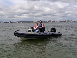
As we adapt we have recently added a new session to our program a ‘Women on the Water’ Chat. The aim is to encourage more women afloat whatever their level of boating. This blog will hopefully give you a flavour of our chats and hopefully encourage you as ladies along to our next chat or chaps to encourage their sisters, partners etc to participate.
I launched this last week and invited a group of contacts to join me. I wanted to see whether there was any demand for the chat. What started out as a quick 20min turned into an hour of laughter, chat and supportive comments. I had to call time an hour later to ensure we had something to chat about this week. The good news was that we have filled a gap. It was interesting to see that the insecurities and queries I have had on the water and in my boating pathway, were echoed by the others in the group. Even better news was that by accident I had discovered a lovely group of ladies. These included sailing instructors, lifeboat crew, powerboaters, safety boat crew and dinghy sailors. All happy to help with any queries we receive.
Fast forward a week and I hadn’t publicised this weeks event as extensively as I wanted. I, myself, had been struck by the very thing I was trying to prevent in others. A crisis of confidence as to whether anyone would turn up, so I had lost confidence in publishing it. A quick message half an hour before I was due to start out to the group from last week of “its running but don’t worry if you’re otherwise engaged” still resulted in four of us gathering online around the coffee cups. I had designed my schedule with topics suited to new boaters and yet here were people some of whom work on the water – what could we possibly discuss?
Its fair to say that once again 20mins turned into an hour – there was lots of laughter and some interesting points came from the discussion. The ladies were all respectful of giving each other the opportunity to speak without forcing anyone to and it felt supportive. I look forward to the day when we can meet each other face to face. It feels like I know these people already!
We had chat, we discussed technical points, shared ideas and even discussed the best safety kit for women.
One point raised was that ‘we’, the boating community, seem to have forgotten that boating can be just for fun. We do not have to leave at 3am to make the most use of tide. It may be if we leave later chances are it will just take longer. If we are happier, it’s a safe passage and it’s a beautiful sunny day why not lie in and enjoy the sailing later even if it takes a little longer to get to the destination! Of course, its not quite as clear cut as we must plan, some boats will make no progress against the tide, the trip may be more uncomfortable, or we may use more fuel. But the point was we go boating for fun – don’t feel pressurised into always achieving something specific.
Another interesting issue was weather and the pressure that some have felt on courses that they have to go out whatever the weather because people have paid. It was interesting to hear this vocalised from others as it is something that has put me off courses in the past. We are really lucky with our centre that Dom and I want to enjoy teaching you as much as you want to enjoy your course so if bad weather is forecast we will always contact you to discuss .
Some people are happy to go out whatever the weather and subject to safety considerations that is fine, but many of our clients are leisure boaters starting out. We want you to enjoy boating as much as we do and therefore don’t want to put you off by sending you out in vile weather! How do we get this information out there to reassure people?
Both points came back to a fundamental question – why do you have a boat? If you want to only go out on sunny calm days that is absolutely ok. If you like going out in more challenging conditions then again that is fine. Just don’t be afraid to ensure that you are meeting your objectives. Is the boating safe, fun and enjoyable?
A little tip I was given years ago – always come home before your crew ask to be brought in. That way they will want to go out again.
One of our participants then came up with a fabulous quote – one I didn’t immediately recognise but should:
“Whether you get away, or whether you don’t; whether you arrive at your destination or whether you reach somewhere else, or whether you never get anywhere at all, you’re always busy, and you never do anything in particular;” Wind in the Willows
To me this quote sums up what boating should be about – no pressure, no stress just chillout time.
The conversation moved onto boating plans for this summer. Whilst plans are currently on hold, we discussed one participant’s plans to cross the channel. This lady has the skillset and has done the research – now it’s the confidence to go and do it when the situation permits. It was interesting for some of the more experienced to discuss how they work out passage plans and tides, comparing techniques whilst it allowed some newer boaters to be aware of the depth of planning that is required for such a trip. It is reassuring to see ambitious women out there boating.
I was fascinated that within the group we had all said we wanted fun, enjoyable, relaxed boating but that should not be mistaken for a lack of ability. When we want to undertake a channel crossing or further it is to embraced. Interestingly most of us also race to a great or lesser extent so again don’t mistake our wish for chilled sailed for a lack of competitiveness when we want!
We chatted about how language can be misinterpreted and whether we over plan. We talked about the balance between having a thorough and competent plan in case needed and yet also taking a step back and remembering what it is we are trying to achieve. Its is easy to take a trip like Poole to Lymington and say well its only come out the harbour and turn left and fundamentally it is. But we should take care to ensure newcomers to our world understand that we have done much more planning than that and should something go wrong we have a back up plan.
Finally the conversation somehow moved onto lifejackets. Those that know me know this is a topic to infuriate me and a conversation I have had many times. At a Women on the Water Chat it was inevitable the topic would arise! The designs of lifejackets for ladies whilst being told by reps I am the only one to have raised it. The beauty of a meetup like this is I discover I am not alone; we have all had similar conversations. There is a gap in the market for female friendly lifejackets. It is interesting that all of us had chosen a similar style of lifejacket. It is not one that we often see in use at training centres but we all found most comfortable. Food for thought for our courses. We did specifically choose a style of lifejacket at our centre that is suitable for both men and women.
Naturally, the conversation also moved onto being given the wrong size waterproofs on boats. The expectation that any clothing would fit women. It was a lightbulb moment for me a few years ago when I bought female fit salopettes. Not only are they comfortable but I can step up and down decks and across jockey seats. We had a compare across the brands and discussed ensuring friends are properly kitted out when accompanying us.
The biggest takeaway for me was not only the supportive environment to raise questions but also the breadth of knowledge. The fact that it is ok to go boating in a non-competitive way. I really do need to find a way to ensure that people know our courses are designed around you. Visit for training or a course certificate I don’t mind. Achieve something specific or lets just go out and play on the water. What I want is for you to enjoy just being afloat without pressure.
Thank you to all who took part today and I hope to see more ladies online for our Women on the Water Chat next week. Wed 2.30pm – email me for the link.
The Wind in the Willows quote absolutely sums up the mood of our chat earlier. I love it so much I’m going to end with a repeat!
“Whether you get away, or whether you don’t; whether you arrive at your destination or whether you reach somewhere else, or whether you never get anywhere at all, you’re always busy, and you never do anything in particular;” Wind in the Willows
If you would like to chat further about boating or the Women on the Women Chat please don’t hesitate to send me a message – Contact Sarah at Dorset Marine Training
I am a Partner in Dorset Marine Training & the Principal for our RYA Training Centre Activities. I am also a Powerboat and VHF Radio Instructor. In the past I have been a Dinghy Instructor and over the years have owned a variety of watercraft. These range from canoes through to sailing dinghies, a 18ft yacht, a selection of small powerboats and our Training RIBs. I am also a qualified Commercial Skipper for motor boats and actively participate in dinghy sailing and racing. I am just at home bimbling around the harbour as I am participating in a race, skippering or teaching. The Women on the Water Chats were established by me to try and encourage more women to try boating, to feel supported as they progress and to explore what they want from their boating.
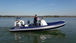
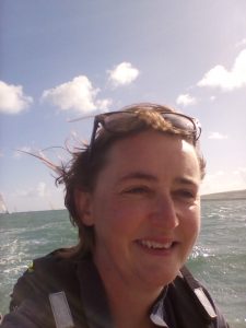
/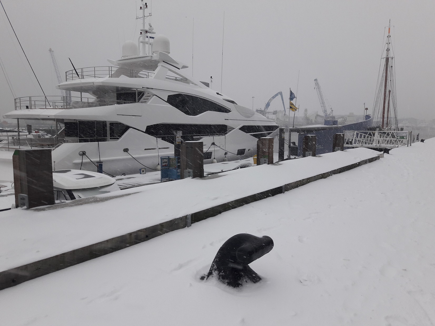
I always get a little down when someone says to me ‘season’s coming to a close’…… it’s like being turfed out of your favourite restaurant at the end of the night because everyone who works there wants to go home….. We should enjoy ourselves based upon our own discovery and ideals.
It’s a beautiful day out there, why aren’t we out? Let’s go Winter Boating!
So, if your idea of boating is sunbathing on the foredeck in the afternoon, the mere suggestion of such with an air temperature of 4 degrees, coupled with the fact that it’s pitch black at 1700, is likely to make you want to stick your swimming costume up my nose. But boating is managing expectations, & planning; as well we know…..
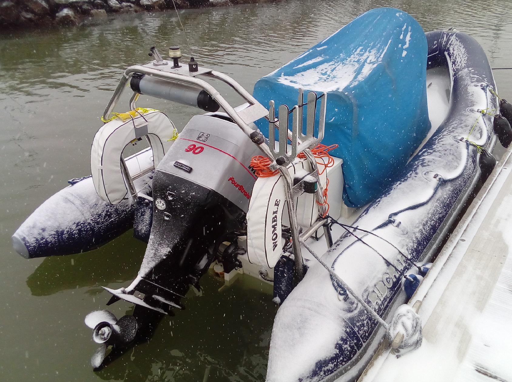
Working in the industry
Our summers are busy and we don’t get a lot of time for our own boating as there’s always the opportunity to turn the ‘not currently booked’ day into a last minute session to help someone learn a skill on board or move their boat to help them enjoy the net day more.. Winter is a different story.
When I was growing up, I have many memories of being out walking in the Peak district (we lived about as far inland as you can get without heading towards the sea on the other side!). All of my fondest memories include a snowdrift or the image of a stove behind a wall with mittens and a hat. I’m sure someone had sold it well to drag me there in the first place. If we’re dressed appropriately and understand what we’re going out to, the environment we meet at this time of year is arguably the most colourful, beautiful and tranquil…
My Grandfather did regularly tell us that there was no such thing as the wrong weather, only the wrong clothes…
Winter for Leisure
Only last week, we took a couple out into the harbour as the weather in October had thwarted their ability to achieve the handling goals we’d desired. The first day in December has just brought a beautifully still, clear and crisp morning with the perfect opportunity to explore the handling characteristics of a boat that needs good weather to be enjoyable. although removing ice from the boats in the morning adds a little to the safety management.
Winter for work
The earlier part of the week saw us undertaking an ‘advanced’ powerboat course for some folks who need a commercial qualification to move forwards with their activities working on the water. Ironically, this course can be run in much more unpleasant conditions due to the expectations of a commercial skipper, although the same band of pleasant weather meant that we focussed on the fine tuning and precision in manouvres rather than coming home in a storm!!
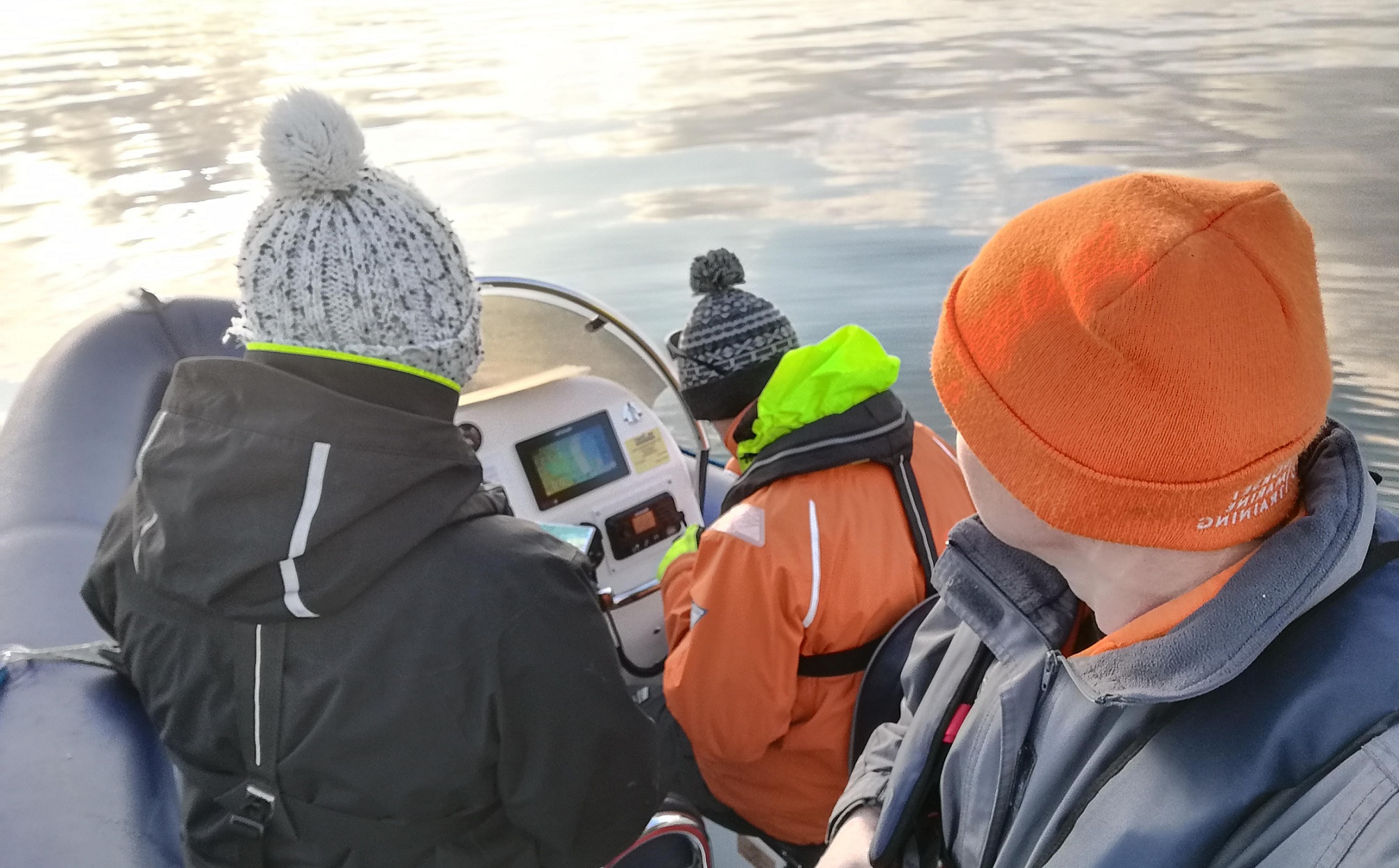
On Land
There’s also navigation to be learnt, Winter time is a perfect opportunity to bolster the unpleasant boating days with a little workup on how to use charts, electronics and associated tools to get us there and back successfully. This skill development is only successful when immediately put into action on the water. Our interactive tools in the classroom make this relevant and fun!!
We keep people’s minds current with Gift vouchers in the run up to Christmas. It’s good to be flexible so that people can use these to come out for a course, have a half day or day experience driving at sea. We also create hot chocolate and cookie infused navigation in the classroom throughout the winter and early spring.
Booking course places has been made easy and we regularly supply the course ‘in advance’ in the form of a gift voucher for Christmas, Birthdays or other special occasions.
Gift vouchers have helped us tailor precisely peoples expectations to the activities, ensuring that we ALWAYS ‘leave people wanting more’
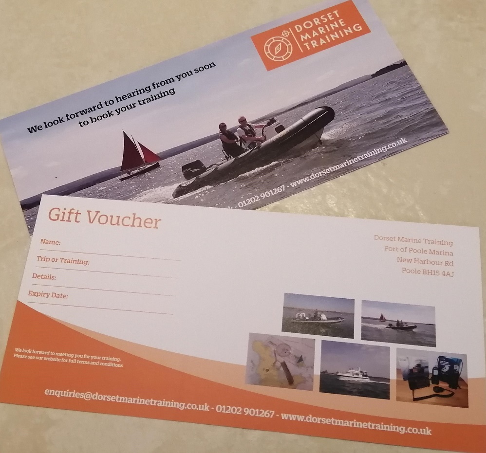
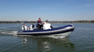
The simple answer would be no, you don’t need to take PB1 first but it is a little more complex. Indeed, many people will tell you not to bother with PB1 but instead to start at PB2. Instead our answer would be that it really depends. Your experience, your attitude towards the water and what you want to achieve from your course will affect your choice.
Many people dismiss this course as ‘a kids ‘course but, in our opinion, it would be a mistake to do so. It is well worth finding out more before your decision. Each year we will have a few clients that we feel would have been better to start at PB1 . This year we were lucky enough to host several courses for adults where PB1 was exactly the right course for those individuals.
The anticipated outcome for those undertaking the PB1 course is that they will obtain a basic understanding of powerboating. In addition, they will be able to take the helm under supervision. It is billed as the ‘Start Powerboating’ course and is great for those who:
Although the course is a full day we tend to run to a slightly shorter day (probably 9.30 – 4.30) to keep people engaged and leave feeling confident rather than exhausted! We also sometimes use a smaller boat for a PB1 courses if we think that will aid confidence.
In addition, youngsters can take this course. They may take it from the age of 8 although we tend to suggest that if they are attending a youngsters-only course that they perhaps wait until age 10 unless very keen about the water. We do of course welcome youngsters on courses with their parents or grandparents too!
For many people this can be the first step on their route to powerboating. Particularly relevant to those who are confident, have perhaps been boating before with friends and who plan to be the Skipper on board their boats.
The course is now referred to as Powerboat Handling which is a good reflection of the topics covered. It is a comprehensive two days and you should expect the course to run 9-5 (approx) both days in order to cover all the material. Please note it is not just a course completion certificate and you do need to reach a certain standard. For the majority the course is achieved within the two days but there will be a few occasions where we need to allocate a little extra time. Upon successful completion you may apply for your International Certificate of Competence (ICC) if required.
Many of our students do start at Level 2 even where they haven’t been on the water before, but they do so understanding that it is a comprehensive and fairly fast paced two days. Of course, we are always happy to schedule extra time if needed as we want you to leave not only with a Certificate but also feeling confident. At the end of your Level 2 course you should feel confident in taking a boat out on your own (or Helming a boat) in daylight, calm conditions and in familiar waters.
PB1 and PB2 follow a similar course structure but the standard which needs to be attained will differ. At PB1 you will undertake manoeuvres under the direct instruction of our Instructor. At PB2 the Instructor will teach you in the first instance. You will be expected to be able to make the manoeuvres yourself by the end and make suitable judgement calls. PB2 also looks at planning speed manoeuvres, retrieving a man overboard and additional theory such as pilotage and basic chartwork.
Hopefully this brief introduction will help guide you towards the right course for you. Please do just give us a call to chat about the best option. Many adults will start at PB2 but don’t be put off PB1 if you feel extra time would build confidence. In our next blog we will look at the course content, what to bring and what to expect from courses.
The answer is not quite as simple as it may first seem. The RYA run two certification schemes, the Powerboat Scheme and the Motor Cruising Scheme. (To be fair there are more than two schemes but these are the one relevant to motorboats)
The Powerboat Scheme is generally for those people who intend to use boats under 10m. These are usually open boats and often single engine. The Motor Cruising Scheme is generally for those who will be using bigger boats. They are usually that are capable of living on board or venturing further afield. Typically, they are over 10m, have accommodation and are often twin engine.
This is a generalisation and there will be circumstances and boats that don’t neatly fit into the categories. Alongside the Powerboat and Motor Cruising Scheme are the Shore based courses or theory that supplements the practical and these courses are used for both practical schemes.
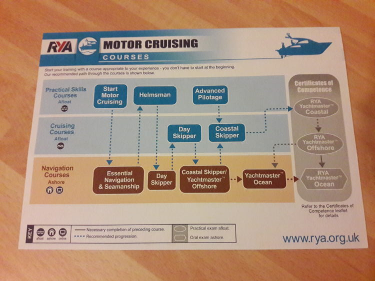
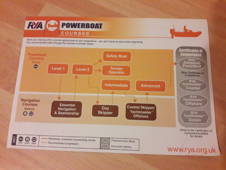
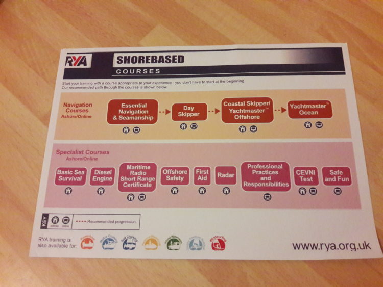
The Powerboat Level 1 (PB1), Powerboat Level 2 (PB2), Intermediate, Tender Operators and Advanced Powerboat Courses all fit under the Powerboat Scheme. By the time people move onto the Intermediate or Advanced Powerboat Scheme, it is recommended that they have theory to Day Skipper or Yachtmaster Theory Standard.
The Motor Cruising Scheme includes the practical Start Motor Cruising, Helmsman, Day Skipper, Advanced Pilotage and Coastal Skipper courses. For some of the higher-level courses there is even a separate exam. Often students will undertake preparation ‘courses’ before Yachtmaster practical exams.
The term Day Skipper is often misunderstood to be one course but it should be noted there is a theory course or a practical course.
If you’re looking to use a small open dayboat you should start by looking at the Powerboat Scheme. Specifically you should look at the PB1 or PB2 courses. When you look to progress and move onto journeys further afield you should supplement the practical courses with some theory. The Essential Navigation& Seamanship and then Day Skipper Theory would be ideal. If you’re planning on using bigger live aboard boats, then look at the Motor Cruising Scheme. You should perhaps start with the Helmsman and moving onto the Day Skipper Practical. Bear in mind the practical is after the Day Skipper Theory course.
Further information on the schemes and courses can be found here: RYA Course Schemes or why not contact us and we’ll send you a bespoke plan suitable to your experiences and aims.
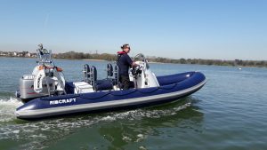
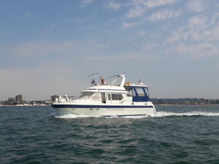
The weather has definitely taken a turn for the cooler this last week. As a result my normal boating gear has had a few additions. New boaters regularly ask me if we boat all year and the answer is a definite yes! The secret is to planning the boating and your waterproof kit well. We’ll cover the boat side in a separate blog but today it’s time to consider our clothing options. I write this from the female and small open boat perspective. Dom might have other views as he is usually tucked up inside a warm cabin!
Step one is to source good footwear. Over the years I have moved to always wearing boots in the winter. Boating boots are not cheap I’m afraid and its really frustrating to buy a pair that doesn’t last. My current favourites are my Maindeck Short Leather Boots. I only bought them at the Boatshow in Sept so can’t comment too much on durability yet. However, so far I’ve found them very cosy (thermal lining) & non slip. They also have a decent sole that takes some of the impact out of waves.
Early on in my boating journey I bought the cheaper boots with thin soles and in my mind that is a mistake – they just don’t last, aren’t warm and don’t take any impact. My last pair of decent boots I absolutely loved for comfort and they did me ok but had a very rapid deterioration once they had got wet until finally the sole fell off! 🙁 It lead to a tricky walk back across the yard!
If you are going to invest in a decent pair of boots keep them as salt water free as possible. Also make sure they dry out well. Footwear is obviously a challenging subject as almost everyday someone asks about my boots. This leads to a happy dance from me demonstrating my comfy boots with dry and cosy feet!
Ok not the most exciting subject to have but trust me – my boating life has been revolutionised by waterproof socks! They look ridiculous so try to put them on in privacy but warm, dry feet is a wonderful feeling! I currently have a pair I bought from Nauticalia in the sale (washed regularly and worn with ordinary socks I hasten to add!). These have lasted well and I plan to supplement them this year with some merino wool versions. I know there are plenty of you wondering why I would even bother covering such a subject but in my experience boots don’t stay waterproof for long so waterproof socks are the way forward!
Too big a subject to discuss in detail as there is something to suit every price range but in brief what do I look for? Good customer service if its expensive – I can say that so far we’ve had great customer service from Musto and that would currently influence my choice. lets hope the good customer service continues. Perhaps others can feed back on other brands?
These are a must – the extra layer is well worth while and I wear mine right from the beginning of the day when the boat still has condensation on. A pocket on the leg is a huge plus for me (very jealous I noticed Dom’s have two pockets whereas mine only has one). It is worth going for those with adjustments at the waist and shoulder as well as reinforced knees. Also look for salopettes with a zip up the front as this allows you to adjust the layers more easily. For the females I strongly suggest buying female fit salopettes – not only will they be more comfortable but you will actually be able to step across jockey seats and onto pontoons without the crotch of the trousers being around your knees! Some ladies swear by ‘dropseat’ trousers but can’t say I tried them!
Fleece lined pockets and collar (ideally removable -not seen this on recent jackets but my ancient jacket from the late 80s has a removable collar. This which makes it easy for washing the salt off). Also want sleeves that tighten to avoid water rushing down your arm when you pick up the mooring buoy! My next jacket will probably be a smock version as I find the long jackets do restrict movement on open powerboats.
Whatever suits but on a rainy or sea spray day nothing beats a lightweight buff for stopping the rain running down your neck. I must have more than 10 now so there is always a dry one to hand!
Now this is where I am in need of advice. Over the years I have spend a fortune on gloves but still not come up with a sensible solution. My preferred choice at the moment is a pair of neoprene sailing clothes – yes they get wet but at least fingers are warm. I have yet to come across a pair of waterproof gloves that do indeed stay waterproof. Been sadly disappointed at many an expensive purchase. If you have any solutions please let me know!
Too many to choose from but don’t forget one. Personally although I look daft, on a sunny winters day I like a woolly hat with a peak on it to keep the sun out of my eyes. On very wet days I’ll wear a waterproof hat to keep my had dry and warm, current favourite is a Sealskin one. Don’t forget to ask for one of our amazing orange beanie hats if you haven’t already acquired one from us!
Layers honestly work. thick layers make it hard to move around the boat but lots of thin technical layers do make boating a lot easier and there is now a wide range to choose from. Long sleeve t-shirts are a must in the winter!
After all this clothing don’t forget to use a suitable lifejacket!
I hope this little blog helps and please do comment on your findings. There is so much choice that we could spend a fortune trialling items unless we share the knowledge. Warm and dry boaters are happy boaters. Don’t forget whilst you are buying these lovely items for yourself to consider what options your crew have!
Supplies can be found from all our local Chandlers (addresses here Dorset Marine Training – Resources Page ) as well as online.
#musto #maindeck #sealskin #nauticalia
Link to guidance from the RYA.
Twice in the last week people have asked me for information on prop guards. I thought perhaps it is time to put a quick post up directing people to the guidance available from the RYA. The RYA are “the national body for dinghy, yacht and motor cruising, all forms of sail racing, RIBs and sports boats, windsurfing and personal watercraft and a leading representative for inland waterways cruising.”
What is a prop guard? These are plastic or metal guards that you place around the propeller on an engine. There are a variety of manufacturers and types. They are particularly in use by organisations using boats that will be around people in the water. In that instance they’re usually put in place to protect anyone in the water from a strike from the propeller. However they can also protect the propeller from striking an object such as a rock or the seabed.
On the face of it they would seem an amazing idea. It is hard to see why we don’t automatically have them in use on all boats. However, there are a few issues to consider and as such the RYA have issued guidance which allows individuals to assess their own situation.
The link to the guidance is here – https://www.rya.org.uk/knowledge-advice/safe-boating/look-after-yourself/equipment-for-uk-pleasure-vessels/Pages/prop-guards.aspx
2019 has seen us teaming up with ‘The Boat Club’ at Parkstone Bay Marina, we’re giving boat club members a regular monthly update on all the various things that make up their boating experiences, from navigation to managing the boat and venturing further afield.
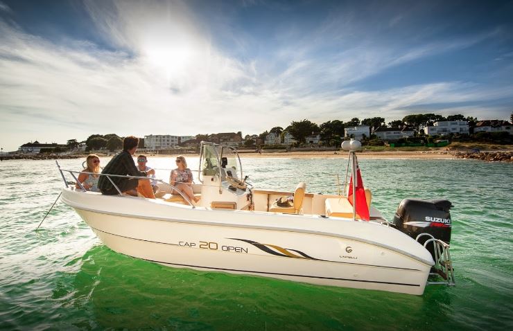 For Dorset Marine Training,
This relationship allows us to introduce our students to the advantage of Club membership boating. Without being too precise, the costs of a years membership at the Boat Club can be the same as simply paying for a berth for your own boat for that same year. If your plan is to head out 20 times in a year, you”l probably make it 10-15 (if we’re honest and the weather fits around your spare time). With a boat of your own, to have to come down, fuel your boat, clean it, realise that something rather important has broken. Start scratching your head, send everyone off to the cafe whilst the problem is rectified, only to realise it’s getting late and no boating today after all…… All of a sudden the attraction of a ‘managed’ boat club becomes immense.
A thoroughly pleasant environment and ethos to encourage you to be able to enjoy hassle free boating on a variety of different craft throughout the harbour and Poole Bay area. For those who want to go further afield, Dorset Marine Training are offering support training through our instructors who love to adventure around that next corner. We can produce some plans to make the longer journeys enjoyable and manageable, using a variety of techniques to get home safely.
Once someone has become a member, we can step onboard to train in more proficient journey planning. Giving people confidence alone or certification to a higher level.
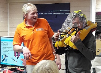
Sarah has been getting involved with some practical training, even helping out with some of the ‘Powerboat Level 2’ courses on the Boat Club’s boats. Dom has created evening training refresher packages which saw the members enjoying a visualisation of exactly how a lifejacket worked last night. We dressed the members in safety kit and set it all off. With some snacks and beer, it was a great environment.
Something you want to do, think you ought to do, even promise to do….. something that will be good and hopefully change you (in a good way)….. We have a ‘new year’s resolution’ to improve the training facilities that we offer each year. The best way to do that is to research it, plan it, then do it.
Yesterday we received our new Handheld ‘Icom m93 DSC’ digital training radios. These comprised two demonstration units for the classroom and a fully functioning unit for the boats. As technology has changed, the offering to us as leisure and commercial boaters has improved. We wanted to give students equipment that is for sale currently. kit that demonstrates the best in current technology. Kit that we believe to be the best on the market.
We’ve always used ICOM radios, because they feel great and they work well. The technology is up to date and well researched and the customer support is unparalled. Whether I’m chatting with ‘Virgil’ in tech support or ‘Ian’ in marketing, they both treat me like a valued customer. Never like the random, gadget obsessed, attention deficit boater than I may appear to be.
A week ago, we ran various polls across our social media channels to find out what sort of VHF radio equipment people were using. This enabled us to quickly see that our audiences are using Digital handheld units to compliment the fixed VHF radios on board their boats
We purchased the M93 DSC radios knowing that we would be supported by ICOM and that they would perform adequately in both Classroom and water based environments. There are a number of VHF courses taking place over the next two months. We will be testing the units out at sea. In a couple of weeks I hope to give a report on, hopefully, how well the M93 is fitting in.
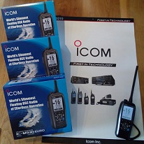
Having just had one of our busiest months for Level 2 Powerboat Courses, we felt it was time to talk about the next steps. We sincerely hope that if you undertook the course with us that you had a great time. We hope you want to carry on your boating. The journey will now be different for each person but the main priorities:
1. Getting afloat. Is it practical for you to get out and start practising afloat now or within the next few weeks?
2. Stuck on Shore. Think back over your course and consider whether there are any aspects of the theory side you’d like to look at in more detail and develop further.
If you have the opportunity to get afloat, it really is important to get out there and start practising. Use a boat whilst the knowledge is fresh and the confidence high. You passed the course, you have the ability to get out there so seize the chance. Think back to day one of your course – what was one of the first things you talked about? Conditions and Planning??
First of all make sure the boat you plan to use is ready. Has it been serviced, is the trailer road ready, is all the kit on board? Have you organised all the personal kit like waterproofs and lifejackets, don’t forget navigation charts? Have you thought about where to launch or if on a mooring whether there are limited times due to tides or locks. Plan carefully, it will make your first trip not only safer, but also more enjoyable.
If you need to borrow a boat look into hire possibilities – a really good start if you’re local is with our friends at Poole Boat Hire. They are limited to the harbour but that still provides plenty of space to explore. Its an hour and a half each way to Wareham for example! If you want to borrow further afield or hire a RIB then contact us for advice. The bonus of hiring is there should be back up in case of breakdown. If its your own boat perhaps consider SeaStart membership.
Check local information and organise a plan for your trip. Don’t forget insurance and harbour dues if its your own boat! Why not refresh your mind with a read through of your Start Powerboating Book? Have a look at the Student Page on our website for useful resources. If you’re a member of a sailing club or similar why not ask if you can get afloat on the safety boat? great idea to take along an experienced helm as crew?
Next think about the actual day. Who is going with you – are they trained, do they need a briefing or any equipment providing? Consider on your first trip who is going with you. If you’ve a friend or family member who is unsure of boating perhaps delay their attendance until a later trip when you’ve a little more experience. Instead take along a couple of people who have boating experience or similar. Plan just a short trip the first time – build up as your experience progresses.
Then check the conditions, forecasts and tides. If it seems a bit ‘iffy’ listen to your instincts and delay for a nice day, however disappointing that might be. Don’t forget to check several sources of info and interpret the information you’ve given. Ask around for local information if needed. Don’t forget to leave a shore side contact and set up RYA SafeTrx
If you do decide to go out, when you hop on board double check the boat. Remember to set SafeTrx running & think about the prestart checks and engines checks. Don’t forget your killcord and before releasing the lines just think about wind and tide as you learnt on your course. Enjoy and stay safe!
If you are unable to get afloat immediately why not have a read of your coursebook Start Powerboating and reflect on the parts of your course you’d like to develop further. The usual next steps for study include: VHF Marine Radio Course, Navigation Training or studying books such as the Powerboat Handbook to understand and refine your practical skills.
Don’t forget if you’re on coastal waters we advise you carry a VHF whether it’s a portable, handheld or a fixed radio set. To operate the VHF you are required to have an ‘Authority to Operate’. (In an emergency please just use the set!). This qualification can be undertaken as either a one day classroom course or you can study online and then arrange a convenient time for a short assessment with us. Initially we find some reluctance to take the radio course. However, we have yet to find a student who hasn’t enjoyed and taken away a lot from the course. It’s underrated and our most commonly received feedback is ‘didn’t expect to enjoy this but had a great day and learnt lots!’
We know its tough to sit in a classroom but we do our best to make the course as relaxed and informal as possible. In order to keep you engaged we use lots of interactive learning and have training radios to practice on. We practice Mayday & PanPan calls along with which channels to use, how to set up the radio to be able to hear clearly and we look at the fabulous DSC functions. If you have any questions about your own radio we have a great contact at Icom who is fab at providing answers.
There is a short assessment at the end of the day but please don’t let this put you off attending. We teach in small groups, are happy to provide bespoke courses and if you want to delay the assessment for another day just let us know at time of booking. Tell us what works for you.
When you attended your Level 2 Powerboat Course it was probably the first time you’d considered navigation and safety kit. Within a two day course we only have time to introduce to information on passage planning and pilotage, buoys and collision regulations. The Essential Navigation course is a fab short course that starts to develop the concepts further. It introduce a few new techniques. It is usually taken online in your own time – there is no final ‘test’. Instead you complete exercises as you progress and on successful completion you receive an RYA Certificate.
If you prefer, we can arrange to run these courses in the classroom over two days. Whether its an online course or classroom course you choose, you will receive a study pack. This includes practice charts, exercises and a plotter/set of dividers like you used on your PB2 course. It a brilliant base for those who later choose to go and study our RYA Dayskipper or Yachtmaster Theory Courses.
Don’t forget we also offer short Powerboat Refresher Sessions on the RIB or can offer bespoke training on either our boat or your own. Just contact us to have a chat.
If after your Powerboat Level 2 (PB2) Course you decided to progress onto a different style of boat, perhaps a hard sided boat, a motorboat or small motor cruiser then think about some bespoke training or perhaps even look towards the Dayskipper Practical course if you’ve decide to creep into bigger boats. Remember all boats handle differently and its important to be confident and safe afloat.
We hope the information here provides you with just a few ideas of how to make the most from your Powerboat Level 2 Course and progress your boating. Please just give us a call with any questions. Whether it’s a simple reminder or you want to book further training we’re always happy to talk. It is impossible to cover all the reminders from a two day course in just a short blog piece but hopefully this has given you a few reminders! We love to hear your progress. Please drop us a line or join our social media channels to tell us your news.
Sarah & Dom
www.dorsetmarinetraining.co.uk
01202 901267
enquiries@dorsetmarinetraining.co.uk
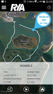
I thought I’d update this entry on ‘Safetrx’, the app from the RYA that allows us to be tracked, but we’re out on the water to escape right???? . Do we forget to leave details as to where we are going and when we plan to be back? What options there are to remedy this? Most of my leisure boating is fairly local and for a while I think I became a bit too relaxed. I assumed everything would be ok. I neglected to tell anyone I was heading out, assuming I would always be able to look after myself. It’s a careful balance when we’re afloat, many of us head out on our boats to avoid technology, ringing phones and other life pressures. Part of the appeal is the ability to run away and hide where no one can find us. But where does this leave us if something were to go wrong?
The image here shows a track of our school boat one night on an exercise that took it right round the back of the islands in the harbour, great experience for the students and well within the abilities and confidence of the instructor but still very dark and maybe into black spots for radio and communications, if the boat hadn’t come back on time, we’d know where it last was and when…..
Since I started teaching RYA Powerboat Level 2 and the VHF / SRC course, I have been vocal about the importance of the Voluntary Coastguard Safety Registration Scheme known as CG66. You were able to register you craft details along with emergency contacts and even upload a picture of your boat, canoe etc. That way people knew what they were searching for. This scheme had great benefits – if you were genuinely missing the coastguard knew what they were looking for. It enabled your family to make a call to say you were overdue even with little knowledge of boating & the coastguard already had your details. Equally if your craft was found without you on the coastguard would start by calling you. This enabled them to see if it was a boat adrift from a mooring or were people missing.
However, yesterday we received notification that no new registrations will now be accepted on the CG66 scheme – so what next?
For those who already have their boats registered on CG66, the scheme should continue to operate for the next two years. However, it makes sense to move towards their new scheme which is open to everyone. They have teamed up with the RYA to provide a scheme that not only offers registration but also options to log passage plans etc. Its worth having a look at this link https://www.gov.uk/government/news/hm-coastguard-adopts-rya-safetrx-as-new-safety-id-scheme to understand what is happening.
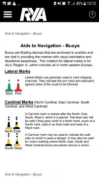
The new scheme is the RYA SafeTrx scheme and more details can be found here – RYA SafeTrx Scheme In addition to registering your boat information, you can also use it for individual boating trips to notify emergency contacts if you’re overdue. There is lots of other local information too with useful phone numbers and VHF channel numbers. It also includes safety information with advice on navigation marks and weather information.
This scheme does not replace the need for other safety kit such as VHF radio, PLBs etc!!
If you’re new to boating or this information has made you think about training then please contact us. We will happily discuss the most appropriate options for you. One of our most popular courses is the RYA Powerboat Level 2 course. This course covers safety equipment and passage planning as well as practical skills.
I downloaded the app yesterday and will let you know how I get on. Anyone else already using it? What feedback do you have?
You’ve made the decision to leap into boat ownership – exciting times but where are the best places to find the boat of your dreams? If you’re not sure what you’re looking for the options can be overwhelming. Even if you know exactly what you’re looking for it can still take some time to find the perfect boat. Having bought and sold a few boats we’re going to share a few of our experiences here. This post is aimed at the fun side of searching for your boat initially. After that you need to check the boat out and advice can be sought from the RYA with their RYA Buying a Boat Advice. If you’re not a RYA member you’ll need to join to access much of the information –RYA Membership
The first question is what sort of boat are you looking for? Ask yourself a few questions to help narrow down the search:
There are many owner associations for different boats and these are a fantastic source of information. For very new boats the association may be run by the manufacturer but often class associations are run by enthusiasts who want to share information. These groups can provide information on where is the nearest owner who will talk to me about the genuine pros and cons of a boat. Alternatively, advice of little tweaks people have made to enjoy their boat more or ideas on where to launch your boat. For some reason (and don’t ask me why!) my experience is that the associations for sailing boats often have dedicated websites whilst powerboats and motor boats are often on social media such as Facebook.
We have gained really useful information in relation to our sailing yacht which is no longer in production. The advice means for example we now have a way of lowering the mast single handedly. With our RIBs we have sourced parts that were seemingly unavailable. Rather than reinventing the wheel there is usually someone out there happy to advise. As well as bespoke groups there are also many forums and Facebook groups dedicated to types of boats such as RIBs or types of boating such as fishing.
For example:
If you’ve decided on the type of boat you’re looking for, do look around a few and get an idea of what is available on the market. If you’re after a particular brand of boat then start putting wanted ads out on owners association websites. Talk to brokers and tell them what you are looking for. We boat owners are a funny lot not liking to sell our boat until we find the right buyer! If you look keen then its amazing what boats you’ll find that aren’t openly advertised.
There are lots of brokers out there but why not talk to our friends at Network Yacht Brokers – Poole as a starting point? Similarly put messages out on Facebook groups that are aimed at boaters like the one you wish to become, people are keen to share their knowledge and welcome others onto the water so will be keen to help you look and again boats will materialise that haven’t been advertised.
We strongly advocate this approach, I think all our boats have been bought through contacts in this way. The first RIB we bought via a contact on the RHIBs Facebook page who knew I was looking. He mentioned one he’d heard of & she’s been a fab purchase. The second RIB came about after telling Nigel and Lucy at Network Yacht Brokers that we were looking for a specific boat. Within a month they’d found us one which is now our main training boat. Our sailing yacht was found via the owners association website as we knew what we were looking for. My sailing dinghies have all come via links from friends on social media. It really is important to spread the word that you’re looking and be patient to see what turns up.
Other advertising sites for keeping an eye on include: Apollo Duck, BoatsandOutboards and for local economically priced boats its worth checking Gumtree
Hopefully that has given you an idea of how and where to start the search. If you’re looking for something specific feel free to let us know. We often hear of boat owners looking to upsize but who haven’t yet placed their boat on the market. Don’t forget to make sure you carry out proper checks as explained on the RYA site before the final purchase. Do think about employing a surveyor and/or marine engineer if appropriate.
Now go have fun in the search for the perfect boats- don’t forget to let us know how you’re getting on. When you find it call us to arrange some bespoke training so you get the most from your boating. Thanks for reading and keep us updated!
Hi and thanks for visiting our blog. In this blog we look at a few questions that were raised by our visitors at the Poole Boat Show. We love helping people to get afloat for the first time & we aim to provide info to assist. We had a fabulous time at the show last weekend. There were lots of visitors to our stand and taking up our free powerboat taster trips out in the RIB.
The show was brilliantly organised and inspired so many people to think about boating. It lead to people considering whether boating was something they could take up. Over the coming weeks we hope to spend more time looking at each of these topics. Let us know what is the most pressing boating question for you.
So the answer to this will be different for everyone. For some the exhilaration of boat ownership leads to a sense of freedom on the seas. For others, the costs or time implications are prohibitive. However, that doesn’t mean you can’t get afloat. Options include hiring or volunteering with organisations. There are Sea Scouts Volunteers , the Maritime Volunteer Service or sailing clubs and events. If you’re looking to buy then questions arise over: where to buy – new or ‘new to you’, private seller or broker, what to buy and how much to pay. You then move into questions over storage and maintenance. We’ll look at these topics over the next few blogs.
This will depend on any previous experience, your own learning style and any insurance requirements. In the UK there is no requirement to have formal qualifications to boating. (Although there is for the VHF radio on board – that’s for another day). However, you may find your insurance company asks for a qualification to show competence. If you’re no previous experience afloat then training certainly seems a good idea particularly if you want friends and family to come boating with you again!
Many of those starting boating in the UK undertake a RYA course. This may be the Helmsman and Dayskipper for Motor Cruisers or the RYA Powerboat Level 2 for Powerboats and RIBs. You may prefer to undertake bespoke training focussing on the areas that particularly affect your boating. It makes sense to undertake the training on your own boat if possible. This way you learn the ‘quirks’ of your boat. The Instructor can also give tips and hints that are specific to your location.
In fact, our clients are evenly split between those who train on our boats and those on their own boats. If you’re not sure what to buy then undertaking a course first will help focus your mind. You can consider what is important to you and you can get advice from your Instructor. If you’re thinking of hiring then make sure you undertake a qualification that meets the requirements you’ll need . Often if you’re hiring abroad you’ll require an International Certificate of Competence. This is a relatively easy process for most people after their RYA course but make sure the course you choose qualifies. If in doubt contact the RYA about the International Certificate of Competence or ask a training centre like ourselves.
There are lots of options for boat storage ranging from keeping it on the land in your drive, on a trailer in a yard or on a drystack in a marina or keeping it afloat on a swing mooring or on a pontoon.
Absolutely -one of the best things about boating is that it’s a family friendly activity. Make sure your training provider is comfortable with training youngsters. Get them involved at whatever level is appropriate for their age and maturity.
Let us know which is the most pressing question for you and we’ll try to get it answered for you in the next blog post. Thanks for reading, new to this blogging lark but hoping we can start a conversation finding out from our readers what topics they want covering and developing our own style of blog so please stick with us!