Weather
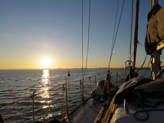
Beautiful Weather for Dom on this Delivery Trip
Weather Training Talk – Updated 5th Feb 2021
The talks are designed as a springboard into learning for those new to boating or refreshers for others. Please note that these talks are intended to complement training courses not replace them as there are lots of other topics to also consider before going afloat.
If you would like to attend our Free Training Talks please contact use or for the Spring 2021 series email us at online @dorsetmarinetraining.co.uk.
Links are provided to external sites. These are provided in the best of faith and although we make every effort to ensure these links are accurate, up to date and relevant, we cannot take responsibility for pages maintained by external providers. Before clicking please undertake your own checks. If you come across any external links that don’t work please let us know.
Introduction:
We first addressed the question of why we wanted to know about the weather. In our everyday lives we are interested in is it going to rain, be a heatwave or a hurricane. As boaters we need to consider many more factors. Not just the wind speed but the direction, sea state, visibility etc. We discussed where we source information and what impact weather has on our boating. We then looked at the terms used in forecasts and live weather vs predictions.
Sources of weather information:
This presentation was mainly focussed with online sources of information but don’t forget forecasts can be obtained from NCI (VHF Ch 65 or their websites such as Hengistbury Head NCI), marina or harbour offices and Maritime Safety Information Broadcasts every three hrs on VHF and Navtex.
Met Office:
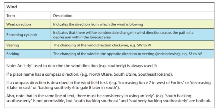
Dom introduced the Met Office Inshore Waters Forecast . This is valid for up to 12 miles offshore. We had a chat about the areas and started to look at the terminology used. For many new leisure boaters this may be the first time they have come across the Beaufort Wind Scale. Note this is a different forecast to the Shipping Forecast…a fascinating insight into both forecasts can be found here . The inshore waters forecast give us information on wind strength & direction, weather, sea state and visibility and includes timescales.
The wind strength in the forecast refers to the Beaufort Scale. We need to understand what it is, how it compares to other wind units and what it actually means for us as boaters. What is reasonable boating weather and how will it effect our day out? The wind strengths that you may go boating in will be different depending on locations, wind direction and crew and boat capabilities amongst other factors. However, for the Powerboat Level 2 students amongst our readers it is suggested that up to a F3 will be nice and calm whilst a F4 will become more challenging. Wind strengths above this are for more experienced boaters.
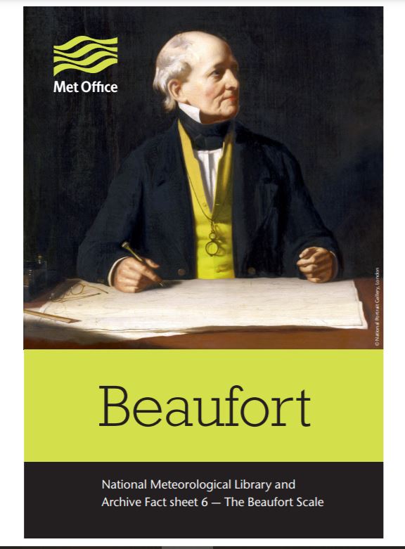
Beaufort Scale
If you’d like to know more about the Beaufort scale along with quirky facts about it, see Met Office Fact Sheet – Beaufort Scale . In this a F2-4 was described as “With which a well-conditioned man of war, under all sail, and ‘clean full’, would go in smooth water from…” and it includes the history through to the scale we see today along with photos of sea states. It has since been updated!
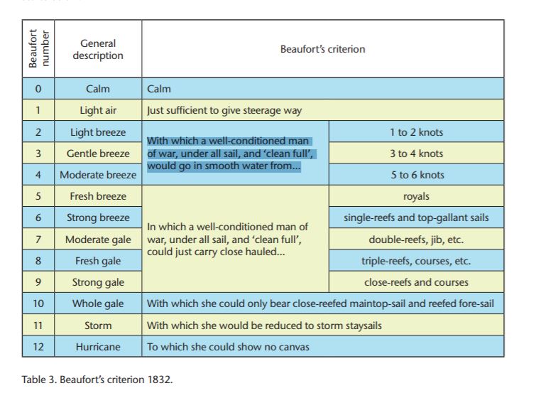
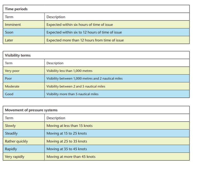
We then moved back to the forecast to look at the terminology used. A guide can be found here – Met Office Glossary In the forecast terms are used relating to time frames, visibility, movement of pressure systems, pressure tendencies and wind directions. It is important to understand where to find out what terms such as imminent actually refer to. There was a question raised about Cyclonic winds, the answer to which can be found in the glossary or the factsheet. This table here is taken from: Met Office Forecast Factsheet
Sea State: Wave height can be confusing. People seem to exaggerate the conditions they have been out in, probably because it seemed rough conditions but it can lull others into a misunderstanding of the conditions the forecast is referring to. Remember a sea state of rough is waves of 2.5 – 4m !
Other Forecasts:
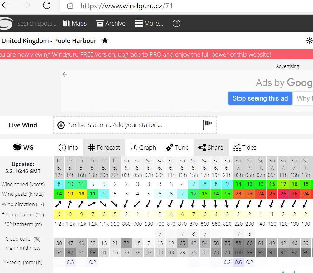
Next up was Windguru – a favourite of Dom’s this gave us the chance to look at different forecasting models. It is important to note the difference between gusts & wind speeds and the colours indicating wind strength. The ability to swap between units of wind speed was highlighted. The topic of accuracy in terms of timescales was then discussed. How far can we start to have confidence in the forecast? How can we zoom out to watch weather patterns to interpret the information.
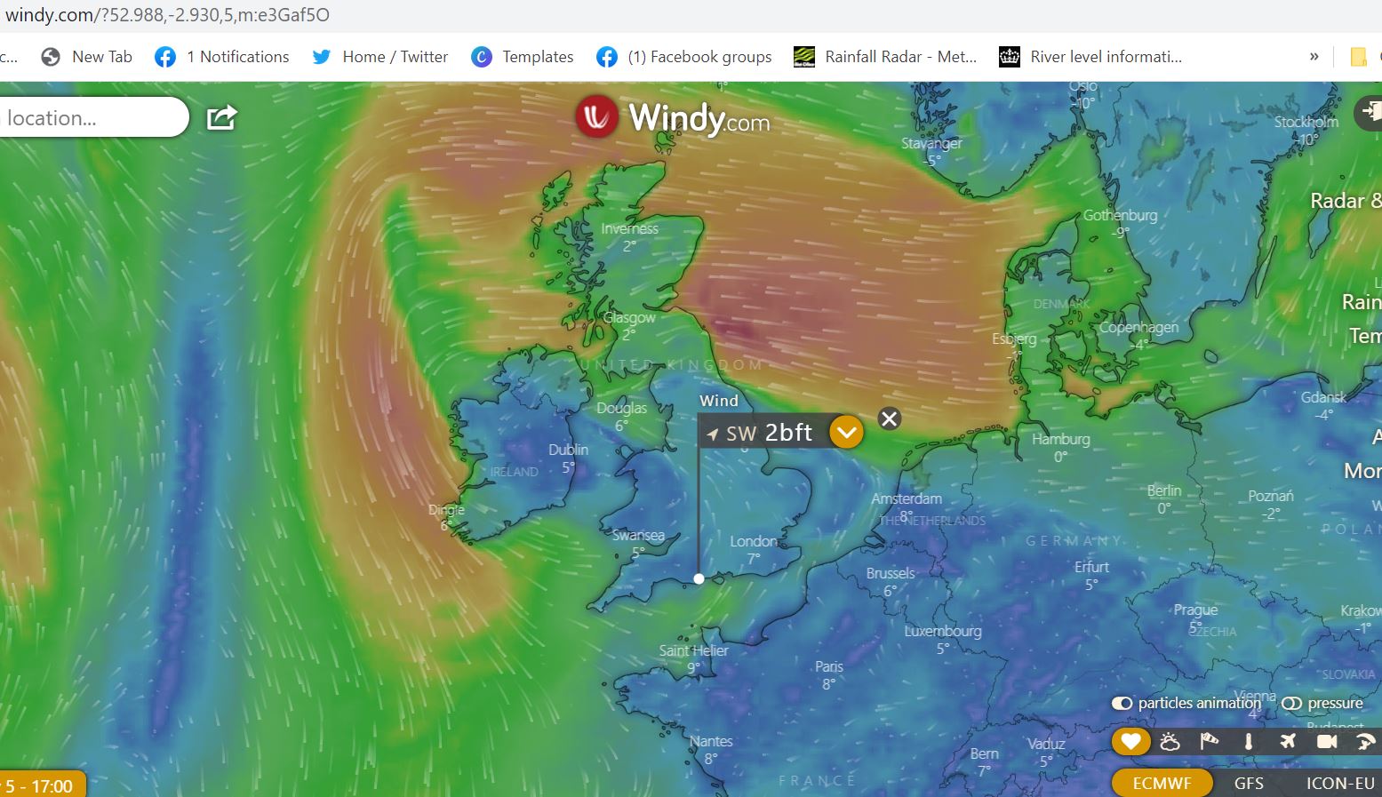
Windy was up next, introduced along with the ability to zoom out and look at developing weather systems. It gave us the opportunity to start to talk about synoptic charts. We talked about high and low pressure systems and how we could look for weather patterns to interpret information. How the colour coding works and the ability to look at rain, waves etc as well as wind. Another nice feature is the link to local webcams to see what is actually happening. Once again we looked at the differing weather modelling systems and looked a week ahead to compare the different models.
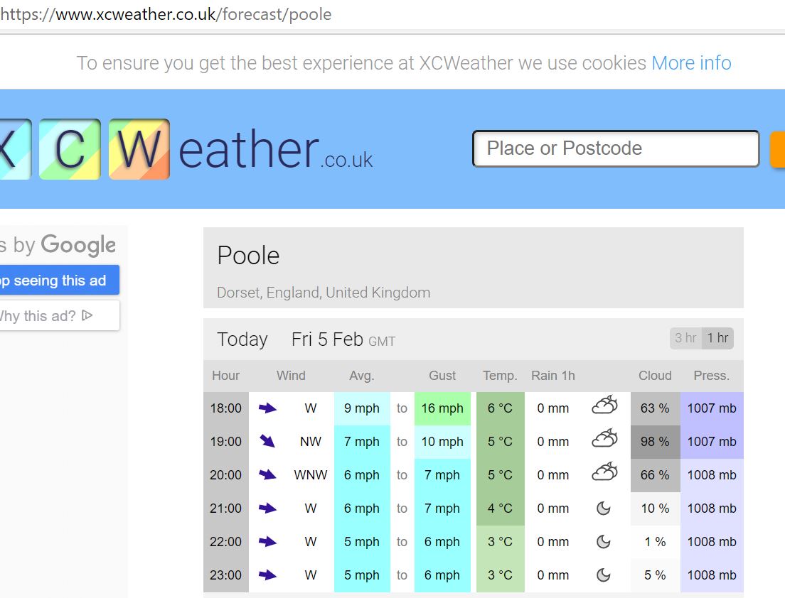
XC Weather proved to be popular. Although much less detailed for a day out in the harbour this was an easy view option. We talked about wind directions and how these can be used to start to look at sheltered places for boating. How does wind direction affect the conditions you will encounter. We used Poole Bay and Poole Harbour to illustrate the points.
Lots of other favourite weather apps were mentioned and there is a lot of choice out there. Compare across forecasts and interpret the information you are given. The other forecasts people mentioned are listed at the end of this blog.
Live weather information:
So far we have been looking at forecasts – these are predictions. We also have sources on information we can use to access live information.
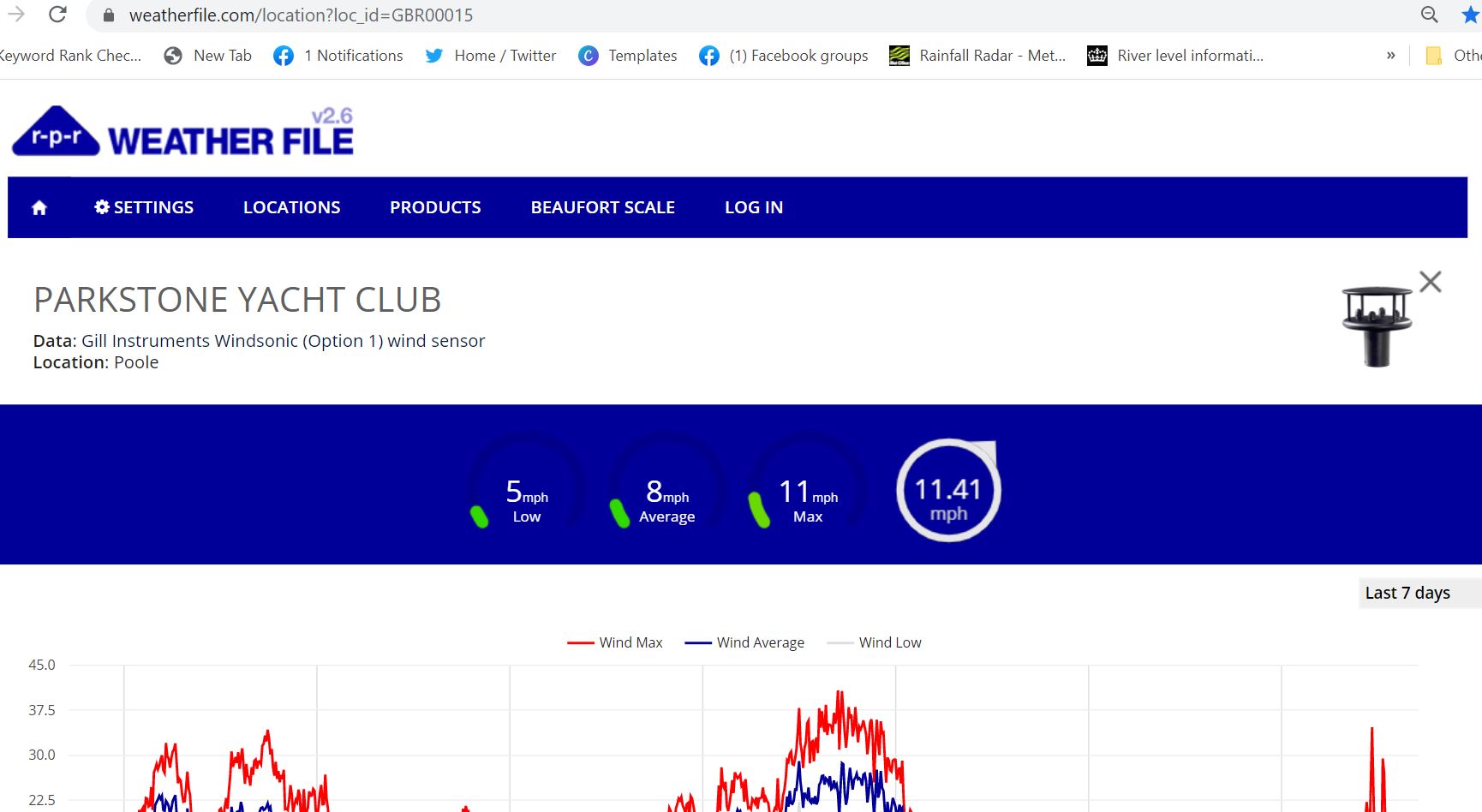
For windstrength the website Weatherfile is a popular option. Very handy for us as there is a weather station right in the middle of our training area. Note that you can change location or the units of measurement in the menu.
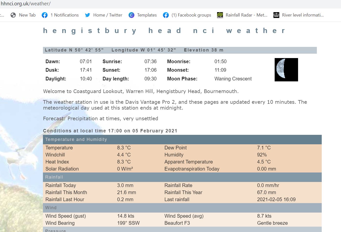
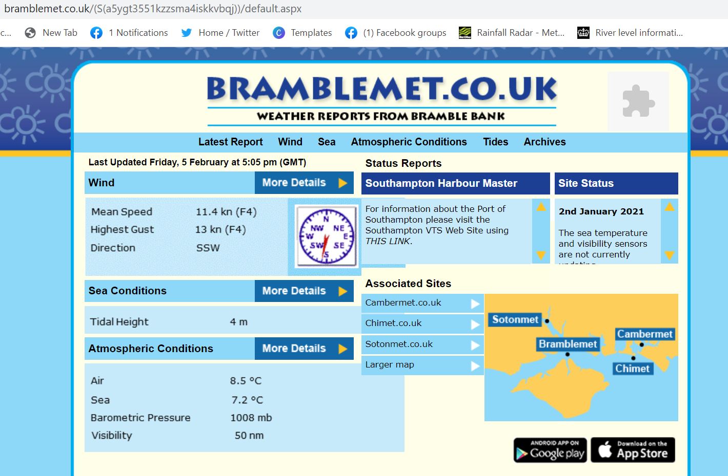
Other popular sources include the website Bramblemet in the Solent BrambleMet or Hengistbury Head NCI Weather station
And many sailing clubs or watersports facilities have their own weather stations some of which are accessible to the public. One local example is Poole Yacht Club Weather click on ‘View Gauges’ towards the bottom of the page.
Webcams can also be useful to get a guide before heading down to the water but remember the angle on these can be deceiving.
ODAS Buoys:
These give us information on wave heights. We find a user friendly view option is at Magic Seaweed Magic Seaweed – Wave Buoys. Click on the buoy nearest your location for information. For further formal information from CEFAS available here CEFAS Wavenet
Weather Radar:
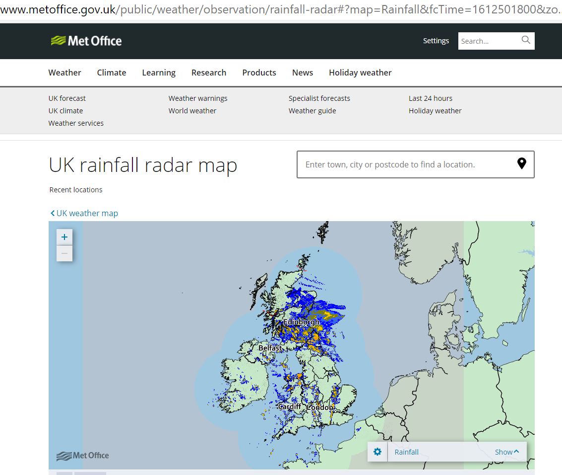
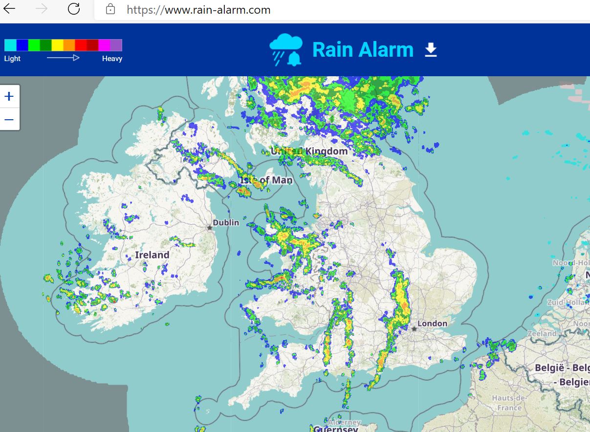
Both Rain Alarm and the Met Office Rain Radar are useful if you’re trying to avoid the rain!
Clouds:
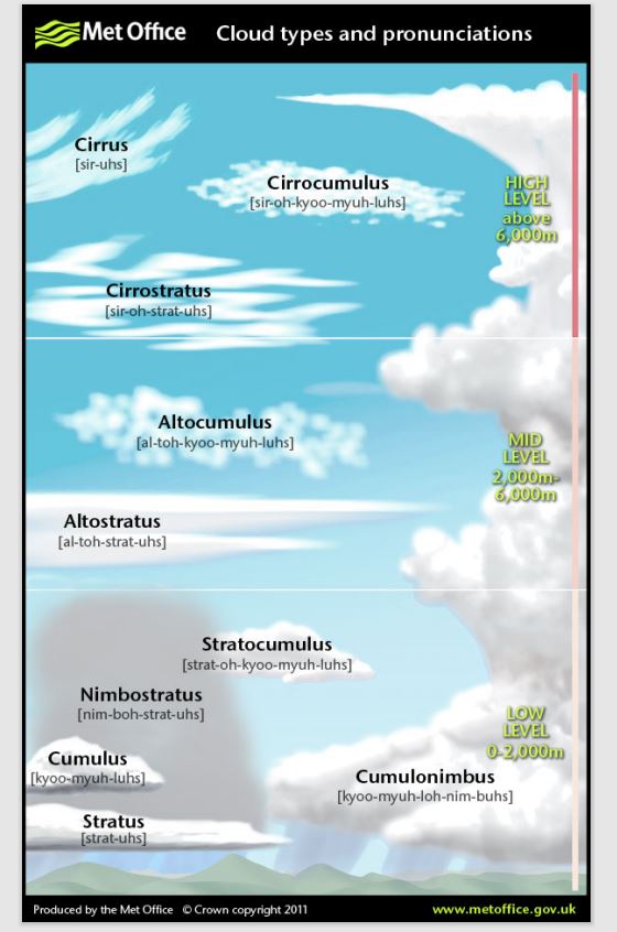
These are a whole topic of their own and we only briefly discussed them in the time we had allocated . If you are looking for more detail then the Met Office produce not only a great factsheet with pictures of clouds but also a really useful video. This useful guide can be downloaded as a poster from their site. On Day Skipper and Yachtmaster Theory Courses we cover these in much more detail.
Barometers & Pressure:
Some years ago I was fortunate to teach a Weather Forecaster for their Powerboat Course. We had a fascinating chat about the weather and I was told that their personal greatest guide was a barometer. The change in pressure being her greatest guide as to what to expect.
In very simple terms, we can usually expect more settled weather during periods of high pressure. It will often be calm and sunny although we should also be aware of the risks of fog. Conversely during periods of low pressure the weather is more unsettled and can be rainy and stormy with high winds.
Conclusion:
By bringing all the information together we can demonstrate the impact on our boating. We looked at local conditions, sea breezes and land breezes, cloud formations and then onto advection fog and radiation fog. We used examples and a chart to demonstrate how different wind directions coupled with tide could impact our boating and how this may differ between powerboats and sail.
Further Info:
If you enjoyed the presentation and would like to know more about weather the Met Office have some great YouTube videos which we have links to on our channel YouTube and even a free course available here Weather Courses . They also have a great range of fact sheets.
The RYA Weather Handbook is well worth a read and can be purchased from the RYA shop.
The RYA Essential Navigation & Seamanship Course also has a useful section on weather and how we can use it for our boating along with many other theory topics. It is a great foundation for boating, usually undertaken online with about 8-10 hours study. (Cost Feb 2021 – £90)
Other links:
We really enjoyed the providing the Training Talks and it is lovely that so many people sent in their own sources of information. We hope you found it useful. Listed below are resources that others sent in to us. We have not yet verified all of these so use your own discretion but looks like some great extra tools. You do need to understand the modelling systems are being used.
Greatweather.co.uk – huge list of resources Great Weather
UKWeatheronline – useful synoptic charts WeatherOnline